142.254.236.118 - IP Lookup: Free IP Address Lookup, Postal Code Lookup, IP Location Lookup, IP ASN, Public IP
Country:
 USA
USARegion:
City:
Location:
Time Zone:
Postal Code:
ISP:
ASN:
language:
User-Agent:
Proxy IP:
Blacklist:
IP information under different IP Channel
ip-api
Country
Region
City
ASN
Time Zone
ISP
Blacklist
Proxy
Latitude
Longitude
Postal
Route
db-ip
Country
Region
City
ASN
Time Zone
ISP
Blacklist
Proxy
Latitude
Longitude
Postal
Route
IPinfo
Country
Region
City
ASN
Time Zone
ISP
Blacklist
Proxy
Latitude
Longitude
Postal
Route
IP2Location
142.254.236.118Country
usRegion
california
City
palm desert
Time Zone
America/Los_Angeles
ISP
Language
User-Agent
Latitude
Longitude
Postal
ipdata
Country
Region
City
ASN
Time Zone
ISP
Blacklist
Proxy
Latitude
Longitude
Postal
Route
Popular places and events near this IP address
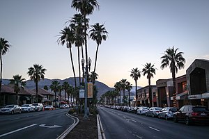
Palm Desert, California
City in California, United States
Distance: Approx. 25 meters
Latitude and longitude: 33.72222222,-116.37444444
Palm Desert is a city in the Coachella Valley region of Riverside County, California. The city is located in the Colorado Desert arm of the Sonoran Desert, about 14 miles (23 km) east of Palm Springs, 121 miles (195 km) northeast of San Diego and 122 miles (196 km) east of Los Angeles. The population was 51,163 at the 2020 census, and the city has been one of the state's fastest-growing since 1980, when its population was 11,801.

Palm Desert High School
Public school
Distance: Approx. 1918 meters
Latitude and longitude: 33.73277778,-116.35833333
Palm Desert High School is a secondary school located in Palm Desert, California. The school is a part of the Desert Sands Unified School District.

Living Desert Zoo and Gardens
Botanical garden and zoo in Riverside County, California
Distance: Approx. 2939 meters
Latitude and longitude: 33.69583333,-116.37027778
The Living Desert Zoo and Gardens, formerly the Living Desert Museum, is a non-profit zoo and desert botanical garden located in Palm Desert, Riverside County, California, United States. The Living Desert is home to over 500 animals representing over 150 species and welcomes over 500,000 visitors annually. Situated in the Sonoran Desert of the Coachella Valley and Santa Rosa Mountains foothills near Palm Springs, California, The Living Desert is set on 1,200 acres, with 80 developed as zoo and gardens.
1959 Ryder Cup
Distance: Approx. 3508 meters
Latitude and longitude: 33.711,-116.339
The 13th Ryder Cup Matches were held November 6–7, 1959 at the Eldorado Country Club in Indian Wells, California. The United States team won the competition by a score of 81⁄2 to 31⁄2 points. The British were again led by Dai Rees, but were unable to repeat the heroics of two years earlier and were comprehensively beaten on American soil.
McCallum Theatre
Distance: Approx. 1629 meters
Latitude and longitude: 33.72972222,-116.38944444
The McCallum Theatre is a 1,127-seat theatre and concert venue located on the southern edge of the campus of College of the Desert in Palm Desert, California, US. It was built by and is operated by an independent non-profit corporation, Friends of the Cultural Center, Inc.
Cahuilla Hills, California
Unincorporated community in California, United States
Distance: Approx. 5394 meters
Latitude and longitude: 33.688,-116.416
Cahuilla Hills is an unincorporated community in the Coachella Valley of Riverside County, California. It lies at an elevation of 932 feet (284 m) in the foothills of the Santa Rosa Mountains. Cahuilla Hills is located 3 miles (4.8 km) southwest of the civic center of Palm Desert.
St. Margaret's Episcopal Church (Palm Desert, California)
Distance: Approx. 2990 meters
Latitude and longitude: 33.7034,-116.3978
St. Margaret's Episcopal Church is located in Palm Desert, California, United States, on State Route 74 in the Coachella Valley region. Parishioners come from Palm Desert, Indian Wells, and the Coachella Valley area.
Palm Desert Public Library
Branch of the Riverside County Library System
Distance: Approx. 452 meters
Latitude and longitude: 33.71805556,-116.37333333
The Palm Desert Library will open on July 1st, 2024 as a City of Palm Desert operated library after the City Council made the decision in 2023 t otake over library operations. The original Palm Desert Library opened its doors in 1962 on Portola Avenue, where it remained for 33 years. Then, in 1995, a new building was planned, financed, and constructed by a partnership between the City of Palm Desert, the County of Riverside, and the College of the Desert.

The Shops at Palm Desert
Shopping mall in Palm Desert, California
Distance: Approx. 1905 meters
Latitude and longitude: 33.7235,-116.395
The Shops at Palm Desert (previously Westfield Palm Desert) is a shopping mall located in Palm Desert, California which serves the Coachella Valley. The mall features the traditional retailers Macy's, JCPenney, Dick's Sporting Goods, and Barnes & Noble, with 122 inline stores. In addition, the mall includes a food court and Tristone Palm Desert 10 Cinemas.
Record Alley
Distance: Approx. 1758 meters
Latitude and longitude: 33.7235,-116.3934
Record Alley is a record shop at the Westfield Palm Desert in Palm Desert, California.
Grill-A-Burger
Restaurant in Palm Desert, California, U.S.
Distance: Approx. 4173 meters
Latitude and longitude: 33.75713889,-116.39019444
Grill-A-Burger is a hamburger restaurant in Palm Desert, California, United States. The business was featured on the Food Network's Diners, Drive-Ins & Dives in 2017. The interior decor has a jungle theme and features gorillas.
Rancho Mirage Library and Observatory
Library and Observatory in Rancho Mirage, California
Distance: Approx. 5217 meters
Latitude and longitude: 33.74833333,-116.42111111
Rancho Mirage Library and Observatory is a public library and science education complex in Rancho Mirage, California. It has been called a "cultural oasis" in the Coachella Valley.
Weather in this IP's area
broken clouds
21 Celsius
20 Celsius
20 Celsius
22 Celsius
1012 hPa
39 %
1012 hPa
961 hPa
10000 meters
0.45 m/s
0.45 m/s
244 degree
61 %