Country:
 USA
USARegion:
City:
Latitude and Longitude:
Time Zone:
Postal Code:
IP information under different IP Channel
ip-api
Country
Region
City
ASN
Time Zone
ISP
Blacklist
Proxy
Latitude
Longitude
Postal
Route
IPinfo
Country
Region
City
ASN
Time Zone
ISP
Blacklist
Proxy
Latitude
Longitude
Postal
Route
MaxMind
Country
Region
City
ASN
Time Zone
ISP
Blacklist
Proxy
Latitude
Longitude
Postal
Route
Luminati
Country
USRegion
il
City
chicago
ASN
Time Zone
America/Chicago
ISP
Equinix (EMEA) Acquisition Enterprises B.V.
Latitude
Longitude
Postal
db-ip
Country
Region
City
ASN
Time Zone
ISP
Blacklist
Proxy
Latitude
Longitude
Postal
Route
ipdata
Country
Region
City
ASN
Time Zone
ISP
Blacklist
Proxy
Latitude
Longitude
Postal
Route
Popular places and events near this IP address

SS Eastland
Passenger ship that rolled over in Chicago in 1915
Distance: Approx. 22 meters
Latitude and longitude: 41.88722222,-87.63169444
SS Eastland was a passenger ship based in Chicago and used for tours. On 24 July 1915, the ship rolled over onto its side while tied to a dock in the Chicago River. In total, 844 passengers and crew were killed in what was the largest loss of life from a single shipwreck on the Great Lakes.

LaSalle Street Tunnel
Chicago's second traffic tunnel, completed on July 4th, 1871, Designed by William Bryson
Distance: Approx. 61 meters
Latitude and longitude: 41.88755556,-87.6325
The LaSalle Street Tunnel was Chicago's second traffic tunnel under the Chicago River. It was started November 3, 1869, and completed July 4, 1871. It was designed by William Bryson who was the resident engineer for the Washington Street Tunnel.

OneEleven
High-rise luxury rental apartment tower located in downtown Chicago, Illinois
Distance: Approx. 118 meters
Latitude and longitude: 41.88638889,-87.63138889
OneEleven (formerly 111 W. Wacker and Waterview Tower) is a luxury rental apartment tower located in downtown Chicago, Illinois. The building is located between LaSalle Street and Clark Street, adjacent to River North and directly on the Chicago River. The building was developed by Related Midwest in a joint venture with Clark Wacker LLC and designed by architect Gary Handel of Handel Architects LLP. Kara Mann of Kara Mann Design was selected for interior design.
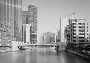
Clark Street Bridge
Bridge in Chicago, Illinois, U.S.
Distance: Approx. 67 meters
Latitude and longitude: 41.8875,-87.631
The Clark Street Bridge is a bascule bridge that spans the Chicago River in downtown Chicago, connecting the Near North Side with The Loop via Clark Street.

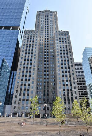
300 North LaSalle
60-story mixed-use skyscraper in Chicago
Distance: Approx. 140 meters
Latitude and longitude: 41.8882,-87.6331
300 North LaSalle is a 60-story mixed-use building, constructed from 2006 to 2009, located on the north bank of the Chicago River on the Near North Side community area of Chicago, Illinois, United States. The building contains 1.3 million square feet (121,770 square meters) of space to include offices, retail shops, restaurants and public spaces, as well as three levels of underground parking. Due to its location on the north bank of the Chicago River, the building features a half-acre sunlit waterfront public garden with direct access to the river's edge.
LaSalle–Wacker Building
Office in Illinois, United States
Distance: Approx. 102 meters
Latitude and longitude: 41.8865,-87.632
The LaSalle–Wacker Building, at 221 North LaSalle Street (also known as 121 West Wacker Drive), is a 41-story skyscraper at the north end of the LaSalle Street canyon in the Loop community area of Chicago, Illinois, United States.
ABA Museum of Law
Founded in 1996 in Chicago, America Headquarters: Illinois, United States
Distance: Approx. 133 meters
Latitude and longitude: 41.8882,-87.6306
The ABA Museum of Law, opened in November 1996 in Chicago, Illinois by the American Bar Association, was the only national museum that focuses on the role of law and the legal profession in America and throughout the world. Its goal was to engage the public in the legal system and make it relevant in their lives. In an effort to increase understanding of lawyers and the work they do, the museum highlighted lawyers who were well known for other work as well as well-known trials.
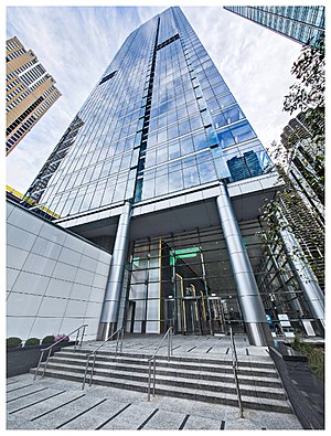
353 North Clark
Building in Illinois, United States
Distance: Approx. 138 meters
Latitude and longitude: 41.888497,-87.631036
353 North Clark is a 624-foot (190 m) tall skyscraper in Chicago, Illinois. The building began construction in 2007 and was completed in 2009. It has 45 floors with a total of 1,173,643 square feet (109,035 m2) of floorspace.

321 North Clark
Commercial offices in Chicago, Illinois
Distance: Approx. 126 meters
Latitude and longitude: 41.888056,-87.630556
321 North Clark at Riverfront Plaza is a 35-story, 155.45 m (510.0 ft) skyscraper constructed from 1983 to 1987 in Chicago, Illinois, United States. The tower was built by BCE Development Properties and designed by Skidmore, Owings & Merrill as part of the Riverfront Plaza development on the north bank of the Chicago River. 321 North Clark opened in April 1987 and was named "city development of the year" by the Chicago Sun-Times.
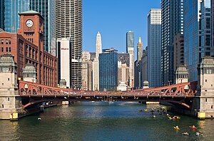
La Salle Street Bridge (Chicago)
Bridge in Chicago, Illinois, U.S.
Distance: Approx. 57 meters
Latitude and longitude: 41.887484,-87.632474
The La Salle Street Bridge (officially the Marshall Suloway Bridge) is a single-deck double-leaf trunnion bascule bridge spanning the main stem of the Chicago River in Chicago, Illinois, that connects the Near North Side with the Loop area. It was constructed in 1928 at a cost of $2,500,000 by the Strobel Steel Constructing Company. The bridge was part of a scheme to widen LaSalle Street and improve access from the Loop to the north side of the river that had been proposed as early as 1902.
North Water Terminal
"L" station in the Near North Side, Chicago, Illinois.
Distance: Approx. 120 meters
Latitude and longitude: 41.88848,-87.63173
The North Water Terminal was an "L" station on the North Side main line, located in the Near North Side neighborhood in Chicago, Illinois. While the initial portion of the Northwestern Elevated (Loop–Wilson) opened in 1900, the terminal opened on November 17, 1908, to accommodate excess traffic in the downtown area. A walkway was provided to connect the terminal station to the nearby Merchandise Mart station.
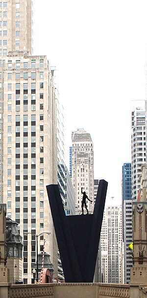
Crossing (sculpture)
Public artwork in Chicago, Illinois, U.S.
Distance: Approx. 145 meters
Latitude and longitude: 41.88858333,-87.63252778
Crossing is a sculpture by Hubertus Von Der Goltz, installed on La Salle Street in Chicago, Illinois. The 25-foot-tall steel artwork has a statue of a man on top of a V-shaped structure. Installed in 1998, it is the only extant permanent work from the 17th annual International Sculpture Conference hosted by Chicago.
Weather in this IP's area
scattered clouds
16 Celsius
15 Celsius
14 Celsius
17 Celsius
1022 hPa
53 %
1022 hPa
1001 hPa
10000 meters
2.68 m/s
4.47 m/s
264 degree
27 %
06:24:07
19:12:18