142.214.246.190 - IP Lookup: Free IP Address Lookup, Postal Code Lookup, IP Location Lookup, IP ASN, Public IP
Country:
Region:
City:
Location:
Time Zone:
Postal Code:
ISP:
ASN:
language:
User-Agent:
Proxy IP:
Blacklist:
IP information under different IP Channel
ip-api
Country
Region
City
ASN
Time Zone
ISP
Blacklist
Proxy
Latitude
Longitude
Postal
Route
db-ip
Country
Region
City
ASN
Time Zone
ISP
Blacklist
Proxy
Latitude
Longitude
Postal
Route
IPinfo
Country
Region
City
ASN
Time Zone
ISP
Blacklist
Proxy
Latitude
Longitude
Postal
Route
IP2Location
142.214.246.190Country
Region
iowa
City
marion
Time Zone
America/Chicago
ISP
Language
User-Agent
Latitude
Longitude
Postal
ipdata
Country
Region
City
ASN
Time Zone
ISP
Blacklist
Proxy
Latitude
Longitude
Postal
Route
Popular places and events near this IP address

Linn-Mar Community School District
Public school district in Marion, Iowa, United States
Distance: Approx. 988 meters
Latitude and longitude: 42.053779,-91.597446
Linn-Mar Community School District is a public school district in Linn County, Iowa, that administrates seven elementary schools, two intermediate schools, two junior high schools and a senior high school. The district includes the northern part of Marion, Iowa, an area in Cedar Rapids, part of Robins and rural areas in the county. As of 2019, more than 7700 students were enrolled in district schools.
Linn-Mar High School
Public secondary school in Marion, Iowa, United States
Distance: Approx. 911 meters
Latitude and longitude: 42.053,-91.598
Linn-Mar High School is a public high school, part of the Linn-Mar Community School District. It serves students in grades 9 through 12 and is located in Marion, Iowa.

First Presbyterian Church (Marion, Iowa)
United States historic place
Distance: Approx. 1184 meters
Latitude and longitude: 42.034411,-91.597094
First Presbyterian Church is located in Marion, Iowa, United States. It was listed on the National Register of Historic Places in 1992.

Granger House (Marion, Iowa)
Historic house in Iowa, United States
Distance: Approx. 1059 meters
Latitude and longitude: 42.035947,-91.599644
The Granger House, also known as the Granger House Victorian Museum, is a historic heritage tourism site located in Marion, Iowa, United States. This Victorian Italianate house was built around 1860 by Charles Myers. Earl Granger bought the house in 1876 and it remained in his family until 1973.

James W. and Ida G. Bowman House
Historic house in Iowa, United States
Distance: Approx. 1183 meters
Latitude and longitude: 42.03438889,-91.59486111
The James W. and Ida G. Bowman House is a historic building located in Marion, Iowa, United States. The Bowmans hired the Cedar Rapids architectural firm of Dieman & Fiske, and specifically partner Charles Dieman, to design this two-story wood-frame house that combines American Craftsman and Prairie School influences. Local contractor Charles I. Wilson completed construction in 1910 in a neighborhood populated by prominent citizens.

Samuel M. Lane House
Historic house in Iowa, United States
Distance: Approx. 1206 meters
Latitude and longitude: 42.0345,-91.59208333
The Samuel M. Lane House is a historic building located in Marion, Iowa, United States. This two-story Italianate style dwelling was built in 1868 using locally produced brick. It is in a neighborhood where the community's more prominent citizens built their homes in the late 19th and early 20th centuries.

Glenn O. and Lucy O. Pyle House
Historic house in Iowa, United States
Distance: Approx. 1192 meters
Latitude and longitude: 42.03441667,-91.59352778
The Glenn O. and Lucy O. Pyle House is a historic building located in Marion, Iowa, United States. Pyle, who was involved in his family's lumberyard, built this 1½-story bungalow in 1924 for his family home. They moved here from a house on 14th Street that he also built.

Marion Carnegie Public Library
United States historic place
Distance: Approx. 1271 meters
Latitude and longitude: 42.03358333,-91.59602778
The Marion Carnegie Public Library is a historic building located in Marion, Iowa, United States. The Marion Federation of Women's Clubs was established in 1901 with the purpose of organizing a public library. Adeliza Daniels was the primary force behind the organization, and she contacted Andrew Carnegie to donate funds for the building.

Marion Commercial Historic District
Historic district in Iowa, United States
Distance: Approx. 1329 meters
Latitude and longitude: 42.03336111,-91.59930556
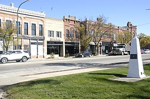
The Marion Commercial Historic District is a nationally recognized historic district located in Marion, Iowa, United States. It was listed on the National Register of Historic Places in 2009. At the time of its nomination it consisted of 41 resources, which included 29 contributing buildings, one contributing site, one contributing structure, two contributing objects, and eight non-contributing buildings.

Pucker Street Historic District
Historic district in Iowa, United States
Distance: Approx. 1230 meters
Latitude and longitude: 42.03416667,-91.59277778
The Pucker Street Historic District is a nationally recognized historic district located in Marion, Iowa, United States. It was listed on the National Register of Historic Places in 2002. At the time of its nomination it consisted of 84 resources, which included 50 contributing buildings, three contributing structures, two contributing objects, and 29 non-contributing buildings.

Terrace Park Historic District
Historic district in Iowa, United States
Distance: Approx. 844 meters
Latitude and longitude: 42.0375,-91.59722222
The Terrace Park Historic District is a nationally recognized historic district located in Marion, Iowa, United States. It was listed on the National Register of Historic Places in 2006. At the time of its nomination it consisted of 27 resources, which included 20 contributing buildings and seven non-contributing buildings.

Marion station (Iowa)
Railroad station in Marion, Iowa, USA
Distance: Approx. 1395 meters
Latitude and longitude: 42.032664,-91.59867
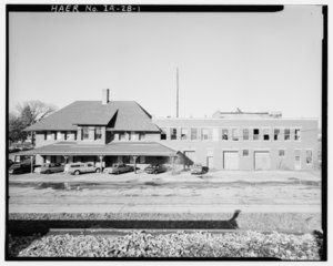
Marion station was a railroad station in Marion, Iowa. It served passenger trains of the Chicago, Milwaukee, St. Paul and Pacific Railroad, commonly known as the Milwaukee Road.
Weather in this IP's area
clear sky
-3 Celsius
-3 Celsius
-5 Celsius
-3 Celsius
1014 hPa
80 %
1014 hPa
982 hPa
10000 meters
0.45 m/s
0.45 m/s
269 degree
6 %