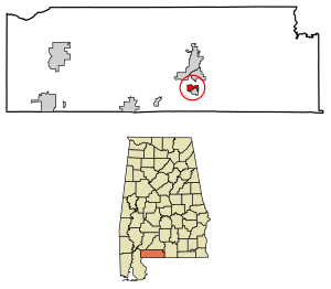
Country:
 USA
USARegion:
City:
Latitude and Longitude:
Time Zone:
Postal Code:
IP information under different IP Channel
ip-api
Country
Region
City
ASN
Time Zone
ISP
Blacklist
Proxy
Latitude
Longitude
Postal
Route
IPinfo
Country
Region
City
ASN
Time Zone
ISP
Blacklist
Proxy
Latitude
Longitude
Postal
Route
MaxMind
Country
Region
City
ASN
Time Zone
ISP
Blacklist
Proxy
Latitude
Longitude
Postal
Route
Luminati
Country
USRegion
al
City
brewton
ASN
Time Zone
America/Chicago
ISP
UNITI-FIBER
Latitude
Longitude
Postal
db-ip
Country
Region
City
ASN
Time Zone
ISP
Blacklist
Proxy
Latitude
Longitude
Postal
Route
ipdata
Country
Region
City
ASN
Time Zone
ISP
Blacklist
Proxy
Latitude
Longitude
Postal
Route
Popular places and events near this IP address

Escambia County, Alabama
County in Alabama, United States
Distance: Approx. 6308 meters
Latitude and longitude: 31.12666667,-87.16222222
Escambia County is a county located in the south central portion of the U.S. state of Alabama. As of the 2020 census, the population was 36,757. Its county seat is Brewton.

East Brewton, Alabama
City in Alabama, United States
Distance: Approx. 5805 meters
Latitude and longitude: 31.092408,-87.053174
East Brewton is a city in Escambia County, Alabama, United States. It was incorporated in October 1918. At the 2020 census, the population was 2,293.
Riverview, Alabama
Town in Alabama, United States
Distance: Approx. 8727 meters
Latitude and longitude: 31.058641,-87.056688
Riverview is a town in Escambia County, Alabama, United States. At the 2010 census the population was 184, up from 99 at the 2000 census.

Battle of Burnt Corn
Battle of the Creek War
Distance: Approx. 7274 meters
Latitude and longitude: 31.18957,-87.12587
The Battle of Burnt Corn, also known as the Battle of Burnt Corn Creek, was an encounter between United States armed forces and Red Stick Creeks that took place July 27, 1813 in present-day southern Alabama. This battle was the first engagement between the U.S. and Red Sticks in the Creek War.
T. R. Miller High School
Public school in Brewton, Alabama, United States
Distance: Approx. 2615 meters
Latitude and longitude: 31.138275,-87.070695
T. R. Miller High School is a public high school located in Brewton, Alabama educating students in grades 9-12. The school was named for local timber baron Thomas Richard Miller who financially contributed to the construction of the original school building. The school mascot is the T. R. Miller Tiger.
WEBJ
Radio station in Brewton, Alabama
Distance: Approx. 4078 meters
Latitude and longitude: 31.10972222,-87.06
WEBJ (1240 AM) is the oldest radio station in Brewton, Alabama, United States, going on air in 1947. The station serves the Brewton area with a news/talk format. The station broadcasts at 1000 watts and the transmitter is located near downtown Brewton.

Fort Crawford (Alabama)
United States historic site
Distance: Approx. 5772 meters
Latitude and longitude: 31.10083333,-87.04555556
Fort Crawford was a fort that once provided defense for settlers in what is today East Brewton, Alabama.
Spring Hill, Escambia County, Alabama
Unincorporated community in Alabama, United States
Distance: Approx. 6264 meters
Latitude and longitude: 31.10805556,-87.03527778
Spring Hill is an unincorporated community in Escambia County, Alabama, United States. Spring Hill is located on County Route 22, 2.2 miles (3.5 km) east of Brewton.
Brewton City Schools
School district in Alabama
Distance: Approx. 2511 meters
Latitude and longitude: 31.1178,-87.0735
Brewton City School District is a school district in Escambia County, Alabama, United States.

Brewton Historic Commercial District
Historic district in Alabama, United States
Distance: Approx. 3656 meters
Latitude and longitude: 31.10388889,-87.07194444
The Brewton Historic Commercial District is a 13-acre (5.3 ha) historic district in Brewton, Escambia County, Alabama. It is centered on U.S. Route 31. During its heyday it was the largest commercial center on the railroad between Montgomery and the Gulf Coast ports of Pensacola and Mobile.

Murder Creek (Alabama)
River in Alabama, United States
Distance: Approx. 6848 meters
Latitude and longitude: 31.0679,-87.0979
Murder Creek is a tributary of the lower Conecuh River. It is primarily located in Conecuh County, Alabama.

Second Saint Siloam Missionary Baptist Church
Historic site
Distance: Approx. 3784 meters
Latitude and longitude: 31.10895278,-87.06438611
The Second St. Siloam Missionary Baptist Church is an historic Baptist church located in Brewton, Alabama, United States.
Weather in this IP's area
clear sky
30 Celsius
32 Celsius
29 Celsius
30 Celsius
1009 hPa
56 %
1009 hPa
1006 hPa
10000 meters
2.06 m/s
2.31 m/s
82 degree
06:45:58
18:25:51