Country:
 USA
USARegion:
City:
Latitude and Longitude:
Time Zone:
Postal Code:
IP information under different IP Channel
ip-api
Country
Region
City
ASN
Time Zone
ISP
Blacklist
Proxy
Latitude
Longitude
Postal
Route
IPinfo
Country
Region
City
ASN
Time Zone
ISP
Blacklist
Proxy
Latitude
Longitude
Postal
Route
MaxMind
Country
Region
City
ASN
Time Zone
ISP
Blacklist
Proxy
Latitude
Longitude
Postal
Route
Luminati
Country
USRegion
fl
City
jacksonville
ASN
Time Zone
America/New_York
ISP
UNITI-FIBER
Latitude
Longitude
Postal
db-ip
Country
Region
City
ASN
Time Zone
ISP
Blacklist
Proxy
Latitude
Longitude
Postal
Route
ipdata
Country
Region
City
ASN
Time Zone
ISP
Blacklist
Proxy
Latitude
Longitude
Postal
Route
Popular places and events near this IP address

World Golf Hall of Fame
Professional sports hall of fame in Pinehurst, North Carolina
Distance: Approx. 7904 meters
Latitude and longitude: 29.99111111,-81.47027778
The World Golf Hall of Fame was, until recently, located at World Golf Village between Jacksonville, Florida and St. Augustine, Florida, in the United States. It is unusual amongst sports halls of fame in that a single site honored both men and women.

Shands Bridge
Bridge in Florida, United States of America
Distance: Approx. 8670 meters
Latitude and longitude: 29.9833,-81.6167
The Shands Bridge is a two-lane automobile bridge carrying SR 16 over the St. Johns River south of Jacksonville, Florida.
St. Johns, Florida
Unincorporated community in Florida, United States
Distance: Approx. 1789 meters
Latitude and longitude: 29.95208333,-81.51794444
St. Johns is an unincorporated community in northwest St. Johns County, Florida, United States and a suburb of Jacksonville.
World Golf Village
Census-designated place in Florida, United States
Distance: Approx. 7904 meters
Latitude and longitude: 29.99111111,-81.47027778
The World Golf Village (WGV) is a golf resort in St. Johns County, Florida, United States, located between Jacksonville and St. Augustine.
Watson Island State Forest
Distance: Approx. 7832 meters
Latitude and longitude: 29.892,-81.584
Watson Island State Forest is located in St. Johns County, Florida. The state forest includes 199 acres of Bottomland Forest, 129 acres of Wet Flatwoods, 124 acres of Mesic Flatwoods, 26 acres of floodplain, 23 acres of Baygall forest, 2 acres of Floodplain Marsh, 2 acres of ruderal and 1 acre of dome swamp.

Fort San Francisco de Pupo
18th-century Spanish fort in Florida, United States
Distance: Approx. 6637 meters
Latitude and longitude: 29.93861111,-81.60388889
Fort San Francisco de Pupo (Spanish: Fuerte San Francisco de Pupo) was an 18th-century Spanish fort on the west bank of the St. Johns River in Florida, about eighteen miles from St. Augustine (San Agustín), the capital of Spanish Florida (La Florida).
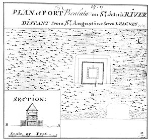
Fort Picolata
Distance: Approx. 6871 meters
Latitude and longitude: 29.92305556,-81.60083333
Fort Picolata (Spanish: Fuerte Picolata) was an 18th-century Spanish fort on the east bank of the St. Johns River, about eighteen miles from St. Augustine (San Agustín), the capital of Spanish Florida (La Florida).

Tocoi Creek High School
Public high school in St. Augustine, Florida, United States
Distance: Approx. 5078 meters
Latitude and longitude: 29.96894444,-81.48886111
Tocoi Creek High School (TCHS) is a new public high school in the World Golf Village census-designated place, in north central area of St. Johns County, Florida near St. Augustine.
Tocoi Creek
Tributary of St. Johns River, Florida
Distance: Approx. 9893 meters
Latitude and longitude: 29.86111111,-81.55277778
Tocoi Creek is a tributary of the St. Johns River in St. Johns County, Florida.
Weather in this IP's area
overcast clouds
25 Celsius
26 Celsius
24 Celsius
26 Celsius
1013 hPa
95 %
1013 hPa
1012 hPa
10000 meters
0.88 m/s
1.91 m/s
40 degree
100 %
07:06:51
19:41:31