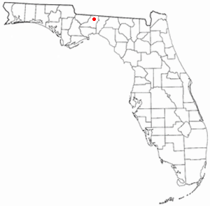
Country:
 USA
USARegion:
City:
Latitude and Longitude:
Time Zone:
Postal Code:
IP information under different IP Channel
ip-api
Country
Region
City
ASN
Time Zone
ISP
Blacklist
Proxy
Latitude
Longitude
Postal
Route
IPinfo
Country
Region
City
ASN
Time Zone
ISP
Blacklist
Proxy
Latitude
Longitude
Postal
Route
MaxMind
Country
Region
City
ASN
Time Zone
ISP
Blacklist
Proxy
Latitude
Longitude
Postal
Route
Luminati
Country
USRegion
fl
City
tallahassee
ASN
Time Zone
America/New_York
ISP
UNITI-FIBER
Latitude
Longitude
Postal
db-ip
Country
Region
City
ASN
Time Zone
ISP
Blacklist
Proxy
Latitude
Longitude
Postal
Route
ipdata
Country
Region
City
ASN
Time Zone
ISP
Blacklist
Proxy
Latitude
Longitude
Postal
Route
Popular places and events near this IP address
Lawton Chiles High School
Public secondary school in Tallahassee, Florida , United States
Distance: Approx. 7250 meters
Latitude and longitude: 30.571695,-84.2108015
Lawton Chiles High School is a public high school located on US 319 in unincorporated Leon County, Florida, United States, north of Tallahassee. It is a part of the Leon County school district.

Bradley's Country Store Complex
United States historic place
Distance: Approx. 6820 meters
Latitude and longitude: 30.59694444,-84.11777778
Bradley's Country Store Complex is located 12 miles (19 km) north of Tallahassee, Florida, United States on Centerville Road (County Road 151) in the community of Felkel, Florida. Bradley's Country Store complex has 17 buildings, most frame vernacular, on 31 acres (130,000 m2) of land.
Felkel, Florida
Unincorporated community in Florida, U.S.
Distance: Approx. 7055 meters
Latitude and longitude: 30.59833333,-84.11527778
Felkel is an unincorporated community in Leon County, Florida, United States.

House Place Plantation
Distance: Approx. 917 meters
Latitude and longitude: 30.5322,-84.1423
The House Place Plantation was a small forced-labor farm of 1,800 acres (730 ha) located in central Leon County, Florida, United States established by R.A. Whitfield.

Welaunee Plantation, Florida
Distance: Approx. 890 meters
Latitude and longitude: 30.533137,-84.140253
Welaunee Plantation was a large quail hunting plantation located in central Leon County, Florida, United States established by Udo M. Fleischmann.

Roberts Farm Historic and Archeological District
Historic district in Florida, United States
Distance: Approx. 1454 meters
Latitude and longitude: 30.53333333,-84.1575
The Roberts Farm Historic and Archeological District (also known as the Theus-Roberts Farm) is a U.S. historic district (designated as such on November 2, 1995) located in Tallahassee, Florida. The district is on Roberts Road, 1-mile (2 km) east of Centerville Road.

Pisgah United Methodist Church
Historic church in Florida, United States
Distance: Approx. 2208 meters
Latitude and longitude: 30.55138889,-84.16361111
The Pisgah United Methodist Church (also known as the Old Pisgah Church) is a historic church north of Tallahassee, Leon County, Florida, United States. It is located southeast of State Road 151 at the end of Pisgah Church Road. On May 3, 1974, it was added to the U.S. National Register of Historic Places.
Miccosukee Land Co-op
Community in Florida
Distance: Approx. 3259 meters
Latitude and longitude: 30.52,-84.12
The Miccosukee Land Cooperative (MLC) is a cohousing community (a kind of intentional community). It is located near Tallahassee, in northeastern Leon County, Florida.

Billingsley Farm
United States historic place
Distance: Approx. 7198 meters
Latitude and longitude: 30.51658333,-84.07472222
The Billingsley Farm is a historic place in Wadesboro, Florida, United States. It is located at 3640 Oakhurst Lane. On September 5, 2007, it was added to the U.S. National Register of Historic Places.

Woodfield Springs Plantation
Distance: Approx. 6134 meters
Latitude and longitude: 30.5785,-84.0986
Woodfield Spring Plantation was a large quail hunting plantation in northern Leon County, Florida, United States. Woodfield Springs was owned by Gilbert W. Humphrey, an executive with the M.A. Hanna Company of Cleveland, Ohio serving as president of the company in 1960 and chairman of the board in 1961. Humphrey's father also was an executive with Hanna and U.S. Secretary of the Tresaury.

Tallahassee Automobile Museum
Automobile museum, Collectibles in Tallahassee, Florida
Distance: Approx. 6227 meters
Latitude and longitude: 30.48642,-84.16245
The Tallahassee Automobile Museum (TACM), also known as the Tallahassee Automobile and Collectibles Museum, is an automobile museum in Tallahassee, Leon County, Florida. The museum is owned by Tallahassee-based businessman DeVoe L. Moore, and primarily showcases items of Americana from Moore's personal collection. The museum's collection includes over 160 automobiles, Steinway grand pianos, die-cast toy cars, pedal cars, antique boating items, golf memorabilia, Hit and Miss motors, brass cash registers, clocks, bicycles, boats, sports memorabilia, motorcycles, can openers, spark plugs, artifacts and memorabilia.
Community Christian School (Tallahassee, Florida)
Private school in Florida, United States
Distance: Approx. 6828 meters
Latitude and longitude: 30.53822222,-84.21577778
Community Christian School (CCS) is a private Christian school located in Tallahassee, Florida for grades K–12. According to its website site, tuition in 2017–2018 was $7,990 per year.
Weather in this IP's area
clear sky
7 Celsius
5 Celsius
5 Celsius
8 Celsius
1026 hPa
91 %
1026 hPa
1021 hPa
10000 meters
2.23 m/s
4.97 m/s
48 degree
07:41:03
19:01:51