Country:
 USA
USARegion:
City:
Latitude and Longitude:
Time Zone:
Postal Code:
IP information under different IP Channel
ip-api
Country
Region
City
ASN
Time Zone
ISP
Blacklist
Proxy
Latitude
Longitude
Postal
Route
IPinfo
Country
Region
City
ASN
Time Zone
ISP
Blacklist
Proxy
Latitude
Longitude
Postal
Route
MaxMind
Country
Region
City
ASN
Time Zone
ISP
Blacklist
Proxy
Latitude
Longitude
Postal
Route
Luminati
Country
USRegion
fl
City
tallahassee
ASN
Time Zone
America/New_York
ISP
UNITI-FIBER
Latitude
Longitude
Postal
db-ip
Country
Region
City
ASN
Time Zone
ISP
Blacklist
Proxy
Latitude
Longitude
Postal
Route
ipdata
Country
Region
City
ASN
Time Zone
ISP
Blacklist
Proxy
Latitude
Longitude
Postal
Route
Popular places and events near this IP address

Lake Jackson Mounds Archaeological State Park
Park in Tallahassee, Florida
Distance: Approx. 1045 meters
Latitude and longitude: 30.5,-84.31361111
Lake Jackson Mounds Archaeological State Park (8LE1) is one of the most important archaeological sites in Florida, the capital of chiefdom and ceremonial center of the Fort Walton Culture inhabited from 1050–1500. The complex originally included seven earthwork mounds, a public plaza and numerous individual village residences. One of several major mound sites in the Florida Panhandle, the park is located in northern Tallahassee, on the south shore of Lake Jackson.

Casa de Laga Plantation
Plantation in Florida, United States
Distance: Approx. 3077 meters
Latitude and longitude: 30.5144,-84.3325
Casa de Laga Plantation was a forced-labor farm of 1,228 acres (497 ha) located in west central Leon County, Florida, United States established by George Alexander Croom. It was also known as the Ball and McCabe Place and later as Shidzuoka. In 1860, 70 enslaved people worked the land, which was primarily devoted to producing cotton as a cash crop.
North Florida Christian School
Private, christian school in Tallahassee, Florida, United States
Distance: Approx. 3629 meters
Latitude and longitude: 30.486897,-84.278237
North Florida Christian School (NFCS) is a private Christian school in Tallahassee, Florida, originally founded as a segregation academy. The school is administered by North Florida Baptist Church, formerly known as Temple Baptist Church.
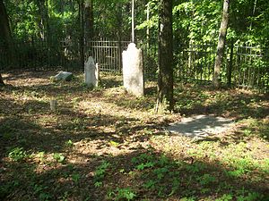
Blackwood-Harwood Plantations Cemetery
Historic site in Leon County, Florida
Distance: Approx. 3335 meters
Latitude and longitude: 30.48694444,-84.35027778
The Blackwood-Harwood Plantations Cemetery is a historic cemetery in Tallahassee, Florida, United States. It is located northeast of the junction of State Road 263 and I-10. On October 6, 1999, it was added to the U.S. National Register of Historic Places.

Lewis House (Tallahassee, Florida)
Historic house in Florida, United States
Distance: Approx. 306 meters
Latitude and longitude: 30.4901,-84.31272
The Lewis House, also known as Lewis Spring House, is a historic home in Tallahassee, Florida, located north of I-10, at 3117 Okeeheepkee Road. It was built in 1954. On February 14, 1979, it was added to the U.S. National Register of Historic Places.

Lichgate on High Road
Historic house in Florida, United States
Distance: Approx. 3418 meters
Latitude and longitude: 30.46027778,-84.31194444
The Lichgate on High Road is a site in Tallahassee, Florida. It is located at 1401 High Road. On March 31, 2006, it was added to the U.S. National Register of Historic Places.

Amos P. Godby High School
Public coeducational secondary school in Tallahassee, Florida, United States
Distance: Approx. 3340 meters
Latitude and longitude: 30.4608,-84.31645
Amos P. Godby High School is a public high school in Tallahassee, Florida, named for Amos P. Godby, who first served as a teacher and coach at Leon High School, and later became Leon County Superintendent and President and Secretary of the Florida Superintendents Association.
WCVC
Radio station in Tallahassee, Florida
Distance: Approx. 2865 meters
Latitude and longitude: 30.48416667,-84.28694444
WCVC is a radio station broadcasting on 1330 kilohertz in Tallahassee, Florida. WCVC is owned and operated by Guadalupe Radio Network of Midland Texas, and broadcasts a Catholic talk format from EWTN. It was a Christian-formatted station, then changed its format in April 2001 to a talk radio station, with callers and hosts discussing news and events of national and local interest. The station changed its format again, to EWTN, in August 2005.
WWLD
Radio station in Cairo, Georgia
Distance: Approx. 3053 meters
Latitude and longitude: 30.492,-84.284
WWLD (102.3 FM) is an urban contemporary formatted radio station licensed to Cairo, Georgia, and serving the Tallahassee, Florida, market and surrounding areas. The station is owned by Cumulus Media. According to Radio and Records, WWLD is now the highest-rated radio station in the Tallahassee market.
WBZE
Radio station in Tallahassee, Florida
Distance: Approx. 3053 meters
Latitude and longitude: 30.492,-84.284
WBZE (98.9 FM, "Star 98.9") is an adult contemporary radio station in the Tallahassee, Florida, market owned by Cumulus Licensing, LLC. Its studios are located on the west side of Tallahassee and its transmitter is based due north of downtown along I-10.
Luna Plantation
Distance: Approx. 2709 meters
Latitude and longitude: 30.5079,-84.3359
Luna Plantation was a quail hunting plantation located in northeastern Leon County, Florida, United States established by Lloyd C. Griscom. Lloyd C. Griscom was the son of Clement A. Griscom from Philadelphia, Pennsylvania. Clement was a shipping magnate, President of the Red Star Line and American Line.

Centre of Tallahassee
Shopping center and entertainment venue in Tallahassee, Florida, US
Distance: Approx. 2973 meters
Latitude and longitude: 30.476,-84.29
The Centre of Tallahassee, formerly Tallahassee Mall, is a local semi-enclosed mixed-use shopping, entertainment, and work office complex (formerly a fully enclosed regional shopping mall) located at the intersection of North Monroe Street and John Knox Road in Tallahassee, Florida. Since the official close of the faltering Northwood Mall in 1986 (and subsequent repurposing as a strip mall-styled office complex), The Tallahassee Mall became the older of two surviving enclosed malls in the Tallahassee area, the other being Governor's Square. The Centre's present anchor stores include AMC Theatres, Ross Dress For Less, and Belk, as well as several big-box stores including Barnes & Noble and Guitar Center.
Weather in this IP's area
overcast clouds
24 Celsius
25 Celsius
23 Celsius
25 Celsius
1013 hPa
97 %
1013 hPa
1008 hPa
10000 meters
100 %
07:17:39
19:52:56