Country:
 USA
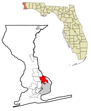
USARegion:
City:
Latitude and Longitude:
Time Zone:
Postal Code:
IP information under different IP Channel
ip-api
Country
Region
City
ASN
Time Zone
ISP
Blacklist
Proxy
Latitude
Longitude
Postal
Route
IPinfo
Country
Region
City
ASN
Time Zone
ISP
Blacklist
Proxy
Latitude
Longitude
Postal
Route
MaxMind
Country
Region
City
ASN
Time Zone
ISP
Blacklist
Proxy
Latitude
Longitude
Postal
Route
Luminati
Country
USRegion
fl
City
pensacola
ASN
Time Zone
America/Chicago
ISP
UNITI-FIBER
Latitude
Longitude
Postal
db-ip
Country
Region
City
ASN
Time Zone
ISP
Blacklist
Proxy
Latitude
Longitude
Postal
Route
ipdata
Country
Region
City
ASN
Time Zone
ISP
Blacklist
Proxy
Latitude
Longitude
Postal
Route
Popular places and events near this IP address

Ensley, Florida
Census-designated place in Florida, United States
Distance: Approx. 4672 meters
Latitude and longitude: 30.52333333,-87.27361111
Ensley is a census-designated place (CDP) in Escambia County, Florida. It is a community in Pensacola, and is located northwest of Pensacola City Limits. The population was 23,817 at the 2020 United States Census, up from 20,602 at the 2010 Census.
Ferry Pass, Florida
Census-designated place in Florida, United States
Distance: Approx. 2371 meters
Latitude and longitude: 30.5125,-87.20138889
Ferry Pass is a census-designated place (CDP) in Escambia County, Florida. It is considered to be a community within Pensacola. It is a principal community in the Pensacola—Ferry Pass—Brent, Florida Metropolitan Statistical Area, and is located north of Pensacola city limits.
University of West Florida
Public university in Pensacola, Florida, US
Distance: Approx. 3585 meters
Latitude and longitude: 30.5495,-87.2181
The University of West Florida (West Florida or UWF) is a public university in Pensacola, Florida, United States. Established in 1963 as a member institution of the State University System of Florida, the University of West Florida is a comprehensive research university without faculties of law or medicine, a designated space-grant institution, and sits on the third largest campus in the State University System, at 1,600 acres (650 ha). The university's mascot is Argie the Argonaut and its logo is the chambered nautilus.

Woodham High School
Distance: Approx. 3154 meters
Latitude and longitude: 30.4974184,-87.2480277
Woodham High School was a secondary school located in Pensacola, Florida. The high school was closed after nearly 42 years of operation in May 2007. It is now known as Woodham Middle School.

Booker T. Washington High School (Pensacola, Florida)
Secondary school in Pensacola, Florida, United States
Distance: Approx. 3947 meters
Latitude and longitude: 30.484874,-87.210316
Booker T. Washington High School is a secondary school currently located at 6000 College Parkway in Pensacola, Florida, and is part of the Escambia County School District. It was named after the African-American education pioneer Booker T. Washington. The previous location for the school is now in use as the J.E. Hall Center.
Jim Spooner Field
Stadium in Pensacola, Florida
Distance: Approx. 3142 meters
Latitude and longitude: 30.541375,-87.207112
Jim Spooner Field is a stadium in Pensacola, Florida, United States, that is primarily used for baseball, is the home field for the University of West Florida baseball team and was home to the Pensacola Pelicans. It opened in 1981 with a seating capacity of about 1,000 people. Over the years, that capacity has more than tripled.

John C. Pace Library
Distance: Approx. 3658 meters
Latitude and longitude: 30.5500228,-87.2172729
The John C. Pace Library is the academic library of the University of West Florida and is the largest library in Northwest Florida. In addition to the main library on the main campus north of Pensacola, Florida, there is a branch library in Fort Walton Beach, Florida. It has 752,000 printed volumes, 1.2 million microfilms and microfiches, 5,100 serial subscriptions and nearly 2,000 online journal subscriptions.
University of West Florida College of Arts and Sciences
College at University of West Florida
Distance: Approx. 3585 meters
Latitude and longitude: 30.5495,-87.2181
The University of West Florida College of Arts and Sciences (CAS) is the liberal arts college at the University of West Florida. It is the largest of UWF's three colleges.

Naval Air Station Ellyson Field
Airport
Distance: Approx. 2878 meters
Latitude and longitude: 30.5277,-87.19753
Naval Air Station Ellyson Field was a former U.S. Navy training base, established in Escambia County, Florida in 1940 at the outset of World War II as an auxiliary facility to Chevalier Field at Naval Air Station Pensacola, Florida. It had three red brick hangars common to the various Navy airfields in the Pensacola area, and eight paved runways, the longest of which was 3,550 ft in length. The short length of the air station's runways became increasingly incompatible with the introduction of higher performance piston aircraft followed by first generation jet aircraft in the post-World War II era.
1969 U.S. Women's Open
Golf tournament
Distance: Approx. 2945 meters
Latitude and longitude: 30.543,-87.235
The 1969 U.S. Women's Open was the 24th U.S. Women's Open, held June 26–29 at Scenic Hills Country Club in Pensacola, Florida. Donna Caponi, age 24, won the first of her two consecutive U.S. Women's Opens, one stroke ahead of runner-up Peggy Wilson. It was the first of four major titles for Caponi and the first of 24 victories on the LPGA Tour.
American Family Planning
Distance: Approx. 3235 meters
Latitude and longitude: 30.48888889,-87.22722222
American Family Planning, formerly known as The Ladies Center and as Community Healthcare Center, was a clinic in Pensacola, Florida, providing abortions and other women's healthcare services. It is notable as the site of a number of acts of anti-abortion violence. Perhaps best-known was the 1994 murder of Dr.
University Town Plaza
Shopping mall in Florida, U.S.
Distance: Approx. 2149 meters
Latitude and longitude: 30.4986,-87.2251
University Town Plaza is an outdoor shopping mall in Pensacola, Florida, United States. It is being developed on the site of the former University Mall, which operated from 1974 to 2013. The mall's original anchor stores were J. C. Penney, Sears, and McRae's.
Weather in this IP's area
clear sky
29 Celsius
30 Celsius
28 Celsius
30 Celsius
1009 hPa
59 %
1009 hPa
1006 hPa
10000 meters
2.57 m/s
20 degree
06:46:10
18:26:41