Country:
 USA
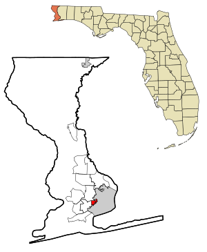
USARegion:
City:
Latitude and Longitude:
Time Zone:
Postal Code:
IP information under different IP Channel
ip-api
Country
Region
City
ASN
Time Zone
ISP
Blacklist
Proxy
Latitude
Longitude
Postal
Route
IPinfo
Country
Region
City
ASN
Time Zone
ISP
Blacklist
Proxy
Latitude
Longitude
Postal
Route
MaxMind
Country
Region
City
ASN
Time Zone
ISP
Blacklist
Proxy
Latitude
Longitude
Postal
Route
Luminati
Country
USRegion
fl
City
pensacola
ASN
Time Zone
America/Chicago
ISP
UNITI-FIBER
Latitude
Longitude
Postal
db-ip
Country
Region
City
ASN
Time Zone
ISP
Blacklist
Proxy
Latitude
Longitude
Postal
Route
ipdata
Country
Region
City
ASN
Time Zone
ISP
Blacklist
Proxy
Latitude
Longitude
Postal
Route
Popular places and events near this IP address

Brent, Florida
Census-designated place in Florida, United States
Distance: Approx. 2994 meters
Latitude and longitude: 30.47055556,-87.24916667
Brent is a census-designated place (CDP) in Escambia County, Florida. It is considered to be a community within Pensacola. The population was 23,447 at the 2020 census, up from 21,804 at the 2010 census.
Goulding, Florida
Census-designated place in Florida, United States
Distance: Approx. 3215 meters
Latitude and longitude: 30.43722222,-87.23055556
Goulding is a census-designated place (CDP) in Escambia County, Florida, United States. The population was 3,392 at the 2020 census, down from 4,102 at the 2010 census. It is part of the Pensacola–Ferry Pass–Brent, Florida Metropolitan Statistical Area.

West Pensacola, Florida
Census-designated place in Florida, United States
Distance: Approx. 2087 meters
Latitude and longitude: 30.4275,-87.26083333
West Pensacola is a census-designated place (CDP) in Escambia County, Florida. The population was 21,019 at the 2020 census, down from 21,339 at the 2010 census. It is part of the Pensacola–Ferry Pass–Brent, Florida Metropolitan Statistical Area.

Pensacola Christian Academy
Private Christian school in Pensacola, Florida, United States
Distance: Approx. 3241 meters
Latitude and longitude: 30.4688,-87.2411
Pensacola Christian Academy (PCA) is a private Christian school serving elementary through high school grades. It is located in Pensacola, Florida, United States.

Pensacola Catholic High School
Private high school in Pensacola, Florida, United States
Distance: Approx. 1473 meters
Latitude and longitude: 30.4375,-87.25083333
Pensacola Catholic High School is a private Catholic co-educational high school in Pensacola, Florida, United States. It was established in 1941 and is located in the Diocese of Pensacola-Tallahassee.

WRRX
Radio station in Gulf Breeze, Florida
Distance: Approx. 2737 meters
Latitude and longitude: 30.444,-87.234
WRRX (106.1 FM) is an urban adult contemporary music formatted radio station in the Pensacola, Florida, market owned by Cumulus Media. Its studios and transmitter are separately located in Pensacola. WRRX signed on in 2000 as WZRO with an active rock format as "Rock 106, Pensacola's Real Rock." Shortly thereafter, WZRO changed calls to WRRX. In 2004, WRRX changed format to Urban AC. It is one of two Urban ACs that Cumulus owns in the Gulf Coast area, the other being WDLT-FM in Mobile, Alabama.
WCOA (AM)
Radio station in Pensacola, Florida
Distance: Approx. 332 meters
Latitude and longitude: 30.44916667,-87.26277778
WCOA (1370 kHz) is a commercial AM radio station in Pensacola, Florida, serving the Emerald Coast. It is owned by Cumulus Media and broadcasts a news/talk radio format. The radio studios and offices are on North W Street off Pensacola Boulevard (U.S. Route 29).
WVTJ
Radio station in Pensacola, Florida
Distance: Approx. 2139 meters
Latitude and longitude: 30.45,-87.24055556
WVTJ (610 AM) is a radio station broadcasting a Gospel format. Licensed to Pensacola, Florida, United States, the station serves the Pensacola area. The station is owned by Pensacola Radio Corporation and features programming from Salem Communications.
Brownsville-Brent-Goulding, Florida
Former CDP in Florida, United States
Distance: Approx. 3215 meters
Latitude and longitude: 30.43722222,-87.23055556
Brownsville-Brent-Goulding was a Census-designated place in Escambia County, Florida during the 1950 United States Census, which consists of the communities of Brent, Brownsville, Goulding and West Pensacola. The population in 1950 was 20,269. The census area's name was reduced to just "Brownsville" during the 1960 Census, when the population increased to 38,417.
Escambia Wood
Distance: Approx. 3115 meters
Latitude and longitude: 30.4553,-87.2317
The Escambia Wood Treating Company (ETC) site is located at 3910 Palafox Highway, northeast of the intersection of Fairfield Drive in Pensacola, Florida, and is in a mixed industrial, commercial, and residential area. The site includes the 26-acre property of the former wood preserving facility and over 60 acres of nearby neighborhoods. The facility was in operation from 1942 until 1982, then abandoned by the owner in 1991.
Crescent Lake (Pensacola)
Reservoir in Brent, Florida
Distance: Approx. 589 meters
Latitude and longitude: 30.45,-87.26666667
Crescent Lake is a man made lake in Pensacola, Florida that was built for the Crescent Lake Subdivision that started selling homes in 1960. It is a natural spring fed lake that was created by a dam being built. The dam broke once in 1969 and was rebuilt.
Brownsville, Escambia County, Florida
Unincorporated community in Florida, United States
Distance: Approx. 1931 meters
Latitude and longitude: 30.43083333,-87.25305556
Brownsville is an unincorporated community in Escambia County, Florida, United States. It is located within the census-designated place of West Pensacola. It was enumerated as a Census-Designated Place in 1960, when the population recorded was 38,417.
Weather in this IP's area
clear sky
31 Celsius
32 Celsius
30 Celsius
32 Celsius
1010 hPa
47 %
1010 hPa
1008 hPa
10000 meters
6.69 m/s
9.77 m/s
50 degree
06:46:17
18:26:52