Country:
Region:
City:
Latitude and Longitude:
Time Zone:
Postal Code:
IP information under different IP Channel
ip-api
Country
Region
City
ASN
Time Zone
ISP
Blacklist
Proxy
Latitude
Longitude
Postal
Route
IPinfo
Country
Region
City
ASN
Time Zone
ISP
Blacklist
Proxy
Latitude
Longitude
Postal
Route
MaxMind
Country
Region
City
ASN
Time Zone
ISP
Blacklist
Proxy
Latitude
Longitude
Postal
Route
Luminati
Country
Region
fl
City
tampa
ASN
Time Zone
America/New_York
ISP
UNITI-FIBER
Latitude
Longitude
Postal
db-ip
Country
Region
City
ASN
Time Zone
ISP
Blacklist
Proxy
Latitude
Longitude
Postal
Route
ipdata
Country
Region
City
ASN
Time Zone
ISP
Blacklist
Proxy
Latitude
Longitude
Postal
Route
Popular places and events near this IP address
Palma Ceia
Human settlement in Tampa, Florida, United States of America
Distance: Approx. 1579 meters
Latitude and longitude: 27.921,-82.495
Palma Ceia is a neighborhood located southwest of downtown Tampa, Florida in South Tampa. It is bounded by Miguel Street West of MacDill Avenue and Neptune Street East of MacDill Avenue to the north; Bay to Bay Boulevard from Dale Mabry to Himes and El Prado between Himes and the Crosstown Expressway to the south; MacDill Avenue between Neptune and San Miguel, Dale Mabry Highway between San Miguel and Bay to Bay and Himes between Bay to Bay and El Prado to the west; and the Lee Roy Selmon Expressway to the east. The street names throughout Palma Ceia are of Cuban origin, coming from streets in the old section of Havana.

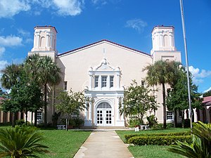
Henry B. Plant High School
Public high school in Tampa, Florida, United States
Distance: Approx. 823 meters
Latitude and longitude: 27.92361111,-82.50222222
H.B. Plant High School is a public high school located in the neighborhood of South Tampa in Tampa, Florida, United States. It opened in 1927 between South Himes Avenue on the east and Dale Mabry Highway on the west. The school is named after railroad and hotel tycoon Henry B. Plant, who connected Tampa to the United States railroad system in 1884.

LeClaire Apartments
United States historic place
Distance: Approx. 1675 meters
Latitude and longitude: 27.92277778,-82.49361111
The LeClaire Apartments is a historic apartment building in Tampa, Florida, United States. It is located at 3013 through 3015 San Carlos Street. It was designed by Tampa architect Fred J. James.
Sunset Park (Tampa)
Neighborhood in Hillsborough, Florida, United States
Distance: Approx. 1394 meters
Latitude and longitude: 27.91888889,-82.52305556
Sunset Park is a neighborhood within the city limits of Tampa, Florida. As of the 2000 census the neighborhood had a population of 3,520. The ZIP Code serving the neighborhood is 33629.

Roosevelt Elementary School (Tampa, Florida)
United States historic place
Distance: Approx. 1556 meters
Latitude and longitude: 27.91638889,-82.49777778
The Roosevelt Elementary School is a historic U.S. school in Tampa, Florida. It is a part of Hillsborough County Public Schools. It is located at 3205 South Ferdinand Avenue and was constructed in 1925.
Palma Ceia West
Neighborhood in Hillsborough, Florida, United States
Distance: Approx. 542 meters
Latitude and longitude: 27.92833333,-82.51416667
Palma Ceia West is a neighborhood within the city limits of Tampa, Florida, located just west of Palma Ceia. As of the 2000 census the neighborhood had a population of 2,531. The ZIP Codes serving the neighborhood are 33609 and 33629.
Virginia Park (Tampa)
Neighborhood in Hillsborough, Florida, United States
Distance: Approx. 876 meters
Latitude and longitude: 27.91916667,-82.50416667
Virginia Park is a neighborhood within the city limits of Tampa, Florida. As of the 2000 census the neighborhood had a population of 4,378. The ZIP Codes serving the area are 33611 and 33629.
Culbreath Bayou
Neighborhood in Hillsborough, Florida, United States
Distance: Approx. 1327 meters
Latitude and longitude: 27.93138889,-82.52166667
Culbreath Bayou is a neighborhood within the city limits of Tampa, Florida. As of the 2000 census the neighborhood had a population of 290. The ZIP Code serving the neighborhood is 33629.
Golf View
Neighborhood in Hillsborough, Florida, United States
Distance: Approx. 1575 meters
Latitude and longitude: 27.93361111,-82.49805556
Golf View is a neighborhood within the South Tampa district of Tampa. As of the 2010 census the neighborhood had a population of 226. The ZIP Codes serving the area are 33609 and 33629.
Swann Estates
Neighborhood in Hillsborough, Florida, United States
Distance: Approx. 1642 meters
Latitude and longitude: 27.93944444,-82.51
Swann Estates is a neighborhood within the city limits of Tampa, Florida. As of the 2000 census the neighborhood had a population of 1,491. The ZIP Codes serving the neighborhood are 33609 and 33629.
Stoney Point (Tampa)
Neighborhood in Hillsborough, Florida, United States
Distance: Approx. 1713 meters
Latitude and longitude: 27.92805556,-82.5275
Stoney Point is a neighborhood within the city limits of Tampa, Florida. As of the 2000 census the neighborhood had a population of 130. The ZIP code serving the area is 33629.
Maryland Manor
Neighborhood in Hillsborough, Florida, United States
Distance: Approx. 879 meters
Latitude and longitude: 27.9175,-82.51416667
Maryland Manor is a neighborhood in the southern area of Tampa, Florida, which represents District 4 of the Tampa City Council. The 2000 census numbers were unavailable, however, the latest estimated population was 1,616.
Weather in this IP's area
light rain
25 Celsius
26 Celsius
24 Celsius
26 Celsius
1006 hPa
82 %
1006 hPa
1005 hPa
10000 meters
7.2 m/s
60 degree
100 %
07:26:02
19:09:07