Country:
 USA
USARegion:
City:
Latitude and Longitude:
Time Zone:
Postal Code:
IP information under different IP Channel
ip-api
Country
Region
City
ASN
Time Zone
ISP
Blacklist
Proxy
Latitude
Longitude
Postal
Route
IPinfo
Country
Region
City
ASN
Time Zone
ISP
Blacklist
Proxy
Latitude
Longitude
Postal
Route
MaxMind
Country
Region
City
ASN
Time Zone
ISP
Blacklist
Proxy
Latitude
Longitude
Postal
Route
Luminati
Country
USRegion
ga
City
valdosta
ASN
Time Zone
America/New_York
ISP
UNITI-FIBER
Latitude
Longitude
Postal
db-ip
Country
Region
City
ASN
Time Zone
ISP
Blacklist
Proxy
Latitude
Longitude
Postal
Route
ipdata
Country
Region
City
ASN
Time Zone
ISP
Blacklist
Proxy
Latitude
Longitude
Postal
Route
Popular places and events near this IP address

Remerton, Georgia
City in Georgia, United States
Distance: Approx. 5744 meters
Latitude and longitude: 30.84361111,-83.30861111
Remerton is a city in Lowndes County, Georgia, United States. The population was 1,123 at the 2010 census, and 1,334 in 2020. It was incorporated as a town in 1951, and chartered as a city under Georgia law in 2000.
Troupville, Georgia
Unincorporated community in Georgia, United States
Distance: Approx. 5124 meters
Latitude and longitude: 30.84916667,-83.3375
"Troupville" (occasionally recorded as Troupeville) is an extinct unincorporated community in Lowndes County, Georgia, United States, near Valdosta. Troupville was a riverboat landing near the confluence of the Withlacoochee River and the Little River (Withlacoochee River) at the uppermost navigable point. It was the third county seat of Lowndes County.

Valwood School
School in Hahira, Georgia
Distance: Approx. 358 meters
Latitude and longitude: 30.896,-83.326
Valwood School is an independent, coeducational, college preparatory school located four miles (6.4 km) outside of Valdosta, Georgia, United States. It offers programs from pre-kindergarten through high school. There were 420 students enrolled in the 2021–2022 school year, 85% of them White.
East Central Technical College
Distance: Approx. 2931 meters
Latitude and longitude: 30.89,-83.35388889
Until July 1, 2010, East Central Technical College was a technical college within the Technical College System of Georgia. Its primary locations were in Fitzgerald and Ocilla, with a satellite and extended campuses located in Douglas, Pearson, and Rochelle. The school served the counties of Ben Hill/Irwin, Coffee, Atkinson, and Wilcox.
Valdosta Mall
Shopping mall in Georgia, United States
Distance: Approx. 5461 meters
Latitude and longitude: 30.84456,-83.32188
Valdosta Mall is an enclosed shopping mall located in Valdosta, Georgia, United States. It is composed of more than 70 stores and restaurants in 560,000 sq ft (52,026 m2) of gross leasable area. Belk, and JCPenney, are the mall's anchor stores.

Little River (Withlacoochee River tributary)
River in the United States
Distance: Approx. 5606 meters
Latitude and longitude: 30.8477,-83.34765
The Little River is a 105-mile-long (169 km) tributary of the Withlacoochee River in the U.S. state of Georgia. Via the Withlacoochee and the Suwannee River its waters flow to the Gulf of Mexico. The Little River was also known historically as the Ockolocoochee River.
Wiregrass Georgia Technical College
Technical college in Valdosta, Georgia, United States
Distance: Approx. 3004 meters
Latitude and longitude: 30.886444,-83.35382
Wiregrass Georgia Technical College (WGTC) is a public community college in Valdosta, Georgia. It is part of the Technical College System of Georgia and provides education for an eleven-county service area in south-central Georgia. The school's service area includes Atkinston, Ben Hill, Berrien, Brooks, Coffee, Cook, Echols, Irwin, Lanier, Lowndes, and Wilcox counties.

South Georgia Medical Center
Hospital in Georgia, United States
Distance: Approx. 5021 meters
Latitude and longitude: 30.861841,-83.286185
South Georgia Medical Center is one of two hospital providers in Valdosta, Georgia and surrounding Lowndes County, Georgia. The facility opened in 1955 as Pineview General Hospital on Alternate Georgia State Route 7 (N Patterson St) north of downtown Valdosta. The hospital has 285 inpatient beds and is locally operated.

Crestwood (Valdosta, Georgia)
Historic house in Georgia, United States
Distance: Approx. 3251 meters
Latitude and longitude: 30.87047,-83.30272
Crestwood is a historic home in Valdosta, Georgia. It was added to the National Register of Historic Places on January 12, 1984. It is located at 502 Eager Road.
Valdosta State Prison
State prison in Valdosta, Georgia, USA
Distance: Approx. 4439 meters
Latitude and longitude: 30.85828,-83.345061
Valdosta State Prison is a Georgia Department of Corrections state prison for men located in Valdosta, Lowndes County, Georgia. The facility first opened in 1959, and has a maximum capacity of 1312 inmates held at close security level.

Brookwood North Historic District
Historic district in Georgia, United States
Distance: Approx. 5783 meters
Latitude and longitude: 30.851667,-83.287778
Brookwood North Historic District in Valdosta, Georgia is a historic district which was listed on the National Register of Historic Places in 1995. The listing included 218 contributing buildings and a contributing site, as well as 88 non-contributing buildings. Its 175 acres (0.71 km2) area is roughly bounded by Patterson St., Georgia Ave., Oak St., Park Ave., Williams St.
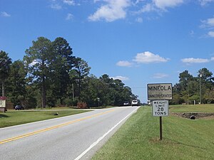
Mineola, Georgia
Unincorporated community in Georgia, U.S.
Distance: Approx. 2486 meters
Latitude and longitude: 30.90777778,-83.34361111
Mineola is an unincorporated community in Lowndes County, in the U.S. state of Georgia.
Weather in this IP's area
clear sky
7 Celsius
7 Celsius
6 Celsius
8 Celsius
1026 hPa
94 %
1026 hPa
1021 hPa
10000 meters
0.89 m/s
1.34 m/s
95 degree
07:38:05
18:58:15