Country:
 USA
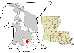
USARegion:
City:
Latitude and Longitude:
Time Zone:
Postal Code:
IP information under different IP Channel
ip-api
Country
Region
City
ASN
Time Zone
ISP
Blacklist
Proxy
Latitude
Longitude
Postal
Route
IPinfo
Country
Region
City
ASN
Time Zone
ISP
Blacklist
Proxy
Latitude
Longitude
Postal
Route
MaxMind
Country
Region
City
ASN
Time Zone
ISP
Blacklist
Proxy
Latitude
Longitude
Postal
Route
Luminati
Country
USRegion
la
City
batonrouge
ASN
Time Zone
America/Chicago
ISP
UNITI-FIBER
Latitude
Longitude
Postal
db-ip
Country
Region
City
ASN
Time Zone
ISP
Blacklist
Proxy
Latitude
Longitude
Postal
Route
ipdata
Country
Region
City
ASN
Time Zone
ISP
Blacklist
Proxy
Latitude
Longitude
Postal
Route
Popular places and events near this IP address
Inniswold, Louisiana
Census-designated place in Louisiana, United States
Distance: Approx. 4819 meters
Latitude and longitude: 30.40055556,-91.07166667
Inniswold is an unincorporated area and census-designated place (CDP) in East Baton Rouge Parish, Louisiana, United States. The population was 6,180 at the 2010 census, up from 4,944 in 2000. In 2020, its population was 5,987.

Shenandoah, Louisiana
Census-designated place in Louisiana, United States
Distance: Approx. 4382 meters
Latitude and longitude: 30.40138889,-91.00444444
Shenandoah is an unincorporated area and census-designated place (CDP) in East Baton Rouge Parish, Louisiana, United States. It is part of the Baton Rouge Metropolitan Statistical Area. The population was 18,399 at the 2010 census, up from 17,070 in 2000.
St. Jean Vianney School
School in Louisiana, United States
Distance: Approx. 2946 meters
Latitude and longitude: 30.42388889,-91.00555556
St. Jean Vianney Catholic School is the newest Roman Catholic Elementary/Middle Parochial School in Baton Rouge, Louisiana. It runs from kindergarten to eighth grade and is a part of the Roman Catholic Diocese of Baton Rouge.
Parkview Baptist High School
Private school in Baton Rouge, Louisiana, United States
Distance: Approx. 3867 meters
Latitude and longitude: 30.39805556,-91.05
Parkview Baptist School (PBS) is a private K-12 Christian school located in Baton Rouge, Louisiana, United States.
Louisiana Culinary Institute
Distance: Approx. 3710 meters
Latitude and longitude: 30.41027778,-91.06611111
The Louisiana Culinary Institute is a for-profit junior culinary college in Baton Rouge, Louisiana. It offers Associate degrees in Culinary Arts and Hospitality and Culinary Management. In 2013, The Cooking Channel hosted a series of "The Freshman Class" program, at the institute, which followed four freshman through their studies.
Belaire High School
Free public school
Distance: Approx. 4271 meters
Latitude and longitude: 30.466893,-91.049044
Belaire High School (usually abbreviated as "Belaire" or BHS) is a public school in East Baton Rouge Parish. It is located in Baton Rouge, Louisiana. The school is a part of the East Baton Rouge Parish Public Schools.
St. Michael the Archangel High School (East Baton Rouge Parish, Louisiana)
Private, coeducational school in Baton Rouge, , Louisiana, United States
Distance: Approx. 4929 meters
Latitude and longitude: 30.41,-90.98972222
St. Michael the Archangel Diocesan Regional High School (often referred to as St. Michael the Archangel or just St.
Broadmoor High School
Public school in the United States
Distance: Approx. 4082 meters
Latitude and longitude: 30.44222222,-91.07555556
Broadmoor Senior High School (Broadmoor High School or BHS) is an accredited high school in Baton Rouge, Louisiana, United States. It is a part of the East Baton Rouge Parish School System.
2016 shooting of Baton Rouge police officers
Mass shooting in Baton Rouge, Louisiana
Distance: Approx. 4470 meters
Latitude and longitude: 30.4338,-91.0817
On July 17, 2016, Gavin Eugene Long shot six police officers in Baton Rouge, Louisiana in an ambush attack, in the wake of the shooting of Alton Sterling. Four died, including one who was critically wounded and died from complications in 2022, and two others were hospitalized; of the officers who initially died, two were members of the Baton Rouge Police Department, while the third worked for the East Baton Rouge Parish Sheriff's Office. Long, who associated himself with organizations linked to black separatism and the sovereign citizen movement, was shot and killed by a SWAT officer during a shootout with police at the scene.

Mango's Beach Volleyball Club
Distance: Approx. 1909 meters
Latitude and longitude: 30.4241,-91.0538
Mango's Beach Volleyball Club is a beach volleyball facility located in Baton Rouge, Louisiana. The facility, built in 1995, serves as the home of the LSU Tigers women's beach volleyball team, local leagues and local volleyball tournaments. The facility has 13 sand courts where tournaments are held and where LSU plays its home matches and hold practices.
Aubin, Louisiana
Unincorporated community in Louisiana
Distance: Approx. 2930 meters
Latitude and longitude: 30.41944444,-91.06305556
Aubin is an unincorporated community in East Baton Rouge Parish, Louisiana, United States. The community is located 4 miles (6.4 kilometres) to the southeast of Baton Rouge and less than 2 miles (3.2 kilometres) northeast of Westminster and 7 miles (11 kilometres) east of the Mississippi River.
Nesser, Louisiana
Unincorporated community in Louisiana
Distance: Approx. 3911 meters
Latitude and longitude: 30.39833333,-91.05194444
Nesser is an unincorporated community in East Baton Rouge Parish, Louisiana, United States. The community is located 2 miles (3.2 kilometres) northwest of Old Jefferson and 2 miles (3.2 kilometres) southeast of Westminster.
Weather in this IP's area
broken clouds
24 Celsius
25 Celsius
23 Celsius
25 Celsius
1013 hPa
88 %
1013 hPa
1012 hPa
10000 meters
0.89 m/s
2.24 m/s
360 degree
66 %
06:44:35
19:19:45