Country:
 USA
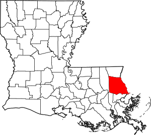
USARegion:
City:
Latitude and Longitude:
Time Zone:
Postal Code:
IP information under different IP Channel
ip-api
Country
Region
City
ASN
Time Zone
ISP
Blacklist
Proxy
Latitude
Longitude
Postal
Route
IPinfo
Country
Region
City
ASN
Time Zone
ISP
Blacklist
Proxy
Latitude
Longitude
Postal
Route
MaxMind
Country
Region
City
ASN
Time Zone
ISP
Blacklist
Proxy
Latitude
Longitude
Postal
Route
Luminati
Country
USRegion
la
City
covington
ASN
Time Zone
America/Chicago
ISP
UNITI-FIBER
Latitude
Longitude
Postal
db-ip
Country
Region
City
ASN
Time Zone
ISP
Blacklist
Proxy
Latitude
Longitude
Postal
Route
ipdata
Country
Region
City
ASN
Time Zone
ISP
Blacklist
Proxy
Latitude
Longitude
Postal
Route
Popular places and events near this IP address

Covington, Louisiana
City in Louisiana, United States
Distance: Approx. 971 meters
Latitude and longitude: 30.47888889,-90.10416667
Covington is a city in, and the parish seat of, St. Tammany Parish, Louisiana, United States. The population was 11,564 at the 2020 United States census.
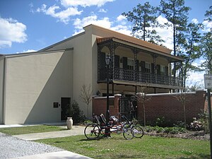
St. Paul's School (Louisiana)
Private school in Covington, Louisiana, United States
Distance: Approx. 2107 meters
Latitude and longitude: 30.46785,-90.10533056
Saint Paul's School is a private all-boys Lasallian high school, located in Covington, Louisiana just to the north of New Orleans, United States. Located in the Roman Catholic Archdiocese of New Orleans, the school is run by the Christian Brothers and is one of the 1,000 Lasallian schools in more than 80 countries. It is part of 300 years of history originating from the founding of the Christian Brother Schools by Saint Jean Baptiste de La Salle.
Abita River
River in Louisiana, United States
Distance: Approx. 3502 meters
Latitude and longitude: 30.45444444,-90.10277778
The Abita River is a 9.3-mile-long (15.0 km) river in southeastern Louisiana in the United States. It is a tributary of the Bogue Falaya, which flows to the Tchefuncte River and then onto Lake Pontchartrain. The Abita River rises in central St.
Abita Brewing Company
American brewery in Louisiana
Distance: Approx. 3958 meters
Latitude and longitude: 30.4824087,-90.056605
The Abita Brewing Company is a brewery in Covington, Louisiana, United States, 43 miles (69 km) north of New Orleans. Abita was founded by Jim Patton and Rush Cumming in 1986, in downtown Abita Springs, Louisiana. The original location in downtown Abita Springs is now the Abita Brew Pub.
St. Scholastica Academy (Covington, Louisiana)
Private, all-girls high school in Covington, , Louisiana, United States
Distance: Approx. 1335 meters
Latitude and longitude: 30.47361111,-90.09777778
St. Scholastica Academy (SSA) is a private, Roman Catholic, all-girls high school in Covington, Louisiana. It is located in the Roman Catholic Archdiocese of New Orleans.

Christ Episcopal Church (Covington, Louisiana)
Historic church in Louisiana, United States
Distance: Approx. 2059 meters
Latitude and longitude: 30.46722222,-90.09527778
Christ Episcopal Church is a historic Episcopal church at 120 N. New Hampshire Street in Covington, Louisiana. The church was built in 1846 by Jonathan Arthur of London for descendants of English settlers in British West Florida (1763–1783). It was consecrated by Bishop Leonidas Polk on April 11, 1847, Christ Church is the oldest public building being used in Covington.

Covington Brewhouse
Brewery in Louisiana, United States
Distance: Approx. 877 meters
Latitude and longitude: 30.47778056,-90.09885
Covington Brewhouse was a brewery in the historic district of downtown Covington, Louisiana. The brewery itself is operated in the old Alexius Hardware building which is situated between the 100-year-old train depot, the landmark water tower, and the city's trailhead park. The brewery produces year round beers including Pontchartrain Pilsner, Bayou Bock, and Strawberry Ale.
St. Tammany Parish Sheriff's Office
Law enforcement agency
Distance: Approx. 613 meters
Latitude and longitude: 30.48025,-90.09619722
The St. Tammany Parish Sheriff's Office (STPSO) is the chief law enforcement agency of St. Tammany Parish, Louisiana.

Division of St. John Historic District
United States historic place
Distance: Approx. 1147 meters
Latitude and longitude: 30.475833,-90.093889
The Division of St. John Historic District, in Covington, Louisiana, also known as the Covington Historic District, is a 100 acres (40 ha) historic district which was listed on the National Register of Historic Places in 1982. It is the original portion of Covington, on the east of north–south U.S. 190; Business 190 also known as LA 21 runs through it, is E. Boston St.
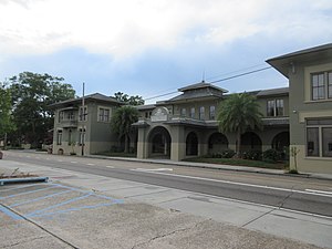
Southern Hotel (Covington, Louisiana)
United States historic place
Distance: Approx. 1120 meters
Latitude and longitude: 30.475636,-90.096078
The Southern Hotel in Covington, Louisiana, is located in the Division of St. John Historic District also known as the Covington Historic District, a historic district which was listed on the National Register of Historic Places in 1982. The hotel is a local landmark.
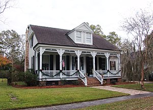
Frederick House (Covington, Louisiana)
United States historic place
Distance: Approx. 1678 meters
Latitude and longitude: 30.47055556,-90.09666667
The Frederick House, at 238 Vermont St. in Covington, Louisiana, is a one-and-half-story raised house built around 1890. It was listed on the National Register of Historic Places in 1982.
Claiborne Cottage Hotel
United States historic place
Distance: Approx. 1637 meters
Latitude and longitude: 30.4734,-90.08817
The Claiborne Cottage Hotel, near Covington in St. Tammany Parish, Louisiana is a former hotel which was opened in 1880 in the former St. Tammany Parish Courthouse (built 1818–19).
Weather in this IP's area
overcast clouds
24 Celsius
24 Celsius
23 Celsius
25 Celsius
1013 hPa
83 %
1013 hPa
1012 hPa
10000 meters
2.81 m/s
10 m/s
26 degree
100 %
06:40:48
19:16:03