142.134.210.223 - IP Lookup: Free IP Address Lookup, Postal Code Lookup, IP Location Lookup, IP ASN, Public IP
Country:
Region:
City:
Location:
Time Zone:
Postal Code:
IP information under different IP Channel
ip-api
Country
Region
City
ASN
Time Zone
ISP
Blacklist
Proxy
Latitude
Longitude
Postal
Route
Luminati
Country
Region
nl
City
stjohns
ASN
Time Zone
America/St_Johns
ISP
CANET-ASN-4
Latitude
Longitude
Postal
IPinfo
Country
Region
City
ASN
Time Zone
ISP
Blacklist
Proxy
Latitude
Longitude
Postal
Route
IP2Location
142.134.210.223Country
Region
newfoundland and labrador
City
corner brook
Time Zone
America/St_Johns
ISP
Language
User-Agent
Latitude
Longitude
Postal
db-ip
Country
Region
City
ASN
Time Zone
ISP
Blacklist
Proxy
Latitude
Longitude
Postal
Route
ipdata
Country
Region
City
ASN
Time Zone
ISP
Blacklist
Proxy
Latitude
Longitude
Postal
Route
Popular places and events near this IP address

Humber River (Newfoundland and Labrador)
Distance: Approx. 4022 meters
Latitude and longitude: 48.95851389,-57.89479444
The Humber River is a river on Newfoundland in the Canadian province of Newfoundland and Labrador. It is approximately 120 kilometres long; it flows through the Long Range Mountains, southeast then southwest, through Deer Lake, to the Bay of Islands at Corner Brook. It begins near the town of Hampden.

Curling, Newfoundland and Labrador
Neighbourhood in Corner Brook, Newfoundland and Labrador, Canada
Distance: Approx. 3705 meters
Latitude and longitude: 48.95916667,-57.99777778
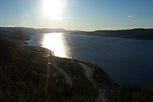
Curling is a mainly residential neighbourhood of the city of Corner Brook, Newfoundland and Labrador. It is situated just west of the main part of the city. Located in the Humber Arm of the Bay of Islands, Curling was originally a fishing community.
Division No. 5, Newfoundland and Labrador
Census division in Newfoundland and Labrador, Canada
Distance: Approx. 1832 meters
Latitude and longitude: 48.95916667,-57.92611111
Census Division No. 5 is a Statistics Canada statistical division composed of the areas of the province of Newfoundland and Labrador called Humber Valley, Bay of Islands, and White Bay. It covers a land area of 10,365.63 km² (4,002.19 sq mi), and had a population of 42,014 according to the 2016 census.
Roman Catholic Diocese of Corner Brook and Labrador
Catholic ecclesiastical territory
Distance: Approx. 1863 meters
Latitude and longitude: 48.95,-57.95
The Roman Catholic Diocese of Corner Brook and Labrador (Latin: Dioecesis Riviangulanensis-Labradorensis) (erected 9 May 1870, as the Prefecture Apostolic of Western Newfoundland) is a suffragan of the Archdiocese of St. John's, Newfoundland. The Cathedral of the diocese is located in Corner Brook.

Irishtown-Summerside
Town in Newfoundland and Labrador, Canada
Distance: Approx. 1855 meters
Latitude and longitude: 48.98333333,-57.95
Irishtown-Summerside is a town in the Canadian province of Newfoundland and Labrador. It is located about 2.5 miles north of Corner Brook. The Post Office was established on March 1, 1965, and the first Postmistress was Blanch Anderson.
Corner Brook Regional High
Public high school in Corner Brook, Newfoundland and Labrador, Canada
Distance: Approx. 2903 meters
Latitude and longitude: 48.9413,-57.9394
Corner Brook Regional High School, known colloquially as "CBRH", is a Canadian secondary school in Corner Brook, Newfoundland and Labrador. It is one of the largest schools in the province of Newfoundland and Labrador; it also has the largest student population of any school in the province. The school handles both English and French immersion streams.

Blomidon Golf & Country Club
Distance: Approx. 3292 meters
Latitude and longitude: 48.94249,-57.92254
Blomidon Golf & Country Club is a golf course located in Corner Brook, Newfoundland and Labrador, Canada.
Grenfell Campus
Campus of Canadian university
Distance: Approx. 3190 meters
Latitude and longitude: 48.94009,-57.9322
Grenfell Campus, formerly Sir Wilfred Grenfell College, is a campus of the Memorial University of Newfoundland (MUN). It is located in the city of Corner Brook, Newfoundland and Labrador, Canada. The campus has approximately 1,300 students enrolled in degree programs for the arts, education, fine arts, science, resource management and nursing.

Corner Brook Civic Centre
Arena in Corner Brook, Canada
Distance: Approx. 3083 meters
Latitude and longitude: 48.9396,-57.93971111
The Corner Brook Civic Centre (previously named the Canada Games Centre and the Pepsi Centre) is a 3,100-seat multi-purpose arena in Corner Brook, Newfoundland and Labrador, Canada. It was home to the ice hockey, figure skating, judo, and squash events of the 1999 Canada Winter Games. Previously run by Memorial University through Western Sports and Entertainment, it is currently owned and operated by the City of Corner Brook.
Cathedral of St. John the Evangelist (Corner Brook)
Distance: Approx. 1863 meters
Latitude and longitude: 48.95,-57.95
The Cathedral of St. John the Evangelist is the Anglican cathedral of the Diocese of Western Newfoundland. It is in the city of Corner Brook.

Corner Brook (electoral district)
Provincial electoral district in Newfoundland and Labrador, Canada
Distance: Approx. 2491 meters
Latitude and longitude: 48.944706,-57.942125
Corner Brook is a provincial electoral district in Newfoundland and Labrador. As of 2011, there are 13,718 people living in the district. Corner Brook merges most of the former district of Humber East and most of the former district of Humber West.

CKVB-FM
Radio station in Corner Brook, Newfoundland and Labrador
Distance: Approx. 1901 meters
Latitude and longitude: 48.94972222,-57.94555556
CKVB-FM (100.1 BayFM) is a Canadian radio station. The station broadcasts a Country/community radio format on 100.1 FM in Corner Brook, Newfoundland and Labrador. Until June 2023, the station was branded as Bay of Islands Radio (BOIR).
Weather in this IP's area
overcast clouds
-2 Celsius
-2 Celsius
-2 Celsius
-2 Celsius
980 hPa
99 %
980 hPa
980 hPa
475 meters
0.79 m/s
0.71 m/s
197 degree
99 %
