Country:
Region:
City:
Latitude and Longitude:
Time Zone:
Postal Code:
IP information under different IP Channel
ip-api
Country
Region
City
ASN
Time Zone
ISP
Blacklist
Proxy
Latitude
Longitude
Postal
Route
Luminati
Country
Region
nl
City
paradise
ASN
Time Zone
America/St_Johns
ISP
CANET-ASN-4
Latitude
Longitude
Postal
IPinfo
Country
Region
City
ASN
Time Zone
ISP
Blacklist
Proxy
Latitude
Longitude
Postal
Route
db-ip
Country
Region
City
ASN
Time Zone
ISP
Blacklist
Proxy
Latitude
Longitude
Postal
Route
ipdata
Country
Region
City
ASN
Time Zone
ISP
Blacklist
Proxy
Latitude
Longitude
Postal
Route
Popular places and events near this IP address

Paradise, Newfoundland and Labrador
Town in Newfoundland, Canada
Distance: Approx. 1366 meters
Latitude and longitude: 47.53333333,-52.86666667
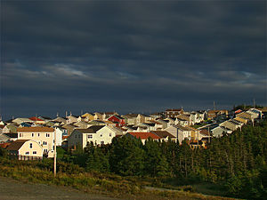
Paradise is a town on the Avalon Peninsula in the province of Newfoundland and Labrador, Canada. Paradise is the third largest settlement in the province and is part of the St. John's metropolitan area, the 20th largest metropolitan area in Canada.
VOCM (AM)
Radio station in St. John's, Newfoundland and Labrador, Canada
Distance: Approx. 7750 meters
Latitude and longitude: 47.54765833,-52.78304444
VOCM is an AM radio station in St. John's, Newfoundland and Labrador, Canada, broadcasting at 590 kHz. Owned by Stingray Group, VOCM first went on the air on October 19, 1936.

VOAR-FM
Christian radio station in Mount Pearl, Newfoundland and Labrador
Distance: Approx. 4605 meters
Latitude and longitude: 47.5347,-52.8211
VOAR-FM (96.7 MHz) is a Canadian radio station, which airs a Christian radio format. It is licensed to Mount Pearl, Newfoundland and Labrador, and serves the St. John's metropolitan area.

Mount Pearl South
Provincial electoral district in Newfoundland and Labrador, Canada
Distance: Approx. 6199 meters
Latitude and longitude: 47.501,-52.807
Mount Pearl South is a defunct provincial electoral district for the House of Assembly of Newfoundland and Labrador, Canada. Prior to the 2007 provincial election, the district was known as Mount Pearl. Mount Pearl South has seen an expansion in big-box retail outlets in recent years.

Mount Pearl North
Provincial electoral district in Newfoundland and Labrador, Canada
Distance: Approx. 5333 meters
Latitude and longitude: 47.524,-52.81
Mount Pearl North, formerly known as Waterford Valley, is a provincial electoral district for the House of Assembly of Newfoundland and Labrador, Canada. As of 2011, there are 9,622 eligible voters living within the district. This suburban district includes the northern part of the city of Mount Pearl and part of the city of St.
St. John's (Paddys Pond) Water Aerodrome
Airport in St. John's, Newfoundland and Labrador
Distance: Approx. 6418 meters
Latitude and longitude: 47.46833333,-52.88944444
St. John's (Paddys Pond) Water Aerodrome (TC LID: CCQ5) is located 5 nautical miles (9.3 km; 5.8 mi) southwest of St. John's, Newfoundland and Labrador, Canada on Paddy's Pond.

CKSJ-FM
Radio station in St. John's, Newfoundland and Labrador
Distance: Approx. 6963 meters
Latitude and longitude: 47.53444444,-52.78916667
CKSJ-FM (101.1 MHz, Coast 101.1) is a radio station broadcasting in St. John's, Newfoundland and Labrador, Canada. Approved by the Canadian Radio-television and Telecommunications Commission in 2003, the station began broadcasting on February 12, 2004, and is the most recent radio station to have launched in that city.
Admiralty House, Mount Pearl
Communications Museum in Mount Pearl, Newfoundland and Labrador
Distance: Approx. 6885 meters
Latitude and longitude: 47.50475556,-52.79473056
Admiralty House is a one-storey, wooden gable-roofed, municipally-designated heritage building originally built as a wireless communications station in Mount Pearl, Newfoundland and Labrador, Canada. It currently serves as a museum and archives. The building is purported to be the last standing of 11 such identical stations built around the world during the First World War.
Donovans, Newfoundland and Labrador
Distance: Approx. 3450 meters
Latitude and longitude: 47.52583333,-52.835
Donovans was a village located west of St. John's, Newfoundland and Labrador, eastern Canada. It had a population of 325 by 1956.

Manuels River
River in Newfoundland and Labrador, Canada
Distance: Approx. 5322 meters
Latitude and longitude: 47.52722222,-52.95166667
The Manuels River is located in the eastern portion of the town of Conception Bay South, Newfoundland and Labrador. It forms on the high lands of the central Avalon Plateau, traverses approximately 10 kilometres of terrain and empties into the waters of Conception Bay. The river is accessible via walking trails, which start at the Manuels River Hibernia Interpretation Centre located on the Conception Bay Highway.

Mount Pearl
City in Newfoundland and Labrador, Canada
Distance: Approx. 5694 meters
Latitude and longitude: 47.51888889,-52.80583333
Mount Pearl is the fourth-largest municipality and second-largest city in Newfoundland and Labrador, Canada. The city is located southwest of St. John's, on the eastern tip of the Avalon Peninsula on the island of Newfoundland.
Tuckamore Youth Treatment Centre
Distance: Approx. 1385 meters
Latitude and longitude: 47.5341,-52.8673
The Tuckamore Youth Treatment Centre is a residential treatment centre under Eastern Health (now NL Health Services), in the Canadian province of Newfoundland and Labrador. It treats "a dozen youth at a time" aged 12-18 years with "complex mental health issues". Located in Paradise, it is one of the only mental health-focused residential treatment centres in Newfoundland and Labrador that treat youth, with "young people [having] to leave the province for this kind of help" prior to the opening of the Tuckamore Centre and its "sister facility"; as such, it receives youth from all over the province.
Weather in this IP's area
overcast clouds
3 Celsius
2 Celsius
2 Celsius
4 Celsius
997 hPa
87 %
997 hPa
978 hPa
10000 meters
1.34 m/s
5.81 m/s
290 degree
88 %
06:56:37
16:34:03