141.98.143.7 - IP Lookup: Free IP Address Lookup, Postal Code Lookup, IP Location Lookup, IP ASN, Public IP
Country:
Region:
City:
Location:
Time Zone:
Postal Code:
IP information under different IP Channel
ip-api
Country
Region
City
ASN
Time Zone
ISP
Blacklist
Proxy
Latitude
Longitude
Postal
Route
Luminati
Country
Region
11
City
tirana
ASN
Time Zone
Europe/Tirane
ISP
Vodafone Albania Sh.A.
Latitude
Longitude
Postal
IPinfo
Country
Region
City
ASN
Time Zone
ISP
Blacklist
Proxy
Latitude
Longitude
Postal
Route
IP2Location
141.98.143.7Country
Region
fier
City
lushnje
Time Zone
Europe/Tirane
ISP
Language
User-Agent
Latitude
Longitude
Postal
db-ip
Country
Region
City
ASN
Time Zone
ISP
Blacklist
Proxy
Latitude
Longitude
Postal
Route
ipdata
Country
Region
City
ASN
Time Zone
ISP
Blacklist
Proxy
Latitude
Longitude
Postal
Route
Popular places and events near this IP address

Lushnjë District
Defunct (2000) Albanian administrative area
Distance: Approx. 7489 meters
Latitude and longitude: 40.93333333,19.61666667
Lushnjë District (Albanian: Rrethi i Lushnjës) was one of the 36 districts of Albania, which were dissolved in July 2000 and replaced by 12 newly created counties. It had a population of 144,351 in 2001, and an area of 712 km2 (275 sq mi). It was in the west of the country and 80 km south of Tirana, and its capital was the city of Lushnjë.

Myzeqe
Largest plain in Western Lowlands of Albania
Distance: Approx. 4276 meters
Latitude and longitude: 40.91666667,19.66666667
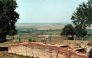
The Myzeqe (Albanian: [myzɛˈcɛ]; Albanian definite form: Myzeqeja; Aromanian: Muzachia) is a plain in the Western Lowlands of Albania. The Myzeqe is the largest and widest plain, measured by area, in the Lowlands.
Battle of Savra
1385 battle between Ottoman and Zetan forces in modern-day Albania
Distance: Approx. 5008 meters
Latitude and longitude: 40.9,19.68333333
The Battle of Savra (Albanian: Beteja e Savrës; Serbian: Bitka na Saurskom polju; Turkish: Savra Muharebesi; "Battle on the Saurian field") or the Battle of the Vjosë was fought on 18 September 1385 between Ottoman and much smaller Zetan forces, at the Savra field near Lushnjë (in modern-day southern Albania).

Abdurrahman Roza Haxhiu Stadium
Multipurpose stadium in Lushnja, Albania
Distance: Approx. 820 meters
Latitude and longitude: 40.935425,19.70964444
Abdurrahman Stadium Roza Haxhiu Stadium (or: Stadium A. Roza Haxhiu) is a stadium for many uses in Lushnja, Albania. It is currently used mostly for the football match and is the host field for the KS Lushnja team. The stadium has a capacity of 8,500 seats and a standing capacity of about 12,000 participants.
Rrasë
Municipal unit in Elbasan, Albania
Distance: Approx. 9785 meters
Latitude and longitude: 40.96666667,19.81666667
Rrasë is a former municipality in the Elbasan County, central Albania. At the 2015 local government reform it became a subdivision of the municipality Belsh. The population at the 2011 census was 1,594.
Krutje
Municipal unit in Fier, Albania
Distance: Approx. 8571 meters
Latitude and longitude: 40.86666667,19.68333333
Krutje is a former municipality in the Fier County, western Albania. At the 2015 local government reform it became a subdivision of the municipality Lushnjë. The population at the 2023 census was 5,523.
Golem, Fier
Municipal unit in Fier, Albania
Distance: Approx. 3304 meters
Latitude and longitude: 40.96666667,19.68333333
Golem is a former municipality in the Fier County, western Albania. At the 2015 local government reform it became a subdivision of the municipality Lushnjë. The population at the 2023 census was 3,529.

Dushk
Municipal unit in Fier, Albania
Distance: Approx. 7226 meters
Latitude and longitude: 41,19.66666667
Dushk is a former municipality in the Fier County, western Albania. At the 2015 local government reform it became a subdivision of the municipality Lushnjë. The population at the 2023 census was 5,157.
Hysgjokaj
Municipal unit in Fier, Albania
Distance: Approx. 7139 meters
Latitude and longitude: 40.96666667,19.78333333
Hysgjokaj is a village and a former municipality in the Fier County, western Albania. At the 2015 local government reform it became a subdivision of the municipality Lushnjë. The population at the 2023 census was 1,787.
Ballagat
Municipal unit in Fier, Albania
Distance: Approx. 8288 meters
Latitude and longitude: 41,19.76666667
Ballagat is a village and a former municipality in the Fier County, western Albania. At the 2015 local government reform it became a subdivision of the municipality Lushnjë. The population at the 2023 census was 1,711.
Karbunarë
Municipal unit in Fier, Albania
Distance: Approx. 2975 meters
Latitude and longitude: 40.91666667,19.71666667
Karbunarë (Albanian definite form: Karbunara) is a former municipality in the Fier County, western Albania. At the 2015 local government reform it became a subdivision of the municipality Lushnjë. The population at the 2023 census was 2,692.

Congress of Lushnjë Museum
Museum in Albania
Distance: Approx. 228 meters
Latitude and longitude: 40.94111111,19.7075
Congress of Lushnjë Museum (Albanian: Muzeu i Kongresit të Lushnjes) is a museum in Lushnjë, Albania. The Congress of Lushnjë was held here in 1920. In 1970, the building was turned into a museum devoted to patriotism.
Weather in this IP's area
moderate rain
11 Celsius
11 Celsius
11 Celsius
11 Celsius
1012 hPa
94 %
1012 hPa
1004 hPa
10000 meters
2.34 m/s
2.94 m/s
68 degree
100 %