141.39.221.231 - IP Lookup: Free IP Address Lookup, Postal Code Lookup, IP Location Lookup, IP ASN, Public IP
Country:
Region:
City:
Location:
Time Zone:
Postal Code:
IP information under different IP Channel
ip-api
Country
Region
City
ASN
Time Zone
ISP
Blacklist
Proxy
Latitude
Longitude
Postal
Route
Luminati
Country
ASN
Time Zone
Europe/Berlin
ISP
Tobias Fiebig
Latitude
Longitude
Postal
IPinfo
Country
Region
City
ASN
Time Zone
ISP
Blacklist
Proxy
Latitude
Longitude
Postal
Route
IP2Location
141.39.221.231Country
Region
niedersachsen
City
osnabruck
Time Zone
Europe/Berlin
ISP
Language
User-Agent
Latitude
Longitude
Postal
db-ip
Country
Region
City
ASN
Time Zone
ISP
Blacklist
Proxy
Latitude
Longitude
Postal
Route
ipdata
Country
Region
City
ASN
Time Zone
ISP
Blacklist
Proxy
Latitude
Longitude
Postal
Route
Popular places and events near this IP address

Osnabrück University
German university
Distance: Approx. 504 meters
Latitude and longitude: 52.273,8.042
Osnabrück University (German: Universität Osnabrück) is a public research university located in the city of Osnabrück in Lower Saxony, Germany. In 2011 it was attended by 11,034 students; the staff of 1,858 consisted of 209 professors, 936 additional academic personnel (lecturers without professorships, post-doctoral researchers and post-graduate assistants) and 713 non-academic personnel. The university is known for its many interdisciplinary degree programmes, some of them rare or even unique among German universities, including European Studies, Migration Research, Applied Systems Science and Cognitive Science.
Roman Catholic Diocese of Osnabrück
Catholic diocese in Germany
Distance: Approx. 613 meters
Latitude and longitude: 52.2776,8.0447
The Diocese of Osnabrück (Latin: Dioecesis Osnabrugensis) is a Latin Church ecclesiastical territory or diocese of the Catholic church in Germany. The diocese was originally founded circa 800. It should not be confused with the smaller Prince-Bishopric of Osnabrück–an ecclesiastical principality of the Holy Roman Empire until 1803–over which the bishop, as prince-bishop, exercised both temporal and spiritual authority.
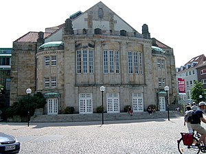
Theater Osnabrück
Theater in Osnabrück, Germany
Distance: Approx. 538 meters
Latitude and longitude: 52.27666667,8.04444444
Theater Osnabrück is a German theatre in Osnabrück, Germany. It operates under the auspices of the Städtische Bühnen Osnabrück gGmbH. The primary performance venues are the Theater am Domhof (seating capacity 642) and the emma-theater (seating capacity 96). The roots of the company date back to 1771, with theatrical presentations at the Schloss Osnabrück.
Gymnasium Carolinum (Osnabrück)
School in Germany, established 804 AD
Distance: Approx. 617 meters
Latitude and longitude: 52.27791667,8.04555556
The Gymnasium Carolinum in Osnabrück, Germany, was founded in 804 by Charlemagne, king of the Franks. It is reputedly the oldest school in Germany and is also one of the oldest surviving schools in the world.

Osnabrück Land
Distance: Approx. 635 meters
Latitude and longitude: 52.2775,8.04388889
Osnabrück Land (German: Osnabrücker Land) is a region in southwest Lower Saxony in Germany, which extends into the state of North Rhine-Westphalia. Its centre is the city of Osnabrück. The region is dominated by the Teutoburg Forest and the River Hase.

St. Peter's Cathedral, Osnabrück
Church in Lower Saxony, Germany
Distance: Approx. 599 meters
Latitude and longitude: 52.27755,8.04498
St. Peter's Cathedral in Osnabrück, Germany is the cathedral of the Roman Catholic Diocese of Osnabrück. The cathedral is a late Romanesque building and dominates the city's skyline.

Innenstadt (Osnabrück district)
Distance: Approx. 691 meters
Latitude and longitude: 52.2667,8.05
The Innenstadt (city centre) is the central district of the city of Osnabrück in Lower Saxony, Germany; its population is roughly 8,300. The Innenstadt comprises the medieval Altstadt (old town) and Neustadt (new town), which were united in 1306. The Altstadt developed around the town's three medieval churches, which initially constituted small parishes in the local area: the Lutheran Kirche St.
Osnabrück Town Hall
Historic German building
Distance: Approx. 750 meters
Latitude and longitude: 52.2774,8.0412
The Town Hall (German: Rathaus) of Osnabrück, Germany, was built in the late Gothic style from 1487 to 1512. It is one of Osnabrück's most important buildings and emblems and continues to be used as the city's town hall today. The Treaty of Westphalia was negotiated and signed by the combatants of the Thirty Years' War at the town halls of Osnabrück and Münster in 1648.

Ledenhof
Distance: Approx. 298 meters
Latitude and longitude: 52.2724,8.0451
The Ledenhof (formerly known also as the Alte Münze) is a historic building in the city of Osnabrück, Lower Saxony, Germany. During the medieval period it was the city residence of the noble von Leden family. Having initially been an extensive courtly building complex, today only the seven-storey Steinwerk (stone structure) building and the great hall with stair tower remain.

OsnabrückHalle
Distance: Approx. 534 meters
Latitude and longitude: 52.2715,8.0419
The OsnabrückHalle (formerly Stadthalle Osnabrück) is a prominent events building in the city of Osnabrück, Lower Saxony, Germany.

Osnabrück Uplands
Low hills in the northwest of the Lower Saxon Hills near Osnabrück in Germany
Distance: Approx. 677 meters
Latitude and longitude: 52.26728,8.05319
The Osnabrück Uplands, Osnabrück Hills or, less commonly, Osnabrück Hill Country (German: Osnabrücker Hügelland or Osnabrücker Bergland), are the low hills, or Hügelland, rarely over 200 m above NHN, in the northwest of the Lower Saxon Hills near Osnabrück in Germany. They are bounded by the Wiehen Hills to the north and the Teutoburg Forest to the south. Regionally, especially in tourism, they are often referred to locally as the Osnabrücker Bergland, however this is usually not a precisely defined physical landscape, but refers to an area roughly comprising the municipal boundaries of Osnabrück and a narrow radius around the city.

St. Catherine's Church, Osnabrück
Church in Osnabrück, Germany
Distance: Approx. 458 meters
Latitude and longitude: 52.2732,8.0427
St. Catherine's Church, also known as the St. Katharinenkirche in German, is a late Gothic hall Evangelical church in the old town of Osnabrück, Germany.
Weather in this IP's area
overcast clouds
6 Celsius
6 Celsius
5 Celsius
6 Celsius
1037 hPa
96 %
1037 hPa
1028 hPa
10000 meters
0.09 m/s
0.29 m/s
328 degree
100 %


