141.27.245.48 - IP Lookup: Free IP Address Lookup, Postal Code Lookup, IP Location Lookup, IP ASN, Public IP
Country:
Region:
City:
Location:
Time Zone:
Postal Code:
IP information under different IP Channel
ip-api
Country
Region
City
ASN
Time Zone
ISP
Blacklist
Proxy
Latitude
Longitude
Postal
Route
Luminati
Country
Region
by
City
hochberg
ASN
Time Zone
Europe/Berlin
ISP
Verein zur Foerderung eines Deutschen Forschungsnetzes e.V.
Latitude
Longitude
Postal
IPinfo
Country
Region
City
ASN
Time Zone
ISP
Blacklist
Proxy
Latitude
Longitude
Postal
Route
IP2Location
141.27.245.48Country
Region
bayern
City
wuerzburg
Time Zone
Europe/Berlin
ISP
Language
User-Agent
Latitude
Longitude
Postal
db-ip
Country
Region
City
ASN
Time Zone
ISP
Blacklist
Proxy
Latitude
Longitude
Postal
Route
ipdata
Country
Region
City
ASN
Time Zone
ISP
Blacklist
Proxy
Latitude
Longitude
Postal
Route
Popular places and events near this IP address

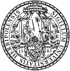
University of Würzburg
University in Germany
Distance: Approx. 45 meters
Latitude and longitude: 49.78805556,9.93527778
The Julius Maximilian University of Würzburg (also referred to as the University of Würzburg, in German Julius-Maximilians-Universität Würzburg) is a public research university in Würzburg, Germany. Founded in 1402, it is one of the oldest institutions of higher learning in Germany. The university initially had a brief run and was closed in 1415.

Würzburg Residence
Palace in Würzburg, Germany
Distance: Approx. 566 meters
Latitude and longitude: 49.79277778,9.93861111
The Würzburg Residence (German: Würzburger Residenz) is a palace in Würzburg, Germany. Johann Lukas von Hildebrandt and Maximilian von Welsch, representatives of the Austrian/Southern German Baroque style, were involved in the construction, as well as Robert de Cotte and Germain Boffrand, who were followers of the French style. Balthasar Neumann, court architect of the Bishop of Würzburg, was the principal architect of the Residence, which was commissioned by the Prince-Bishop of Würzburg Johann Philipp Franz von Schönborn and his brother Friedrich Carl von Schönborn in 1720, and completed in 1744.

Prince-Bishopric of Würzburg
State of the Holy Roman Empire (1168–1803)
Distance: Approx. 551 meters
Latitude and longitude: 49.78333333,9.93333333
The Prince-Bishopric of Würzburg (German: Fürstbistum Würzburg; Hochstift Würzburg) was an ecclesiastical principality of the Holy Roman Empire located in Lower Franconia, west of the Prince-Bishopric of Bamberg. Würzburg had been a diocese since 743. As established by the Concordat of 1448, bishops in Germany were chosen by the canons of the cathedral chapter and their election was later confirmed by the pope.

Battle of Würzburg
1796 battle during the War of the First Coalition
Distance: Approx. 753 meters
Latitude and longitude: 49.79333333,9.92944444
The Battle of Würzburg was fought on 3 September 1796 between an army of the Habsburg monarchy led by Archduke Charles, Duke of Teschen and an army of the First French Republic led by Jean-Baptiste Jourdan. The French attacked the archduke's forces, but they were resisted until the arrival of reinforcements decided the engagement in favor of the Austrians. The French retreated west toward the Rhine River.

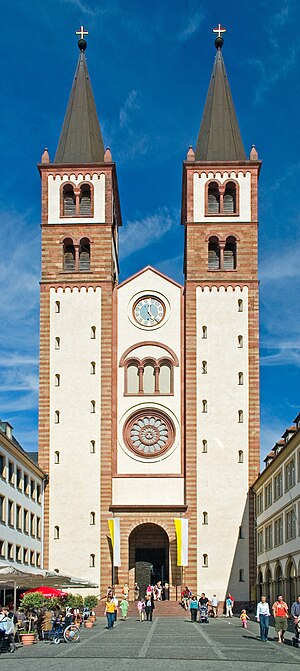
Würzburg Cathedral
Church in Würzburg, Germany
Distance: Approx. 650 meters
Latitude and longitude: 49.79333333,9.93222222
Würzburg Cathedral (German: Würzburger Dom) is a Roman Catholic cathedral in Würzburg in Bavaria, Germany, dedicated to Saint Kilian. It is the seat of the Bishop of Würzburg and has served as the burial place for the Prince-Bishops of Würzburg for hundreds of years. With an overall length of 103 metres, it is the fourth largest Romanesque church building in Germany, and a masterpiece of German architecture from the Salian period.

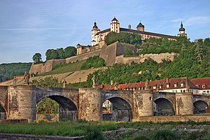
Würzburg
City in Bavaria, Germany
Distance: Approx. 551 meters
Latitude and longitude: 49.78333333,9.93333333
Würzburg (German: [ˈvʏʁtsbʊʁk] ; Main-Franconian: Wörtzburch) is, after Nuremberg and Fürth, the third-largest city in Franconia located in the north of Bavaria. Würzburg is the administrative seat of the Regierungsbezirk Lower Franconia. It spans the banks of the Main river.

Trams in Würzburg
Overview of trams in Würzburg
Distance: Approx. 551 meters
Latitude and longitude: 49.78333333,9.93333333
The Würzburg tramway network (German: Straßenbahnnetz Würzburg) is a network of tramways forming part of the public transport system in Würzburg, a city in the federal state of Bavaria, Germany. The network presently consists of five lines, with a total track length of 42 kilometres (26 mi) (yielding a one-way route length of approximately 21 kilometres (13 mi)). It is currently operated by Würzburger Straßenbahn GmbH, a subsidiary of Würzburger Versorgungs- und Verkehrs-GmbH (WVV), and integrated in the Verkehrsverbund Mainfranken (VVM).
Mainfranken Theater Würzburg
Distance: Approx. 781 meters
Latitude and longitude: 49.795,9.93666667
Mainfranken Theater Würzburg is a theatre in Würzburg, Germany. The new building was designed by the architect Jörg Friedrich.
Hochschule für Musik Würzburg
University of music
Distance: Approx. 788 meters
Latitude and longitude: 49.7944,9.9406
The Hochschule für Musik Würzburg (University of Music Würzburg) was founded in 1797 by Franz Joseph Fröhlich as Collegium musicum academicum (Academic college of music). From 1921 to 1973, it was named Bayerisches Staatskonservatorium der Musik (Bavarian State Conservatory of Music). The current name was given on 1 September 1973.

Martin von Wagner Museum
Art museum in Würzburg, Germany
Distance: Approx. 578 meters
Latitude and longitude: 49.79272,9.93926
The Martin von Wagner Museum contains the art collection of the University of Würzburg and has been located in the south wing of the Würzburg Residence since 1963. It is among the largest university museums in Europe.
Neumünster, Würzburg
Distance: Approx. 730 meters
Latitude and longitude: 49.79394,9.93161
The Neumünster Collegiate church (German: Kollegiatstift Neumünster, French: Collégiale de Neumünster) is a former collegiate church in Würzburg, Germany. The church dates back to the 11th century.

Battle of Würzburg (1945)
Battle in World War II
Distance: Approx. 757 meters
Latitude and longitude: 49.79344444,9.92958333
The Battle of Würzburg (31 March—6 April 1945) which ended up with the capture Upper Franconia by 42nd Infantry Division ("Rainbow").
Weather in this IP's area
clear sky
-0 Celsius
-0 Celsius
-0 Celsius
1 Celsius
1036 hPa
58 %
1036 hPa
1012 hPa
10000 meters
1.2 m/s
1.19 m/s
49 degree
7 %


