141.207.238.151 - IP Lookup: Free IP Address Lookup, Postal Code Lookup, IP Location Lookup, IP ASN, Public IP
Country:
Region:
City:
Location:
Time Zone:
Postal Code:
ISP:
ASN:
language:
User-Agent:
Proxy IP:
Blacklist:
IP information under different IP Channel
ip-api
Country
Region
City
ASN
Time Zone
ISP
Blacklist
Proxy
Latitude
Longitude
Postal
Route
db-ip
Country
Region
City
ASN
Time Zone
ISP
Blacklist
Proxy
Latitude
Longitude
Postal
Route
IPinfo
Country
Region
City
ASN
Time Zone
ISP
Blacklist
Proxy
Latitude
Longitude
Postal
Route
IP2Location
141.207.238.151Country
Region
california
City
vista
Time Zone
America/Los_Angeles
ISP
Language
User-Agent
Latitude
Longitude
Postal
ipdata
Country
Region
City
ASN
Time Zone
ISP
Blacklist
Proxy
Latitude
Longitude
Postal
Route
Popular places and events near this IP address

Vista, California
City in California, United States
Distance: Approx. 723 meters
Latitude and longitude: 33.19361111,-117.24111111
Vista (; Spanish for "view") is a city in San Diego County, California. It is a medium-sized city within the San Diego-Carlsbad, CA metropolitan statistical area. As of the 2020 census, Vista had a population of 98,381.

Tri-City Christian School (California)
School in Vista, San Diego, California, United States
Distance: Approx. 3600 meters
Latitude and longitude: 33.19140833,-117.27976111
Tri-City Christian School is a private Christian school located in Vista, California. Founded in 1971, the school serves approximately 650 students, from preschool through high school, with the mission of "training up spiritual champions for Jesus Christ." Tri-City Christian School is accredited by the Western Association of Schools and Colleges (WASC) and the Association of Christian Schools International (ACSI).
Guajome Park Academy
Public charter school in Vista, California, United States
Distance: Approx. 3357 meters
Latitude and longitude: 33.22944444,-117.25027778
Guajome Park Academy (commonly referred to as Guajome or GPA) is a K–12 public charter school in Vista, California, United States that was established in 1994. It offers the IB Diploma Programme for eleventh and twelfth-graders. During the 2004-2005 school year, 1,238 students were enrolled: 530 in the middle school and 708 in the high school.[1] The school is named after nearby Guajome County Park.

Sierra Vista High School (Nevada)
Public high school in the United States
Distance: Approx. 2352 meters
Latitude and longitude: 33.2211,-117.2411
Sierra Vista High School is a nine-month school year term public high school located in Spring Valley, Nevada, United States. Sierra Vista is a part of the Clark County School District.
Vista Unified School District
School district in California, United States
Distance: Approx. 3476 meters
Latitude and longitude: 33.2262,-117.2222
Vista Unified School District is a public school district headquartered in Vista, California, United States. It serves sections of northern San Diego County. The Vista Unified School District is the 4th largest school district in San Diego County and includes 32 schools with diverse educational programs for kindergarten through adult education students.

Rancho Guajome Adobe
Historic house in California, United States
Distance: Approx. 3850 meters
Latitude and longitude: 33.23321944,-117.25400556
Rancho Guajome Adobe is a historic 19th-century hacienda (and now a historic house museum) in Rancho Guajome Adobe County Park, on North Santa Fe Avenue in Vista in San Diego County, California. Built in 1852–53, it is a well-preserved but late example of Spanish-Mexican colonial architecture, and was designated a National Historic Landmark in 1970. It is also a California Historical Landmark and on the National Register of Historic Places.
Buena Vista Hills (San Diego County)
A low mountain range in western San Diego County, California
Distance: Approx. 1799 meters
Latitude and longitude: 33.21448083,-117.23392417
The Buena Vista Hills are a low mountain range in the Peninsular Ranges System, in western San Diego County, California. They are located in the San Marcos region of the county.

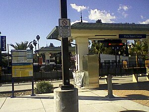
Vista Transit Center
Transit center in Vista, California, United States
Distance: Approx. 426 meters
Latitude and longitude: 33.2032,-117.245
Vista Transit Center is a transit center located in Vista, California, served by North County Transit District's SPRINTER hybrid rail line and BREEZE bus line. The station is located midpoint between the rail line's western terminus at Oceanside Transit Center and eastern terminus at Escondido Transit Center. A preview Sprinter service stopped at Vista Transit Center on December 28, 2007, and regular service commenced March 9, 2008.

Alta Vista Botanical Gardens
Botanical garden in Vista, California
Distance: Approx. 2432 meters
Latitude and longitude: 33.210175,-117.21939444
Alta Vista Botanical Gardens is a botanical garden in Vista, California, United States, established in 1999.
Rancho Buena Vista
Mexican land grant in California
Distance: Approx. 1164 meters
Latitude and longitude: 33.2,-117.23
Rancho Buena Vista was a 2,288-acre (9.26 km2) Mexican land grant in present day San Diego County, California, given in 1845 by Governor Pío Pico to Felipe, an Indian. The name means "good view" in Spanish. The grant was south of San Luis Rey River and Rancho Monserate and encompassed present day Vista.

Civic Center–Vista station
Hybrid rail station in Vista, California, United States
Distance: Approx. 1205 meters
Latitude and longitude: 33.1902,-117.237
Civic Center–Vista station (previously known as Escondido Avenue station and Civic Center Drive station) is a station in Vista, California that is served by North County Transit District's SPRINTER hybrid rail line. The station is located at 810 Phillips Street. Although the Sprinter began service in March 2008, the eastbound platform of the station remained closed for several months due to construction to improve its platform.

Melrose Drive station
Hybrid rail station in Oceanside, California, United States
Distance: Approx. 2707 meters
Latitude and longitude: 33.2196,-117.2597
Melrose Drive is a station in Oceanside, California that is served by North County Transit District's Sprinter hybrid rail line. The station is located at 14951⁄2 N. Melrose Drive. It consists of a single platform and track.
Weather in this IP's area
clear sky
8 Celsius
6 Celsius
6 Celsius
10 Celsius
1020 hPa
84 %
1020 hPa
1009 hPa
10000 meters
2.57 m/s
40 degree