141.148.110.163 - IP Lookup: Free IP Address Lookup, Postal Code Lookup, IP Location Lookup, IP ASN, Public IP
Country:
Region:
City:
Location:
Time Zone:
Postal Code:
IP information under different IP Channel
ip-api
Country
Region
City
ASN
Time Zone
ISP
Blacklist
Proxy
Latitude
Longitude
Postal
Route
Luminati
Country
Region
ut
City
westjordan
ASN
Time Zone
America/Denver
ISP
DYN
Latitude
Longitude
Postal
IPinfo
Country
Region
City
ASN
Time Zone
ISP
Blacklist
Proxy
Latitude
Longitude
Postal
Route
IP2Location
141.148.110.163Country
Region
utah
City
west jordan
Time Zone
America/Denver
ISP
Language
User-Agent
Latitude
Longitude
Postal
db-ip
Country
Region
City
ASN
Time Zone
ISP
Blacklist
Proxy
Latitude
Longitude
Postal
Route
ipdata
Country
Region
City
ASN
Time Zone
ISP
Blacklist
Proxy
Latitude
Longitude
Postal
Route
Popular places and events near this IP address
West Jordan, Utah
City in Utah, United States
Distance: Approx. 3172 meters
Latitude and longitude: 40.60638889,-111.97611111
West Jordan is a city in Salt Lake County, Utah, United States. It is a suburb of Salt Lake City. According to the 2020 Census, the city had a population of 116,961, placing it as the third most populous in the state.
West Jordan High School
Public school in the United States
Distance: Approx. 1932 meters
Latitude and longitude: 40.603,-111.96
West Jordan High School is a public high school located southwest of Salt Lake City in West Jordan, Utah. It enrolls around 1,800 students.
Broadview College
Private college in West Jordan, Utah, United States
Distance: Approx. 235 meters
Latitude and longitude: 40.61027778,-111.94138889
Broadview College, formerly Utah Career College, is a private for-profit college in West Jordan, Utah. It primarily awards associate degrees.
Jordan School District
School district in Utah, United States
Distance: Approx. 456 meters
Latitude and longitude: 40.606,-111.936
Jordan School District is a school district in the southwestern portion of Salt Lake County, Utah, United States. It now employs 3,364 teachers and other licensed personnel who educate more than 57,800 students. An additional 3,092 employees provide support services for the system.

Conservation Garden Park
Park in West Jordan, Utah, US
Distance: Approx. 1349 meters
Latitude and longitude: 40.60138889,-111.92694444
Conservation Garden Park is located on the grounds of Jordan Valley Water Conservancy District at 8215 South 1300 West, West Jordan, Utah. The project consists of approximately six acres of demonstration gardens and waterwise landscape exhibits and the new Education Center (under construction) which was completed and opened to the public in summer 2011. The Center is designed to LEED Platinum standards, showcases environmental building technologies, and broadens the theme of the gardens to include conservation of energy and natural resources.
Bingham Junction station
Light rail station in Midvale, Utah, United States
Distance: Approx. 2190 meters
Latitude and longitude: 40.617268,-111.914984
Bingham Junction station is a light rail station in Midvale, Utah, United States, served by the Red Line of the Utah Transit Authority's (UTA) TRAX light rail system. The Red Line provides service from the University of Utah to the Daybreak community of South Jordan.
Historic Gardner station
Light rail station in West Jordan, Utah, United States
Distance: Approx. 1253 meters
Latitude and longitude: 40.608167,-111.924072
Historic Gardner station is a light rail station in West Jordan, Utah, United States, served by the Utah Transit Authority's (UTA) TRAX light rail system Red Line. The Red Line provides service from the University of Utah to the Daybreak community of South Jordan.
West Jordan City Center station
Light rail station in West Jordan, Utah, United States
Distance: Approx. 551 meters
Latitude and longitude: 40.604905,-111.936377
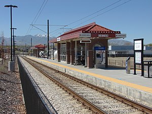
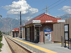
West Jordan City Center station is a light rail station in the West Jordan, Utah, United States, served by the Red Line of the Utah Transit Authority's (UTA) TRAX light rail system. The Red Line provides service from the University of Utah to the Daybreak community of South Jordan.

2700 West Sugar Factory Road station
Light rail station in West Jordan, Utah, United States
Distance: Approx. 1910 meters
Latitude and longitude: 40.59904,-111.95672
2700 West Sugar Factory Road station, sometimes referred to as simply 2700 West, is a light rail station in West Jordan, Utah, in the United States, served by the Red Line of the Utah Transit Authority's (UTA) TRAX light rail system. The Red Line provides service from the University of Utah to the Daybreak community of South Jordan.

Jordan Valley station
Light rail station in West Jordan, Utah, United States
Distance: Approx. 3236 meters
Latitude and longitude: 40.594822,-111.971849
Jordan Valley station is a light rail station in West Jordan, Utah, United States, served by the Red Line of the Utah Transit Authority's (UTA) TRAX light rail system. The Red Line provides service from the University of Utah to the Daybreak community of South Jordan.

Gardner Mill
United States historic place
Distance: Approx. 1378 meters
Latitude and longitude: 40.60916667,-111.9225
The Gardner Mill, at 1100 West 7800 South in West Jordan, Utah, United States was built in 1877 and is the focal point of today's Gardner Village.

West Jordan Ward Meetinghouse
Historic church in Utah, United States
Distance: Approx. 1251 meters
Latitude and longitude: 40.60777778,-111.92416667
The West Jordan Ward Meetinghouse, at 1140 W. 7800 South in West Jordan, Utah, was designed and built in 1867 by Elias Morris as a Mormon meetinghouse, in a style that was later termed a "first-phase meetinghouse". Since also known as D.U.P. Pioneer Hall, it includes Classical Revival. As of 1995, it was historically significant as the sole remaining church and public building in West Jordan.
Weather in this IP's area
broken clouds
0 Celsius
-5 Celsius
-1 Celsius
1 Celsius
1027 hPa
69 %
1027 hPa
834 hPa
10000 meters
5.14 m/s
300 degree
75 %


