141.136.221.162 - IP Lookup: Free IP Address Lookup, Postal Code Lookup, IP Location Lookup, IP ASN, Public IP
Country:
Region:
City:
Location:
Time Zone:
Postal Code:
ISP:
ASN:
language:
User-Agent:
Proxy IP:
Blacklist:
IP information under different IP Channel
ip-api
Country
Region
City
ASN
Time Zone
ISP
Blacklist
Proxy
Latitude
Longitude
Postal
Route
db-ip
Country
Region
City
ASN
Time Zone
ISP
Blacklist
Proxy
Latitude
Longitude
Postal
Route
IPinfo
Country
Region
City
ASN
Time Zone
ISP
Blacklist
Proxy
Latitude
Longitude
Postal
Route
IP2Location
141.136.221.162Country
Region
splitsko-dalmatinska zupanija
City
postira
Time Zone
Europe/Zagreb
ISP
Language
User-Agent
Latitude
Longitude
Postal
ipdata
Country
Region
City
ASN
Time Zone
ISP
Blacklist
Proxy
Latitude
Longitude
Postal
Route
Popular places and events near this IP address

Cetina
River in Croatia
Distance: Approx. 8308 meters
Latitude and longitude: 43.4398,16.6864
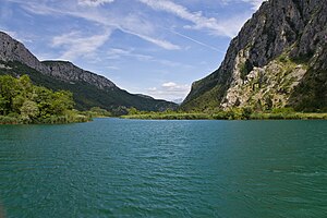
The Cetina (pronounced [tsětina]) is a river in southern Croatia. It has a length of 101 km (63 mi) and its basin covers an area of 1,463 km2 (565 sq mi). From its source, Cetina descends from an elevation of 385 metres (1,263 ft) above sea level to the Adriatic Sea.

Omiš
Town in Split-Dalmatia, Croatia
Distance: Approx. 7568 meters
Latitude and longitude: 43.43333333,16.68333333
Omiš (pronounced [ɔ̌miːʃ]) is a town and port in the Dalmatia region of Croatia, and a municipality in the Split-Dalmatia County. The town is approximately 25 kilometres (16 miles) south-east of Croatia's second largest city, Split, where the Cetina River meets the Adriatic Sea. Omiš municipality has a population of 14,936 and its area is 266 square kilometres (103 sq mi).
Supetar
Town in Split-Dalmatia, Croatia
Distance: Approx. 6288 meters
Latitude and longitude: 43.38444444,16.55527778
Supetar (Croatian pronunciation: [sǔpetar], Italian: San Pietro della Brazza) is a town on the northern part of the Dalmatian island of Brač, in the Split-Dalmatia County, in Croatia. It became the island's official centre in 1827. The town of Supetar includes Supetar itself and the three villages of Splitska, Škrip and Mirca.

Nerežišća
Municipality in Split-Dalmatia County, Croatia
Distance: Approx. 6215 meters
Latitude and longitude: 43.33333333,16.58333333
Nerežišća (Croatian pronunciation: [něreʒiːɕt͡ɕa]) is a village and a municipality on the island Brač in Croatia. In the 2011 census, it had a total population of 862, in the following settlements: Donji Humac, population 157 Dračevica, population 89 Nerežišća, population 616 In the same census, 98.84% were Croats. In the past, Nerežišća was the capital of the island.

Postira
Village and municipality in Split-Dalmatia County, Croatia
Distance: Approx. 777 meters
Latitude and longitude: 43.38333333,16.63333333
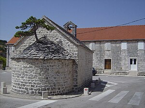
Postira is a village and a municipality in Croatia in the Split-Dalmatia County on the island of Brač.

Donji Humac
Place in Split-Dalmatia, Croatia
Distance: Approx. 7150 meters
Latitude and longitude: 43.33333333,16.56666667
Donji Humac is one of the oldest settlements on the Croatian island of Brač, located on an inland hill. The top of the hill is marked by a widely visible Baroque bell-tower. The nearby Kopačina cave was inhabited more than 13,200 years ago.

Splitska
Village on Brač, Croatia
Distance: Approx. 2717 meters
Latitude and longitude: 43.38333333,16.6
Splitska is an ancient village on the island of Brač in Croatia. The population is 368 (census 2011). The village got its name from a derivative of Split (the second largest city in Croatia with over 200,000 inhabitants).

Duće
Village in Croatia
Distance: Approx. 8654 meters
Latitude and longitude: 43.45,16.66666667
Duće is a Croatian village situated close to Omiš in the Dugi Rat municipality, Split-Dalmatia County. It is a series of small settlements in Poljica, the area between the foot of the Mosor mountains and the Adriatic Sea. The village was founded prior to the 12th century.

Pražnica
Village in Croatia
Distance: Approx. 8622 meters
Latitude and longitude: 43.31666667,16.7
Pražnica is a village in Croatia on the island of Brač. It is connected by the D113 highway.
Škrip
Village in Croatia
Distance: Approx. 3928 meters
Latitude and longitude: 43.35,16.6
Škrip is a village in Croatia. It is the oldest settlement on the island Brač.

Dol, Brač
Village in Croatia
Distance: Approx. 3196 meters
Latitude and longitude: 43.35,16.61666667
Dol is a village in Croatia, close to the town of Postira on the island Brač. It has a population of 130.
Brač Channel
Distance: Approx. 3891 meters
Latitude and longitude: 43.39515705,16.67277951
The Brač Channel (Croatian: Brački kanal) is a channel in the Adriatic Sea between the Dalmatian mainland and the island of Brač.
Weather in this IP's area
clear sky
12 Celsius
11 Celsius
12 Celsius
12 Celsius
1032 hPa
45 %
1032 hPa
1006 hPa
10000 meters
1.49 m/s
1.91 m/s
353 degree

