141.136.215.110 - IP Lookup: Free IP Address Lookup, Postal Code Lookup, IP Location Lookup, IP ASN, Public IP
Country:
Region:
City:
Location:
Time Zone:
Postal Code:
IP information under different IP Channel
ip-api
Country
Region
City
ASN
Time Zone
ISP
Blacklist
Proxy
Latitude
Longitude
Postal
Route
Luminati
Country
Region
21
City
zagreb
ASN
Time Zone
Europe/Zagreb
ISP
Hrvatski Telekom d.d.
Latitude
Longitude
Postal
IPinfo
Country
Region
City
ASN
Time Zone
ISP
Blacklist
Proxy
Latitude
Longitude
Postal
Route
IP2Location
141.136.215.110Country
Region
zadarska zupanija
City
starigrad
Time Zone
Europe/Zagreb
ISP
Language
User-Agent
Latitude
Longitude
Postal
db-ip
Country
Region
City
ASN
Time Zone
ISP
Blacklist
Proxy
Latitude
Longitude
Postal
Route
ipdata
Country
Region
City
ASN
Time Zone
ISP
Blacklist
Proxy
Latitude
Longitude
Postal
Route
Popular places and events near this IP address

Paklenica
Historic site in Zadar County, Croatia
Distance: Approx. 8226 meters
Latitude and longitude: 44.36666667,15.43333333
The Paklenica karst river canyon is a national park in Croatia. It is near Starigrad, northern Dalmatia, on the southern slopes of Velebit mountain, not far from Zadar. It contains two canyons, Mala (Small) and Velika (Big) Paklenica.
Posedarje
Municipality in Zadar County, Croatia
Distance: Approx. 9093 meters
Latitude and longitude: 44.21666667,15.48333333
Posedarje (Croatian pronunciation: [pǒsedaːrje], Italian: Possedaria) is a municipality in Zadar County of Croatia with 3,607 inhabitants (2011 census).
Operation Maslenica
Croatian Army offensive launched in January 1993
Distance: Approx. 8934 meters
Latitude and longitude: 44.23666667,15.52277778
Operation Maslenica was a Croatian Army offensive launched in January 1993 to retake territory in northern Dalmatia and Lika from Krajina Serb forces, with the stated military objective of pushing the Serbs back from approaches to Zadar, Maslenica and Karlobag, allowing a secure land route between Dalmatia and northern Croatia to be opened. While an undoubted net Croatian tactical success, the operation was only a moderate strategic success, and was condemned by the UN Security Council.

Ražanac
Municipality in Zadar, Croatia
Distance: Approx. 7498 meters
Latitude and longitude: 44.28333333,15.35
Ražanac is a municipality in Croatia in the Zadar County. According to the 2011 census, there are 2,940 inhabitants, 98% of which are Croats.
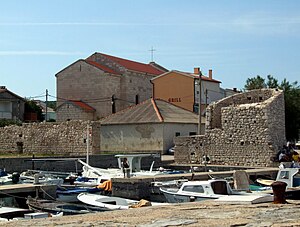
Starigrad, Zadar County
Municipality in Croatia
Distance: Approx. 469 meters
Latitude and longitude: 44.29527778,15.43805556
Starigrad (Italian: Ortopula) is a municipality in Croatia in the Zadar County. The total population is 1,876 (census 2011). According to the 2011 census, 96% of the population are Croats.
Seline, Croatia
Place in Zadar, Croatia
Distance: Approx. 3425 meters
Latitude and longitude: 44.27722222,15.47991667
Seline is a village in the Starigrad municipality of Zadar County, Croatia. Seline has a population of 455 (census 2001),. The population is by and large Croatian.

Maslenica Bridge (A1)
Bridge in Southern Croatia
Distance: Approx. 8902 meters
Latitude and longitude: 44.23666667,15.52222222
Maslenica Bridge (Croatian: Most Maslenica, but also known as Croatian: Maslenički most) is a 377.6 m (1,239 ft) long reinforced concrete arch bridge spanning the Novsko Ždrilo strait of the Adriatic Sea, north of Zadar, Croatia, carrying the Croatian A1 motorway. It is located between the Rovanjske and Posedarje interchanges of the A1 motorway. The bridge comprises a 200-metre (660 ft) span reinforced concrete arch, with an arch rise of 65 metres (213 ft).

Radovin
Place in Zadar, Croatia
Distance: Approx. 8183 meters
Latitude and longitude: 44.23333333,15.38333333
Radovin is a small village in Zadar County, Croatia, located near the city of Zadar and belongs to the municipality of Ražanac. The population is 549 people (census 2011). There is few shops, churches, water sources and a cafe.

Slivnica, Croatia
Village in Zadar County, Croatia
Distance: Approx. 4829 meters
Latitude and longitude: 44.25,15.45
Slivnica is a small village in Zadar County, Croatia. It is divided in two parts: Upper and Lower (Gornja and Donja) Slivnica. Population is 834 (2011).
Novsko Ždrilo
Strait in Croatia
Distance: Approx. 9112 meters
Latitude and longitude: 44.23442291,15.52279931
Novsko Ždrilo is a strait of the Adriatic Sea in Croatia between the Novigrad Sea (a bay of the Adriatic) and the Velebit Channel. There are two bridges across the strait bearing the same name, Maslenica Bridge.
Weather in this IP's area
clear sky
3 Celsius
2 Celsius
3 Celsius
3 Celsius
1029 hPa
87 %
1029 hPa
1029 hPa
10000 meters
1.65 m/s
1.96 m/s
99 degree
3 %


