141.136.132.165 - IP Lookup: Free IP Address Lookup, Postal Code Lookup, IP Location Lookup, IP ASN, Public IP
Country:
Region:
City:
Location:
Time Zone:
Postal Code:
IP information under different IP Channel
ip-api
Country
Region
City
ASN
Time Zone
ISP
Blacklist
Proxy
Latitude
Longitude
Postal
Route
Luminati
Country
Region
21
City
zagreb
ASN
Time Zone
Europe/Zagreb
ISP
Hrvatski Telekom d.d.
Latitude
Longitude
Postal
IPinfo
Country
Region
City
ASN
Time Zone
ISP
Blacklist
Proxy
Latitude
Longitude
Postal
Route
IP2Location
141.136.132.165Country
Region
karlovacka zupanija
City
karlovac
Time Zone
Europe/Zagreb
ISP
Language
User-Agent
Latitude
Longitude
Postal
db-ip
Country
Region
City
ASN
Time Zone
ISP
Blacklist
Proxy
Latitude
Longitude
Postal
Route
ipdata
Country
Region
City
ASN
Time Zone
ISP
Blacklist
Proxy
Latitude
Longitude
Postal
Route
Popular places and events near this IP address

Karlovac County
County in central Croatia
Distance: Approx. 904 meters
Latitude and longitude: 45.49305556,15.55583333
Karlovac County (Croatian: Karlovačka županija) is a county in central Croatia, with the administrative center in Karlovac. It borders Bosnia and Herzegovina and Slovenia. The city of Karlovac is a fort from the times of the Military Frontier.

Karlovac
City in Karlovac County, Croatia
Distance: Approx. 463 meters
Latitude and longitude: 45.48333333,15.55
Karlovac (pronounced [kâːrloʋats]) is a city in central Croatia. In the 2021 census, its population was 49,377. Karlovac is the administrative centre of Karlovac County.
Korana
River in Croatia, Bosnia and Herzegovina
Distance: Approx. 2556 meters
Latitude and longitude: 45.5,15.575
The Korana is a river in central Croatia and west Bosnia and Herzegovina. The river has a total length of 138.6 km (86.1 mi) and watershed area of 2,301.5 km2 (888.6 sq mi). The river's name is derived from Proto-Indo-European *karr- 'rock'.
Mrežnica
River in Croatia
Distance: Approx. 2760 meters
Latitude and longitude: 45.4657,15.5654
The Mrežnica (pronounced [mreʒnit͡sa]) is a river in Karlovac County, Croatia. It is 63 kilometres (39 mi) long and its basin covers an area of 64 square kilometres (25 sq mi). Mrežnica is considered special due to its large number of waterfalls, totalling 93.

Stadion Branko Čavlović-Čavlek
Football stadium in Karlovac, Croatia
Distance: Approx. 1295 meters
Latitude and longitude: 45.48449722,15.56393333
Stadion Branko Čavlović-Čavlek is a football stadium in Karlovac, Croatia. It serves as home stadium for the NK Karlovac 1919 football club. The stadium was built in 1975 and has a capacity of 12,000 seats.
Karlovac Gymnasium
Public school in Karlovac, Croatia
Distance: Approx. 645 meters
Latitude and longitude: 45.48583333,15.55583333
Karlovac Gymnasium (Croatian: Gimnazija Karlovac), sometimes historically referred to as Higher Real Gymnasium, is a secondary school (gymnasium) located in the city of Karlovac in Croatia.
Donje Mrzlo Polje Mrežničko
Village in Croatia
Distance: Approx. 2549 meters
Latitude and longitude: 45.46666667,15.53333333
Donje Mrzlo Polje Mrežničko (lit. "Lower Cold Field of Mrežnica") is a village in Croatia. It is around 50 kilometers southwest of Zagreb.

Drežnik Viaduct
Bridge in Central Croatia
Distance: Approx. 3107 meters
Latitude and longitude: 45.510317,15.525484
The Drežnik Viaduct is located in Karlovac, Croatia, immediately to the west of the Karlovac interchange on the A1 motorway. It is the longest viaduct in Croatia, spanning 2,485 metres (8,153 ft). It is executed in seven segments (225 m (738 ft)+270 m (890 ft)+4x408 m (1,339 ft)+358 m (1,175 ft) long), separated by expansion joints.
Vodostaj
Village in Croatia
Distance: Approx. 3117 meters
Latitude and longitude: 45.5,15.58333333
Vodostaj is a village in Croatia.

Zagreb Botanical Garden
Botanical garden in Zagreb, Croatia
Distance: Approx. 2638 meters
Latitude and longitude: 45.48,15.58
The Zagreb Botanical Garden (Croatian: Botanički vrt u Zagrebu) is a botanical garden located in downtown Zagreb, Croatia. Founded in 1889 by Antun Heinz, Professor of the University of Zagreb, and opened to public in 1891, it is part of the Faculty of Science. Covering an area of 5 hectares (12 acres), the garden is situated at an altitude of 120 metres (390 ft) above sea level.
Church of St. Nicholas, Karlovac
Church in Karlovac, Croatia
Distance: Approx. 951 meters
Latitude and longitude: 45.49305556,15.55666667
The Church of St. Nicholas or Karlovac Cathedral (Serbian: Саборна црква Светог Николе у Карловцу), is a Serbian Orthodox church located in Karlovac, in central Croatia. The original church (destroyed in 1993) was finished in 1787, and was dedicated to Saint Nicholas.

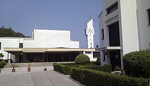
National Shrine of Saint Joseph (Karlovac)
Church in Croatia
Distance: Approx. 1572 meters
Latitude and longitude: 45.4954,15.5314
National Shrine of Saint Joseph (Croatian: Nacionalno svetište svetog Josipa) is a Croatian Catholic national shrine dedicated to Saint Joseph located in the city of Karlovac, in Parish of Our Lady of the Snows. Saint Joseph is a patron saint of Karlovac, Karlovac County and Croatia.
Weather in this IP's area
broken clouds
8 Celsius
6 Celsius
4 Celsius
8 Celsius
1023 hPa
83 %
1023 hPa
1010 hPa
10000 meters
2.64 m/s
8.37 m/s
233 degree
53 %


