141.11.31.212 - IP Lookup: Free IP Address Lookup, Postal Code Lookup, IP Location Lookup, IP ASN, Public IP
Country:
Region:
City:
Location:
Time Zone:
Postal Code:
IP information under different IP Channel
ip-api
Country
Region
City
ASN
Time Zone
ISP
Blacklist
Proxy
Latitude
Longitude
Postal
Route
Luminati
Country
Region
62
City
tivoli
ASN
Time Zone
Europe/Rome
ISP
Seflow s.r.l.
Latitude
Longitude
Postal
IPinfo
Country
Region
City
ASN
Time Zone
ISP
Blacklist
Proxy
Latitude
Longitude
Postal
Route
IP2Location
141.11.31.212Country
Region
lazio
City
tivoli
Time Zone
Europe/Rome
ISP
Language
User-Agent
Latitude
Longitude
Postal
db-ip
Country
Region
City
ASN
Time Zone
ISP
Blacklist
Proxy
Latitude
Longitude
Postal
Route
ipdata
Country
Region
City
ASN
Time Zone
ISP
Blacklist
Proxy
Latitude
Longitude
Postal
Route
Popular places and events near this IP address

Tivoli, Lazio
Comune in Lazio, Italy
Distance: Approx. 149 meters
Latitude and longitude: 41.95972222,12.79805556
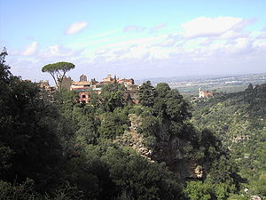
Tivoli ( TIV-ə-lee; Italian: [ˈtiːvoli]; Latin: Tibur) is a town and comune in Lazio, central Italy, 30 kilometres (19 miles) north-east of Rome, at the falls of the Aniene river where it issues from the Sabine Hills. The city offers a wide view over the Roman Campagna.

Hadrian's Villa
Archaeological complex in Tivoli, Italy
Distance: Approx. 2742 meters
Latitude and longitude: 41.946004,12.772515
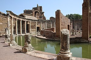
Hadrian's Villa (Italian: Villa Adriana; Latin: Villa Hadriana) is a UNESCO World Heritage Site comprising the ruins and archaeological remains of a large villa complex built around AD 120 by Roman emperor Hadrian near Tivoli outside Rome. It is the most imposing and complex Roman villa known. The complex contains over 30 monumental and scenic buildings arranged on a series of artificial esplanades at different heights and surrounded by gardens decorated with water basins and nymphaea (fountains).

Albulae Aquae
Distance: Approx. 6523 meters
Latitude and longitude: 41.966805,12.720499
Albulae Aquae ("White Waters") is a group of springs located 6 kilometres (3.7 mi) west of Tivoli, Italy. Its Latin name derives from the ancient Roman settlement here. The spring water is bluish, strongly impregnated with sulphur and carbonate of lime, and rises at a temperature of about 24 °C (75 °F).

Temple of Vesta, Tivoli
Distance: Approx. 667 meters
Latitude and longitude: 41.9667,12.8009
The so-called Temple of Vesta is a small circular Roman temple (so a tholos) in Tivoli, Italy, dating to the early 1st century BC. Its ruins are dramatically sited on the acropolis of the Etruscan and Roman city, overlooking the falls of the Aniene and a picturesque narrow gully. The temple's capitals have been much admired and imitated and their variation of the Corinthian order sometimes called the "Tivoli order". They have two rows of acanthus leaves, and its abacus is decorated with oversize fleurons in the form of hibiscus flowers (probably intended to be Hibiscus syriacus) with pronounced spiral pistils.
Roman Catholic Diocese of Tivoli
Latin Catholic ecclesiastical jurisdiction in Italy
Distance: Approx. 1217 meters
Latitude and longitude: 41.95,12.8
The Diocese of Tivoli (Latin: Dioecesis Tiburtina) is a Latin Church ecclesiastical territory or diocese of the Catholic Church in Latium, Italy, which has existed since the 2nd century. In 2002 territory was added to it from the Territorial Abbey of Subiaco. The diocese is immediately exempt to the Holy See.
Santuario di Nostra Signora di Fatima a San Vittorino
Distance: Approx. 5058 meters
Latitude and longitude: 41.9158,12.7915
The Santuario di Nostra Signora di Fatima is a church in Rome, in the zone San Vittorino. Although located in the commune of Rome, from the ecclesiastical point of view it is part of the Diocese of Tivoli. It was built between 1970 and 1979 to the designs of the architect Lorenzo Monardo and inaugurated May 13, 1979 by Monsignor Guglielmo Giaquinta, Bishop of Tivoli.
Villa Gregoriana
Distance: Approx. 558 meters
Latitude and longitude: 41.96555556,12.80138889
Villa Gregoriana is a park in Tivoli, Italy, located at the foot of the city's ancient acropolis. It consists mainly of thick woodland with paths that lead to the small circular Roman Temple of Vesta, the caves of Neptune and the Sirens, which form part of a series of gorges and cascades, and to the Great Waterfall. The park was commissioned by Pope Gregory XVI in 1835 to rebuild the bed of the Aniene River, which had been damaged by the flood of 1826.
Tivoli Cathedral
Distance: Approx. 550 meters
Latitude and longitude: 41.96555556,12.79666667
Tivoli Cathedral (Italian: Duomo di Tivoli or Basilica Cattedrale di San Lorenzo Martire) is a Roman Catholic cathedral, dedicated to Saint Lawrence, in Tivoli, Lazio, Italy. It is the seat of the bishop of Tivoli.

Guidonia Air Base
Airport in Guidonia Montecelio, Rome
Distance: Approx. 5813 meters
Latitude and longitude: 41.99027778,12.74083333
Guidonia Air Base (Italian: Aeroporto di Guidonia, ICAO: LIRG) is a military airport in Guidonia Montecelio, Province of Rome, near Rome. It is home to the Italian Air Force's main logistic center.
Stadio Olindo Galli
Distance: Approx. 3489 meters
Latitude and longitude: 41.95252028,12.83951528
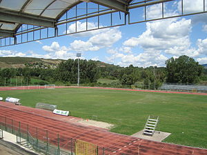
Stadio Olindo Galli is a football and athletics stadium in Tivoli, Italy. The main tenants are Lega Pro side Lupa Roma, and Tivoli Calcio and ASD Estense Tivoli, who both play in the regional Prima Categoria division.

Ponte Lucano
Bridge in Italy
Distance: Approx. 3143 meters
Latitude and longitude: 41.9549,12.7618
The Lucano bridge (in Italian: ponte Lucano) is a Roman stone bridge over the Aniene river in the Province of Rome, Italy, on the via Tiburtina. Coming from the direction of Rome, the bridge is found after Tivoli Terme and before Hadrian's Villa. This bridge was part of the project for the most endangered monuments of the World Monuments Fund for the year 2010.
San Pietro alla Carità
Churches of Tivoli
Distance: Approx. 342 meters
Latitude and longitude: 41.96361111,12.79694444
Chiesa di San Pietro alla Carità ("Church of Saint Peter to the Charity" in English) is a Romanesque architecture Catholic Church of Tivoli, Lazio. The church is one of the oldest in Tivoli and its present appearance is due to 12th-century rebuilding and restoration in 1951 following the bombing suffered during World War II. Inside is a cosmatesque floor.
Weather in this IP's area
overcast clouds
7 Celsius
5 Celsius
6 Celsius
8 Celsius
1020 hPa
45 %
1020 hPa
987 hPa
10000 meters
2.68 m/s
4.6 m/s
347 degree
87 %


