Country:
 Thailand
Region:
City:
Latitude and Longitude:
Time Zone:
Postal Code:
IP information under different IP Channel
ip-api
Country
Region
City
ASN
Time Zone
ISP
Blacklist
Proxy
Latitude
Longitude
Postal
Route
IPinfo
Country
Region
City
ASN
Time Zone
ISP
Blacklist
Proxy
Latitude
Longitude
Postal
Route
MaxMind
Country
Region
City
ASN
Time Zone
ISP
Blacklist
Proxy
Latitude
Longitude
Postal
Route
Luminati
Country
THRegion
10
City
bangkok
ASN
Time Zone
Asia/Bangkok
ISP
Cato Networks Ltd
Latitude
Longitude
Postal
db-ip
Country
Region
City
ASN
Time Zone
ISP
Blacklist
Proxy
Latitude
Longitude
Postal
Route
ipdata
Country
Region
City
ASN
Time Zone
ISP
Blacklist
Proxy
Latitude
Longitude
Postal
Route
Popular places and events near this IP address

State Railway of Thailand
State-owned rail operator of Thailand
Distance: Approx. 490 meters
Latitude and longitude: 13.7468,100.517
The State Railway of Thailand (SRT) (Thai: การรถไฟแห่งประเทศไทย, abbrev. รฟท., RTGS: kan rot fai haeng prathet thai) is the state-owned rail operator under the jurisdiction of the Ministry of Transport in Thailand.
Varadis Palace
Museum and library in a former royal residence
Distance: Approx. 696 meters
Latitude and longitude: 13.75638889,100.51361111
Varadis Palace (Thai: วังวรดิศ; RTGS: Wang Woradit) is the former residence of Prince Tisavarakumarn, the Prince Damrong Rajanubhab on Lan Luang Road in Bangkok, Thailand. The palace was built in 1911 by German architect Karl Döhring during the reign of King Rama V to the reign of King Rama VI. After Prince Tisavarakumarn died at this palace on 1 December 1943, the palace was preserved by his heir Mom Rajawongse Sangkadis Diskul, former Ambassador to Malaysia, Switzerland and the Vatican and presently by his great grandson, Mom Luang Panadda Diskul, former Provincial Governor of Nakhon Pathom and Chiang Mai and a member of the House of Senate. In 1977 the palace building was renovated and converted into a museum and library.
Debsirin School
Government school in Bangkok, Thailand
Distance: Approx. 489 meters
Latitude and longitude: 13.747,100.51588889
Debsirin School (Thai: โรงเรียนเทพศิรินทร์, pronounced [tʰêːp.sì.rīn]) is a boys' secondary school in Thailand. Founded by King Chulalongkorn in 1885 , its alumni include King Ananda Mahidol, Malaysia's founding father Tunku Abdul Rahman, more than 70 cabinet members, including five prime ministers, and numerous military leaders and dignitaries. Debsirin School participates in Jaturamitr Samakkee, a biennial traditional football competition between the four oldest boys' schools in Thailand.--.

Khlong Phadung Krung Kasem
Distance: Approx. 393 meters
Latitude and longitude: 13.7477,100.5167
Khlong Phadung Krung Kasem (Thai: คลองผดุงกรุงเกษม, pronounced [kʰlɔ̄ːŋ pʰā.dūŋ krūŋ kā.sěːm]) is a canal (khlong) in Bangkok. It was dug in 1851 in order to serve as a new outer moat for the expanding city, extending its boundaries from the Rattanakosin Island to the north and east.

Odeon Circle
Roundabout in Bangkok with Chinese-style gate
Distance: Approx. 535 meters
Latitude and longitude: 13.75383611,100.51305833
Odeon Circle or Wongwian Odeon (Thai: วงเวียนโอเดียน, pronounced [wōŋ.wīan ʔōː.dîan], RTGS: Wongwian Odian; Chinese: 崇聖牌樓; pinyin: Chóng shèng páilóu) is a roundabout in Bangkok. It is the intersection of Yaowarat, Charoen Krung, and Tri Mit or Mittaphap Thai-China roads in Samphanthawong district. A red paifang, which was built by Thai Chinese descents as part of the celebrations of King Bhumibol’s 72nd anniversary in 1999, is located at the center of the circle.

Bobae Market
Distance: Approx. 287 meters
Latitude and longitude: 13.75346944,100.51593889
Bobae Market (Thai: ตลาดโบ๊เบ๊, RTGS: Talat Bobe, pronounced [tā.làːt bóː.béː]), usually shortened to Bobae, is a well-known cheap clothing market, both retail and wholesale. The market area has two huge wholesale shopping areas, Bobae Market and Bobae Tower. Bobae Market's site on Krung Kasem Road along Khlong Phadung Krung Kasem (Phadung Krung Kasem Canal), where Khlong Phadung Krung Kasem cuts across Khlong Maha Nak in Khlong Maha Nak Subdistrict, Pom Prap Sattru Phai District, is between the Yotse Bridge (Kasat Suek intersection) and Jaturapak Rangsarit Bridge (Saphan Khao intersection) in Si Yaek Maha Nak Subdistrict, Dusit District, with some parts overlaps Rong Mueang Subdistrict, Pathum Wan District.

Kasat Suek
Road junction
Distance: Approx. 241 meters
Latitude and longitude: 13.74908333,100.51672778
Kasat Suek (Thai: กษัตริย์ศึก, pronounced [kā.sàt sɯ̀k]) refers to an intersection and its corresponding bridge on the periphery of Pom Prap Sattru Phai and Pathum Wan Districts, Bangkok. The intersection is also known by the names Bobae Intersection and Yotse Intersection.

Rama I Road
Street in Bangkok, Thailand
Distance: Approx. 246 meters
Latitude and longitude: 13.74902778,100.51680556
Rama I Road (Thai: ถนนพระรามที่ 1, RTGS: Thanon Phra Ram Thi Nueng; usually shortened to ถนนพระราม 1) is a road in Bangkok. It starts from the end of Bamrung Mueang Road where it intersects Krung Kasem Road at the border between the districts of Pom Prap Sattru Phai and Pathum Wan. From this point, it crosses Kasat Suek Bridge, also known as Yotse Bridge, which runs above Khlong Phadung Krung Kasem and the railway running from nearby Hua Lamphong railway station.

Khlong Maha Nak subdistrict
Khwaeng in Thailand
Distance: Approx. 325 meters
Latitude and longitude: 13.75280556,100.51469444
Khlong Maha Nak (Thai: คลองมหานาค, pronounced [kʰlɔ̄ːŋ mā.hǎː nâːk]) is one of five khwaengs (subdistricts) of Pom Prap Sattru Phai District, Bangkok.

Wat Borom Niwat
Buddhist temple in Thailand
Distance: Approx. 250 meters
Latitude and longitude: 13.7519,100.5194
Wat Borom Niwat Ratchaworawihan (Thai: วัดบรมนิวาสราชวรวิหาร); also simple known as Wat Borom Niwat or Wat Borom) is a second class royal Thai Buddhist temple, located in the Rong Mueang Subdistrict, Pathum Wan District, downtown Bangkok. Wat Borom Niwat is a temple that King Mongkut (Rama IV) when he was ordained as a monk ordered to be built in the year 1834 under the name "Wat Borommasuk" (วัดบรมสุข). The original status of this temple was aranwasi (อรัญวาสี; "dwelling in the forest"), in pair with Wat Bowonniwet Vihara, which was a khamwasi (คามวาสี; "dwelling in the community") in Bang Lamphu area in Rattanakosin Island.
Chaturaphak Rangsarit Bridge
Bridge in Bangkok, Thailand
Distance: Approx. 613 meters
Latitude and longitude: 13.75659444,100.51608056
Chaturaphak Rangsarit Bridge (written as Jaturapak Rangsarit, Thai: สะพานจตุรภักตร์รังสฤษดิ์) is a historic bridge in Bangkok. This bridge crossing over the canal Khlong Phadung Krung Kasem at Lan Luang Road, and also called in short as Saphan Khao (สะพานขาว, "white bridge") according to its colour characteristics. Its location is on a tripoint between Khlong Maha Nak and Wat Sommanat Subdistricts of Pom Prap Sattru Phai District and Si Yaek Maha Nak Subdistrict in Dusit District.
Charoen Rat 32 Bridge
Bridge in Pom Prap Sattru Phai District, Bangkok
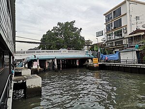
Distance: Approx. 213 meters
Latitude and longitude: 13.75310833,100.517125
Charoen Rat 32 Bridge (Thai: สะพานเจริญราษฎร์ ๓๒) is a historic bridge goes over Khlong Maha Nak canal located where Khlong Maha Nak cuts across Khlong Phadung Krung Kasem in the area known as Bobae, a hub of cheap clothes in Bangkok. Past this point, Khlong Maha Nak becomes Khlong Saen Saep, the longest man made waterway in Thailand. It was the second bridge in the "Charoen" bridge series (after Charoenrat 31 Bridge in Pak Khlong Talat area).
Weather in this IP's area
few clouds
27 Celsius
30 Celsius
27 Celsius
28 Celsius
1010 hPa
83 %
1010 hPa
1009 hPa
10000 meters
2.01 m/s
3.7 m/s
1 degree
18 %
06:07:43
18:02:55