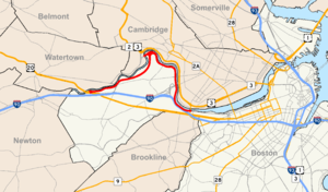
Country:
Region:
City:
Latitude and Longitude:
Time Zone:
Postal Code:
IP information under different IP Channel
ip-api
Country
Region
City
ASN
Time Zone
ISP
Blacklist
Proxy
Latitude
Longitude
Postal
Route
Luminati
Country
Region
ma
City
belmont
ASN
Time Zone
America/New_York
ISP
HARVARD-UNIV
Latitude
Longitude
Postal
IPinfo
Country
Region
City
ASN
Time Zone
ISP
Blacklist
Proxy
Latitude
Longitude
Postal
Route
db-ip
Country
Region
City
ASN
Time Zone
ISP
Blacklist
Proxy
Latitude
Longitude
Postal
Route
ipdata
Country
Region
City
ASN
Time Zone
ISP
Blacklist
Proxy
Latitude
Longitude
Postal
Route
Popular places and events near this IP address
Longfellow House–Washington's Headquarters National Historic Site
Historic site in Cambridge, Massachusetts
Distance: Approx. 369 meters
Latitude and longitude: 42.37666667,-71.12638889
The Longfellow House–Washington's Headquarters National Historic Site (also known as the Vassall-Craigie-Longfellow House and, until December 2010, Longfellow National Historic Site) is a historic site located at 105 Brattle Street in Cambridge, Massachusetts. It was the home of noted American poet Henry Wadsworth Longfellow for almost 50 years, and it had previously served as the headquarters of General George Washington (1775–76). The house was built in 1759 for Jamaican plantation owner John Vassall Jr., who fled the Cambridge area at the beginning of the American Revolutionary War because of his loyalty to the king of England.
Reginald A. Daly House
Historic house in Massachusetts, United States
Distance: Approx. 257 meters
Latitude and longitude: 42.37538889,-71.12627778
The Reginald A. Daly House is a historic house located in Cambridge, Massachusetts. It is a National Historic Landmark, notable for its association with Reginald Aldworth Daly (1871–1957), an eminent geologist, Penrose Medal winner, and Harvard University professor. The house is a two-story wood-frame structure, estimated to have been built in the 1880s or 1890s.
Oliver Hastings House
Historic house in Massachusetts, United States
Distance: Approx. 360 meters
Latitude and longitude: 42.37666667,-71.12666667
The Oliver Hastings House is a historic house Cambridge, Massachusetts. It is a National Historic Landmark, noted as an excellent example of Greek Revival architecture. It was the home of Oliver Hastings, a local builder.

Harvard rugby
Rugby team
Distance: Approx. 302 meters
Latitude and longitude: 42.371,-71.128
The Harvard Rugby Football Club is the National Collegiate Athletic Association (NCAA) Division I rugby union program that represents Harvard University in the Ivy Rugby Conference. Having been established in December 1872, Harvard has the oldest rugby college program in the United States. Harvard's first involvement with the sport can be traced to 1874, when Harvard played a two-game series vs Canadian McGill University.

Mary Fiske Stoughton House
Historic house in Massachusetts, United States
Distance: Approx. 367 meters
Latitude and longitude: 42.37583333,-71.125
The Mary Fiske Stoughton House is a National Historic Landmark house at 90 Brattle Street in Cambridge, Massachusetts. Henry Hobson Richardson designed the house in 1882 in what is now called the Shingle Style, with a minimum of ornament and shingles stretching over the building's irregular volumes like a skin. The house drew immediate notice in the architectural community, and was a significant influence in the growth in popularity of the Shingle style in the late 19th century.
Conventual Church of St. Mary and St. John
Historic church in Massachusetts, United States
Distance: Approx. 344 meters
Latitude and longitude: 42.37222222,-71.12472222
The Conventual Church of St. Mary and St. John is a historic Episcopal church in Cambridge, Massachusetts.

Building at 259 Mount Auburn Street
Historic house in Massachusetts, United States
Distance: Approx. 328 meters
Latitude and longitude: 42.37493056,-71.13202778
259 Mount Auburn Street is a small historic house built in the Italianate style of architecture located in Cambridge, Massachusetts.

Aaron Hill House
Historic house in Massachusetts, United States
Distance: Approx. 279 meters
Latitude and longitude: 42.37616667,-71.129
The Aaron Hill House is a historic house at 17 Brown Street in Cambridge, Massachusetts. It was built c. 1754, and was originally a two-story structure with a steeply pitched roof.

Memorial Drive Apartments Historic District
Historic district in Massachusetts, United States
Distance: Approx. 235 meters
Latitude and longitude: 42.37277778,-71.12583333
The Memorial Drive Apartments Historic District is a historic district encompassing four apartment houses on Memorial Drive in Cambridge, Massachusetts. They are located between the Anderson Memorial Bridge and the Eliot Bridge with street numbers ranging from 983 to 993 Memorial Drive. All four buildings were built between 1916 and 1924, not long after Memorial Drive had been laid out, and were, despite significant similarities of style, designed by three different architects.

Soldiers Field Road
Street in Boston, Massachusetts
Distance: Approx. 120 meters
Latitude and longitude: 42.37277778,-71.12916667
Soldiers Field Road is a major crosstown parkway in Boston, Massachusetts, running west to east from U.S. Route 20 in the northwest corner of Brighton to the Boston University Bridge. It follows the course of the Charles River and also passes by the campuses of Harvard University and Boston University. The road is named for the area south of the road on a bend in the Charles River.

Tory Row
Distance: Approx. 343 meters
Latitude and longitude: 42.37647222,-71.12658333
Tory Row is the nickname historically given by some to the part of Brattle Street in Cambridge, Massachusetts, where many Loyalists had mansions at the time of the American Revolutionary War, and given by others to seven Colonial mansions along Brattle Street. Its historic buildings from the 18th century include the William Brattle House (42 Brattle Street) and the Longfellow House–Washington's Headquarters National Historic Site (105 Brattle Street). Samuel Atkins Eliot, writing in 1913 of the seven Colonial mansions making up Tory Row, called the area "not only one of the most beautiful but also one of the most historic streets in America." Owners of Caribbean slave plantations, including the Vassall and Royall families, built the mansions as a statement of the "incredible wealth" they had amassed from slave labor in Jamaica and Antigua, and they enslaved an unusually high number of people on the premises.

Harvard women's rugby
Rugby team
Distance: Approx. 302 meters
Latitude and longitude: 42.371,-71.128
The Harvard Women's Rugby team is the women's rugby union program that represents Harvard University in Division I tournaments organised by the National Intercollegiate Rugby Association (NIRA). Harvard competes in the Ivy Rugby Conference. The club began activities in 1982, although the university's first involvement with the sport can be traced to 1874, when Harvard played a two-game series vs Canadian McGill University.
Weather in this IP's area
overcast clouds
9 Celsius
7 Celsius
7 Celsius
10 Celsius
1030 hPa
69 %
1030 hPa
1029 hPa
10000 meters
3.09 m/s
180 degree
100 %
06:22:08
16:34:01


