140.148.11.212 - IP Lookup: Free IP Address Lookup, Postal Code Lookup, IP Location Lookup, IP ASN, Public IP
Country:
Region:
City:
Location:
Time Zone:
Postal Code:
IP information under different IP Channel
ip-api
Country
Region
City
ASN
Time Zone
ISP
Blacklist
Proxy
Latitude
Longitude
Postal
Route
Luminati
Country
Region
pue
City
cholula
ASN
Time Zone
America/Mexico_City
ISP
Universidad de Las Americas-Puebla
Latitude
Longitude
Postal
IPinfo
Country
Region
City
ASN
Time Zone
ISP
Blacklist
Proxy
Latitude
Longitude
Postal
Route
IP2Location
140.148.11.212Country
Region
puebla
City
cholula
Time Zone
America/Mexico_City
ISP
Language
User-Agent
Latitude
Longitude
Postal
db-ip
Country
Region
City
ASN
Time Zone
ISP
Blacklist
Proxy
Latitude
Longitude
Postal
Route
ipdata
Country
Region
City
ASN
Time Zone
ISP
Blacklist
Proxy
Latitude
Longitude
Postal
Route
Popular places and events near this IP address
Cholula, Puebla
City and district in Puebla, Mexico
Distance: Approx. 316 meters
Latitude and longitude: 19.06333333,-98.30638889
Cholula (Spanish: [tʃoˈlula] , officially Cholula de Rivadavia; Mezquital Otomi: Mä'ragi), is a city and district located in the metropolitan area of Puebla, Mexico. Cholula is best known for its Great Pyramid, with the Iglesia de Nuestra Señora de los Remedios sanctuary on top, as well as its numerous churches. The city and district of Cholula are divided into two: San Pedro Cholula and San Andrés Cholula.

Iglesia de Nuestra Señora de los Remedios, Cholula
Church in Cholula, Mexico
Distance: Approx. 691 meters
Latitude and longitude: 19.0581,-98.3018
The Iglesia de Nuestra Señora de los Remedios (Our Lady of Remedies Church) is a 16th-century Mexican Catholic parish church built atop the Tlachihualtepetl pyramid in the municipality of Cholula located in the central Mexican state of Puebla. The church was built with carved stone and embellished with 24-carat gilded panels and shims, called laminilla. It has an altar in the neoclassical style.

San Pedro Cholula
Municipality in Puebla, Mexico
Distance: Approx. 316 meters
Latitude and longitude: 19.06333333,-98.30638889
San Pedro Cholula is a municipality in the Mexican state of Puebla and one of two municipalities which made up the city of Cholula. The city has been divided into two sections since the pre Hispanic era, when revolting Toltec-Chichimecas pushed the formerly dominant Olmec-Xicallanca to the eastern side of the city in the 13th century. The new lords called themselves Cholutecas and built a new temple to Quetzalcoatl on the San Pedro side, which eventually eclipsed the formerly prominent Great Pyramid of Cholula, now on the San Andrés side.

San Gabriel Franciscan Convent, Cholula
Church in Puebla, Mexico
Distance: Approx. 231 meters
Latitude and longitude: 19.06222222,-98.30444444
The San Gabriel Franciscan Convent or San Gabriel Friary is a church and friary in Cholula, Metropolitan area of Puebla City, Mexico.

Plaza de la Concordia
Plaza in Cholula, Puebla, Mexico
Distance: Approx. 391 meters
Latitude and longitude: 19.06277778,-98.30694444
The Plaza de la Concordia, or Zócalo, is a large plaza in Cholula, Puebla, Mexico.

Statue of Emiliano Zapata, Cholula
Statue in Cholula, Puebla, Mexico
Distance: Approx. 251 meters
Latitude and longitude: 19.06291667,-98.30552778
The statue of Emiliano Zapata in Cholula, Puebla, Mexico, was erected by Gobierno Municipal de San Pedro Cholula in 2014.

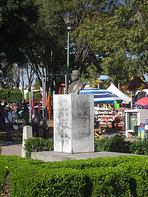
Bust of Bernardino Rivadavia
Sculpture in Cholula, Puebla, Mexico
Distance: Approx. 358 meters
Latitude and longitude: 19.06180556,-98.30588889
The bust of Bernardino Rivadavia is installed in Cholula, Puebla, Mexico.

Statue of Alfredo Toxqui Fernández de Lara
Statue in Cholula, Puebla, Mexico
Distance: Approx. 373 meters
Latitude and longitude: 19.06147222,-98.30569444
The statue of Alfredo Toxqui Fernández de Lara in Cholula, Puebla, was erected by Gobierno Municipal de Cholula de Rivadavia in 2004.

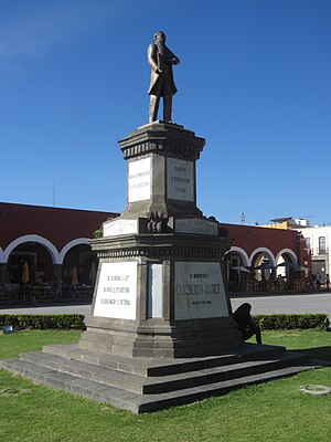
Statue of Benito Juárez, Cholula
Statue in Cholula, Puebla, Mexico
Distance: Approx. 357 meters
Latitude and longitude: 19.06316667,-98.30675
The statue of Benito Juárez is installed in Cholula, Puebla's Plaza de la Concordia, in Mexico.

Statue of Miguel Hidalgo y Costilla, Cholula
Statue in Cholula, Puebla, Mexico
Distance: Approx. 426 meters
Latitude and longitude: 19.06241667,-98.30713889
The statue of Miguel Hidalgo y Costilla is installed in Cholula, Puebla's Plaza de la Concordia, in Mexico.

San Miguel Arcángel Fountain (Cholula)
Fountain in Cholula, Puebla, Mexico
Distance: Approx. 391 meters
Latitude and longitude: 19.06277778,-98.30694444
San Miguel Arcángel Fountain is installed in Cholula, Puebla's Plaza de la Concordia, in Mexico. The fountain was gifted by Philip II of Spain in 1554.

San Gerónimo Tlamaco
City and District in Hidalgo, Mexico
Distance: Approx. 316 meters
Latitude and longitude: 19.06333333,-98.30638889
San Gerónimo Tlamaco is a locality in Mexico belonging to the municipality of Atitalaquia in the state of Hidalgo.
Weather in this IP's area
clear sky
12 Celsius
10 Celsius
9 Celsius
12 Celsius
1019 hPa
45 %
1019 hPa
792 hPa
10000 meters
1.79 m/s
2.24 m/s
359 degree
