140.106.38.230 - IP Lookup: Free IP Address Lookup, Postal Code Lookup, IP Location Lookup, IP ASN, Public IP
Country:
Region:
City:
Location:
Time Zone:
Postal Code:
IP information under different IP Channel
ip-api
Country
Region
City
ASN
Time Zone
ISP
Blacklist
Proxy
Latitude
Longitude
Postal
Route
Luminati
Country
Region
wi
City
riverfalls
ASN
Time Zone
America/Chicago
ISP
SWIFTCURRENT-CONNECT
Latitude
Longitude
Postal
IPinfo
Country
Region
City
ASN
Time Zone
ISP
Blacklist
Proxy
Latitude
Longitude
Postal
Route
IP2Location
140.106.38.230Country
Region
wisconsin
City
ellsworth
Time Zone
America/Chicago
ISP
Language
User-Agent
Latitude
Longitude
Postal
db-ip
Country
Region
City
ASN
Time Zone
ISP
Blacklist
Proxy
Latitude
Longitude
Postal
Route
ipdata
Country
Region
City
ASN
Time Zone
ISP
Blacklist
Proxy
Latitude
Longitude
Postal
Route
Popular places and events near this IP address

Pierce County, Wisconsin
County in Wisconsin, United States
Distance: Approx. 5281 meters
Latitude and longitude: 44.72,-92.42
Pierce County is a county in the U.S. state of Wisconsin. As of the 2020 census, the population was 42,212. Its county seat is Ellsworth.

Trimbelle, Wisconsin
Town in Wisconsin, United States
Distance: Approx. 7731 meters
Latitude and longitude: 44.73166667,-92.58
Trimbelle trim-BEL) is a town in Pierce County, Wisconsin, United States. The population was 1,511 at the 2000 census. The unincorporated communities of Beldenville and Ottman Corners are located in the town.

Ellsworth (town), Wisconsin
Distance: Approx. 4616 meters
Latitude and longitude: 44.72527778,-92.42638889
Ellsworth is a town in Pierce County, Wisconsin, United States. The population was 1,064 at the 2000 census. The Village of Ellsworth is located within the town.

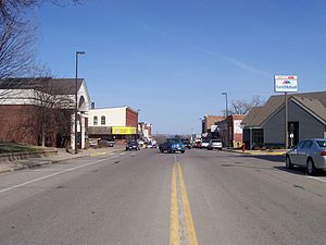
Ellsworth, Wisconsin
Village in Wisconsin, United States
Distance: Approx. 508 meters
Latitude and longitude: 44.7325,-92.48
Ellsworth is a village in and the county seat of Pierce County, Wisconsin, United States. The population was 3,348 at the 2020 census. The village is adjacent to the Town of Ellsworth and now incorporates the formerly separate district known as East Ellsworth.

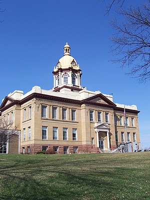
Pierce County Courthouse (Wisconsin)
United States historic place
Distance: Approx. 499 meters
Latitude and longitude: 44.7325,-92.48472222
The Pierce County Courthouse is a historic governmental building in Ellsworth, Wisconsin, United States. Built-in 1905, the courthouse sits on the edge of Ellsworth's business district. Built on a raised foundation of sandstone, it features elements of both the Beaux-Arts and the Neoclassical styles of architecture.
Beldenville, Wisconsin
Unincorporated community in Wisconsin, United States
Distance: Approx. 4597 meters
Latitude and longitude: 44.77388889,-92.50777778
Beldenville is an unincorporated community located in Pierce County, Wisconsin, United States. Beldenville is located on Wisconsin Highway 65 north of Ellsworth. Beldenville has a post office with ZIP code 54003.
Ellsworth Community School
School in Ellsworth, Pierce County, Wisconsin, United States
Distance: Approx. 1152 meters
Latitude and longitude: 44.72636111,-92.48297222
Ellsworth Community High School is a public school serving grades 9 through 12 in Ellsworth, Pierce County, Wisconsin, United States.
Lawton, Wisconsin
Unincorporated community in Wisconsin, United States
Distance: Approx. 6837 meters
Latitude and longitude: 44.77583333,-92.41583333
Lawton is an unincorporated community located in the towns of Ellsworth and Martell, Pierce County, Wisconsin, United States. Lawton is located at the junction of U.S. Route 63 and County Highway N 4.5 miles (7.2 km) northeast of the city of Ellsworth. The community is most likely named for Lawton Peterson, who ran the store in which the first post office was located when it opened in 1894.
Moeville, Wisconsin
Unincorporated community in Wisconsin, United States
Distance: Approx. 6429 meters
Latitude and longitude: 44.68861111,-92.5275
Moeville is an unincorporated community located in the towns of Trenton and Trimbelle, in Pierce County, Wisconsin, United States.
Ottman Corners, Wisconsin
Unincorporated community in Wisconsin, United States
Distance: Approx. 4619 meters
Latitude and longitude: 44.70333333,-92.51722222
Ottman Corners is an unincorporated community located in the town of Trimbelle, Pierce County, Wisconsin, United States. It was named for three brothers: Nelson, Christopher, and James Ottman who came from New York in 1859.
Weather in this IP's area
light snow
-4 Celsius
-9 Celsius
-5 Celsius
-3 Celsius
1004 hPa
93 %
1004 hPa
965 hPa
8047 meters
4.12 m/s
120 degree
100 %