14.1.116.12 - IP Lookup: Free IP Address Lookup, Postal Code Lookup, IP Location Lookup, IP ASN, Public IP
Country:
Region:
City:
Location:
Time Zone:
Postal Code:
IP information under different IP Channel
ip-api
Country
Region
City
ASN
Time Zone
ISP
Blacklist
Proxy
Latitude
Longitude
Postal
Route
Luminati
Country
ASN
Time Zone
Asia/Kolkata
ISP
ORANGE CITY INTERNET SERVICES PVT. LTD.
Latitude
Longitude
Postal
IPinfo
Country
Region
City
ASN
Time Zone
ISP
Blacklist
Proxy
Latitude
Longitude
Postal
Route
IP2Location
14.1.116.12Country
Region
maharashtra
City
nagpur
Time Zone
Asia/Kolkata
ISP
Language
User-Agent
Latitude
Longitude
Postal
db-ip
Country
Region
City
ASN
Time Zone
ISP
Blacklist
Proxy
Latitude
Longitude
Postal
Route
ipdata
Country
Region
City
ASN
Time Zone
ISP
Blacklist
Proxy
Latitude
Longitude
Postal
Route
Popular places and events near this IP address

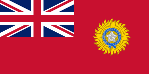
Central Provinces and Berar
Province of British India, and later, Dominion of India (1903–1950)
Distance: Approx. 1017 meters
Latitude and longitude: 21.15,79.09
The Central Provinces and Berar was a province of British India and later the Dominion of India which existed from 1903 to 1950. It was formed by the merger of the Central Provinces with the province of Berar, which was territory leased by the British from the Hyderabad State. Through an agreement signed on 5 November 1902, 6th Nizam Mahbub Ali Khan, Asaf Jah VI leased Berar permanently to the British for an annual payment of 25 lakhs rupees.

Nagpur Province
Province of British India
Distance: Approx. 1017 meters
Latitude and longitude: 21.15,79.09
Nagpur Province was a province of British India that covered parts of the present-day states of Madhya Pradesh, Maharashtra, and Chhattisgarh. The city of Nagpur was the capital of the province. In 1861, Nagpur Province was merged into the Central Provinces together with the Saugor and Nerbudda Territories.

Central Provinces
Province of British India
Distance: Approx. 1017 meters
Latitude and longitude: 21.15,79.09
The Central Provinces was a province of British India. It comprised British conquests from the Mughals and Marathas in central India, and covered parts of present-day Madhya Pradesh, Chhattisgarh and Maharashtra states. Nagpur was the primary winter capital while Pachmarhi served as the regular summer retreat.

Kingdom of Nagpur
Distance: Approx. 1017 meters
Latitude and longitude: 21.15,79.09
The Kingdom of Nagpur was a kingdom within the Maratha Confederacy in the 18th and 19th centuries. It was ruled by the Maratha Bhonsle dynasty in the mid-18th century. The city of Nagpur was the capital of the state.

Raman Science Centre
Science museum in Nagpur, India
Distance: Approx. 747 meters
Latitude and longitude: 21.1459,79.0941
The Raman Science Centre and Raman Planetarium Complex at Nagpur is an interactive science centre affiliated with Mumbai's Nehru Science Centre. The centre was developed to promote a scientific attitude, portray the growth of science and technology and their applications in industry and human welfare, and hold science exhibits. The centre is named after famous Nobel Prize winner Indian physicist Chandrasekhara Venkata Raman.

Shukrawari Lake
Distance: Approx. 453 meters
Latitude and longitude: 21.146,79.099
It is known by the names Shukravari Talao (lake), Gandhi Sagar Lake and Jumma lake. It is located in Nagpur in front of Raman Science Center. The lake which is said to be exists for more than 275 years, was established as a source of water supply by Chand Sultan, the then ruler of Nagpur.
Indira Gandhi Government Medical College, Nagpur
Indian government medical college
Distance: Approx. 715 meters
Latitude and longitude: 21.153418,79.0939735
Indira Gandhi Government Medical College & Hospital (IGGMCH) (also known as Mayo Hospital), established in 1968, is located in Central Nagpur. run by the Government of Maharashtra. It is one of the Three Government Medical Colleges in Nagpur city.

Ram Jhula, Nagpur
Distance: Approx. 1148 meters
Latitude and longitude: 21.1535,79.0894
The Ram Jhula consists of two parallel cable-stayed railway over-bridges in Nagpur, India. The 606.74 metres (1,990.6 ft) long bridge crosses the railway tracks north of Nagpur Junction railway station. The Blue Line of the Nagpur Metro runs along the centre of the bridge on the eastern side.
Chitar Oli Chowk metro station
Nagpur Metro's Aqua Line metro station
Distance: Approx. 1103 meters
Latitude and longitude: 21.14958,79.11041
Chitar Oli Chowk, also known as Chitaroli Chowk, is an elevated metro station on the East-West Corridor of the Aqua Line of Nagpur Metro in Nagpur, India. This metro station was inaugurated on 11 December 2022 by Prime Minister Narendra Modi and was opened to the public on 12 December 2022.
Agrasen Square metro station
Nagpur Metro's Aqua Line metro station
Distance: Approx. 343 meters
Latitude and longitude: 21.15098,79.10293
Agrasen Square is an elevated metro station on the East-West Corridor of the Aqua Line of Nagpur Metro in Nagpur, India. This metro station was inaugurated on 11 December 2022 by Prime Minister Narendra Modi and was opened to the public on 12 December 2022.
Dosar Vaishya Square metro station
Nagpur Metro's Aqua Line metro station
Distance: Approx. 600 meters
Latitude and longitude: 21.15285,79.09489
Dosar Vaishya Square is an elevated metro station on the East-West Corridor of the Aqua Line of Nagpur Metro in Nagpur, India. This metro station was inaugurated on 11 December 2022 by Prime Minister Narendra Modi and was opened to the public on 12 December 2022.
Nagpur Railway Station metro station
Nagpur Metro's Aqua Line metro station
Distance: Approx. 980 meters
Latitude and longitude: 21.15114,79.09044
Nagpur Railway Station is an important elevated metro station on the East-West Corridor of the Aqua Line of Nagpur Metro in Nagpur, India. This metro stations holds the main Nagpur Junction railway station. This metro station was inaugurated on 11 December 2022 by Prime Minister Narendra Modi and was opened to the public on 12 December 2022.
Weather in this IP's area
haze
21 Celsius
21 Celsius
21 Celsius
21 Celsius
1019 hPa
64 %
1019 hPa
984 hPa
2000 meters
1.03 m/s
160 degree
20 %