139.60.195.238 - IP Lookup: Free IP Address Lookup, Postal Code Lookup, IP Location Lookup, IP ASN, Public IP
Country:
Region:
City:
Location:
Time Zone:
Postal Code:
ISP:
ASN:
language:
User-Agent:
Proxy IP:
Blacklist:
IP information under different IP Channel
ip-api
Country
Region
City
ASN
Time Zone
ISP
Blacklist
Proxy
Latitude
Longitude
Postal
Route
db-ip
Country
Region
City
ASN
Time Zone
ISP
Blacklist
Proxy
Latitude
Longitude
Postal
Route
IPinfo
Country
Region
City
ASN
Time Zone
ISP
Blacklist
Proxy
Latitude
Longitude
Postal
Route
IP2Location
139.60.195.238Country
Region
wyoming
City
rock springs
Time Zone
America/Denver
ISP
Language
User-Agent
Latitude
Longitude
Postal
ipdata
Country
Region
City
ASN
Time Zone
ISP
Blacklist
Proxy
Latitude
Longitude
Postal
Route
Popular places and events near this IP address

Rock Springs massacre
1885 killing of Chinese people in Wyoming
Distance: Approx. 1446 meters
Latitude and longitude: 41.59111111,-109.21888889
The Rock Springs massacre, also known as the Rock Springs riot, occurred on September 2, 1885, in the present-day United States city of Rock Springs in Sweetwater County, Wyoming. The riot, and resulting massacre of immigrant Chinese miners by European immigrant miners, was the result of racial prejudice toward the Chinese miners, who were taking jobs from the existing miners. The Union Pacific Coal Department found it economically beneficial to give preference in hiring to Chinese miners, who were willing to work for lower wages than their European counterparts, which angered the existing miners.

Masonic Temple (Rock Springs, Wyoming)
United States historic place
Distance: Approx. 1559 meters
Latitude and longitude: 41.58472222,-109.22055556
The Rock Springs Masonic Temple is a historic site in Rock Springs, Wyoming, United States. It is located at 218 B Street in Rock Springs, Wyoming, United States. It is a contributing property in the Downtown Rock Springs Historic District, which was added to the National Register of Historic Places on January 19, 1994.
Rock Springs High School
Public high school
Distance: Approx. 631 meters
Latitude and longitude: 41.59222222,-109.20638889
Rock Springs High School is a high school campus located in Rock Springs, Wyoming, United States.

Slovenski Dom
United States historic place
Distance: Approx. 1611 meters
Latitude and longitude: 41.59138889,-109.22083333
The Slovenski Dom in Rock Springs, Wyoming was built as a community hall for Slovenian fraternal organizations in 1913. The Slovenski Dom, or Slovenian National Home, was one of a number of similar halls built in places with large ethnic Slovenian populations. The organizing charter stipulated that the hall be known as the "Slovenski Dom", its name in Slovenian, rather than by its English translation.

Rock Springs Elks' Lodge No. 624
United States historic place
Distance: Approx. 1431 meters
Latitude and longitude: 41.58444444,-109.21888889
Rock Springs Elks' Lodge No. 624, also known as Elks' Lodge and denoted 848SW7692, is a three-story 94 feet (29 m) by 96 feet (29 m) building at C and Second Streets in Rock Springs, Wyoming that is listed on the National Register of Historic Places. It was built in 1924 and is architecturally unique in the state.

Downtown Rock Springs Historic District
Historic district in Wyoming, United States
Distance: Approx. 1460 meters
Latitude and longitude: 41.58694444,-109.21972222
The Downtown Rock Springs Historic District is a historic district that was listed on the National Register of Historic Places in 1994, with an enlargement in 2023. It is roughly bounded by K, 4th, C, 2nd, A, and 5th Streets in downtown Rock Springs, Wyoming. The district was site of the 1885 Chinese Massacre.

Gras House
Historic house in Wyoming, United States
Distance: Approx. 1462 meters
Latitude and longitude: 41.59,-109.21944444
The Gras House, at 616 W. Elias in Rock Springs, Wyoming, is a Bungalow/craftsman house that was built in 1913–14. Also known as the Boucvalt—Gras House, it was listed on the National Register of Historic Places in 1986.

Taliaferro House
Historic house in Wyoming, United States
Distance: Approx. 1526 meters
Latitude and longitude: 41.58138889,-109.21861111
The Taliaferro House, at 106 Cedar St. in Rock Springs, Wyoming, was built in c. 1907–1912.

City Hall (Rock Springs, Wyoming)
United States historic place
Distance: Approx. 1553 meters
Latitude and longitude: 41.585,-109.22055556
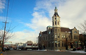
The City Hall of Rock Springs, Wyoming, located at 4th and B Sts. in Rock Springs, is a gray sandstone building that was built in 1894. It includes Richardsonian Romanesque architecture in a design by Salt Lake City architect M.D. Kern.
First National Bank Building (Rock Springs, Wyoming)
United States historic place
Distance: Approx. 1453 meters
Latitude and longitude: 41.58638889,-109.21958333
The First National Bank Building, at 502 S. Main St. in Rock Springs, Wyoming, is a historic building built in 1917. Also known as Security Bank Building, it was listed on the National Register of Historic Places in 1980.

Wardell Court Historic Residential District
Historic district in Wyoming, United States
Distance: Approx. 1137 meters
Latitude and longitude: 41.58222222,-109.21388889
The Wardell Court Historic Residential District in Rock Springs, Wyoming is a 5-acre (2.0 ha) historic district that was listed on the U.S. National Register of Historic Places in 1997. It included 14 contributing buildings and six other buildings in a one-block area. These are all the buildings of a Wardell Court planned community that was formed by the Union Pacific Coal Company during 1920 to 1921 to house company officials.

Saints Cyril and Methodius Catholic Church and Rectory
United States historic place
Distance: Approx. 1544 meters
Latitude and longitude: 41.59138889,-109.22
Saints Cyril and Methodius Catholic Church and Rectory, also known as North Side Church, is a historic church in Rock Springs, Wyoming. The Roman Catholic church was established by Slavic immigrants who found the established Catholic church in Rock Springs to be dominated by Irish parishioners and clergy, and who wished to have a church more closely aligned to their traditions. In 1925 they built their own church two blocks from Our Lady of Sorrows Catholic Church to replace a temporary church built in 1911.
Weather in this IP's area
clear sky
-4 Celsius
-8 Celsius
-4 Celsius
-4 Celsius
1029 hPa
54 %
1029 hPa
796 hPa
10000 meters
2.06 m/s
250 degree
