Country:
 Armenia
Region:
City:
Latitude and Longitude:
Time Zone:
Postal Code:
IP information under different IP Channel
ip-api
Country
Region
City
ASN
Time Zone
ISP
Blacklist
Proxy
Latitude
Longitude
Postal
Route
IPinfo
Country
Region
City
ASN
Time Zone
ISP
Blacklist
Proxy
Latitude
Longitude
Postal
Route
MaxMind
Country
Region
City
ASN
Time Zone
ISP
Blacklist
Proxy
Latitude
Longitude
Postal
Route
Luminati
Country
 RU
RUASN
Time Zone
Europe/Moscow
ISP
JSC RetnNet
Latitude
Longitude
Postal
db-ip
Country
Region
City
ASN
Time Zone
ISP
Blacklist
Proxy
Latitude
Longitude
Postal
Route
ipdata
Country
Region
City
ASN
Time Zone
ISP
Blacklist
Proxy
Latitude
Longitude
Postal
Route
Popular places and events near this IP address
Yerevan Physics Institute
Distance: Approx. 666 meters
Latitude and longitude: 40.20638889,44.485
The A.I. Alikhanyan National Science Laboratory (Armenian: Ա.Ի. Ալիխանյանի անվան Ազգային Գիտական Լաբորատորիա) is a research institute located in Yerevan, Armenia. It was founded in 1943 as a branch of the Yerevan State University by brothers Abram Alikhanov and Artem Alikhanian. It was often referred to by the acronym YerPhI (Yerevan Physics Institute).
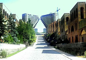
Arabkir District
Place in Yerevan, Armenia
Distance: Approx. 1534 meters
Latitude and longitude: 40.20777778,44.50583333
Arabkir (Armenian: Արաբկիր վարչական շրջան, romanized: Arabkir varch’akan shrjan), is one of the 12 districts of Yerevan, the capital of Armenia. Located to the north of the city centre, Arabkir is bordered by the Davtashen District from the northwest, Ajapnyak District from the west, Kentron District from the south, and Kanaker-Zeytun District from the east. Hrazdan River forms the natural border of the district from the north and the west.
Nor Arabkir
Place in Yerevan, Armenia
Distance: Approx. 407 meters
Latitude and longitude: 40.20027778,44.49416667
Nor Arabkir (Armenian: Նոր Արաբկիր, also, Arabkir), is an upper middle class urban neighbourhood in Yerevan, the capital of Armenia. It is part of the Arabkir District of the city.
National Archives of Armenia
Distance: Approx. 535 meters
Latitude and longitude: 40.1989,44.4949
The National Archives of Armenia (Armenian: Հայաստանի ազգային արխիվ, romanized: Hayastani azgayin arkhiv) are the national archives of Armenia. The agency was officially founded in 1923. The headquarters are located in Yerevan, with regional branches in other cities.
CS Media
Armenian media company
Distance: Approx. 1171 meters
Latitude and longitude: 40.21201389,44.48777778
CS Media, also known as Armenia Media Holding, is a major media company, located in Yerevan, the capital of Armenia. Armenian-American businessman and philanthropist Gerard Cafesjian is a major shareholder in the business. It was founded on 4 September 2004.
Russian-Armenian University
University in Yerevan
Distance: Approx. 1523 meters
Latitude and longitude: 40.21051111,44.50328889
Russian-Armenian University (RAU) (Russian: Российско-армянский университет, РАУ; Armenian: Հայ-Ռուսական համալսարան) is an intergovernmental university being under the joint authority of the Russian Federation and Armenia. The languages of instruction and communication at the university are Russian and Armenian. There are Russian and Armenian education sectors operating at RAU. Upon graduation, students receive two state Diplomas: Armenian and Russian.

Haybusak University of Yerevan
Distance: Approx. 1169 meters
Latitude and longitude: 40.2,44.47611111
Haybusak University of Yerevan, (Armenian: Երևանի Հայբուսակ Համալսարան) is a private university in Armenia.

Komitas Avenue
Street in Yerevan, Armenia
Distance: Approx. 1473 meters
Latitude and longitude: 40.20583333,44.50611111
Komitas Avenue (Armenian: Կոմիտասի պողոտա) is a 3 km-long avenue in the Armenian capital of Yerevan. Named after the prominent Armenian composer Komitas, the avenue is the arterial road of the Arabkir district. The avenue which was opened in 1938, starts with the Mergelyan Institute of Mathematical Machines near Komitas square and ends up with the Lambada bridge junction crossed by the Azatutyan Avenue.

Barekamutyun (Yerevan Metro)
Yerevan Metro Station
Distance: Approx. 473 meters
Latitude and longitude: 40.19805556,44.49277778
Barekamutyun (Armenian: Բարեկամություն) is a Yerevan Metro station. It is one of the original metro stations in the city of Yerevan and was opened to the public on 7 March 1981.
Tumo Center for Creative Technologies
Distance: Approx. 992 meters
Latitude and longitude: 40.19652778,44.48011111
The TUMO Center for Creative Technologies (Armenian: Թումո ստեղծարար տեխնոլոգիաների կենտրոն) is a free education program for teenagers aged 12–18 specializing in technology and design, with education being provided at various TUMO centers and hubs. The first TUMO center opened in Yerevan, Armenia in 2011. There are currently three TUMO centers in Armenia.

Tumanyan Park
Distance: Approx. 1345 meters
Latitude and longitude: 40.19222222,44.47972222
Tumanyan Park (Armenian: Թումանյան Այգի) is a public park in the Ajapnyak district of Yerevan, Armenia. It is located on Halabyan Street in the gorge of Hrazdan River, between the Great Bridge of Hrazdan and the Tumo Center for Creative Technologies. It was opened in 1970 and occupies an area of 7 hectares on the right bank of Hrazdan River.

Buenos Aires Park
Park in Yerevan, Armenia
Distance: Approx. 970 meters
Latitude and longitude: 40.20583333,44.47972222
Buenos Aires Park (Armenian: Բուենոս Այրեսի այգի (Buenos Ayresi aygi)) is a public park in the Ajapnyak District of Yerevan, Armenia. It is located at the northeastern corner of Halabyan-Margaryan intersection, near the Armenia Republican Medical Centre, on the left bank of Hrazdan River. The abandoned park near the Armenia Republican Medical Centre was renovated during summer 2012 and named after Buenos Aires which is twinned with Yerevan since 2000.
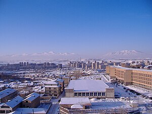
Weather in this IP's area
scattered clouds
8 Celsius
8 Celsius
8 Celsius
8 Celsius
1011 hPa
87 %
1011 hPa
887 hPa
10000 meters
1.54 m/s
270 degree
40 %
07:16:56
18:16:41