139.28.55.91 - IP Lookup: Free IP Address Lookup, Postal Code Lookup, IP Location Lookup, IP ASN, Public IP
Country:
Region:
City:
Location:
Time Zone:
Postal Code:
IP information under different IP Channel
ip-api
Country
Region
City
ASN
Time Zone
ISP
Blacklist
Proxy
Latitude
Longitude
Postal
Route
Luminati
Country
ASN
Time Zone
Europe/Moscow
ISP
LLC Oblastnaya Set
Latitude
Longitude
Postal
IPinfo
Country
Region
City
ASN
Time Zone
ISP
Blacklist
Proxy
Latitude
Longitude
Postal
Route
IP2Location
139.28.55.91Country
Region
leningradskaya oblast'
City
koltushi
Time Zone
Europe/Moscow
ISP
Language
User-Agent
Latitude
Longitude
Postal
db-ip
Country
Region
City
ASN
Time Zone
ISP
Blacklist
Proxy
Latitude
Longitude
Postal
Route
ipdata
Country
Region
City
ASN
Time Zone
ISP
Blacklist
Proxy
Latitude
Longitude
Postal
Route
Popular places and events near this IP address

Ice Palace (Saint Petersburg)
Multi-purpose arena in Saint Petersburg, Russia
Distance: Approx. 9982 meters
Latitude and longitude: 59.921667,30.466389
The Ice Palace (Russian: Ледовый Дворец, Ledovy Dvorets) is an arena in Saint Petersburg, Russia. It was built for the 2000 IIHF World Championship and opened in 2000. It holds 12,300 people.

Rzhevka Airport
Airport in Saint Petersburg, Russia
Distance: Approx. 6418 meters
Latitude and longitude: 59.98,30.58833333
Rzhevka Airport (Russian: Аэропорт Ржевка) (IATA: RVH, ICAO: ULSS) is an airport in Leningrad Oblast, Russia located 15 km east of Saint Petersburg. Now the airport serves small aircraft. The airport was officially closed in 2007 and its runways are currently used as dealer car parking.

Vsevolozhsky District
District in Leningrad Oblast, Russia
Distance: Approx. 9502 meters
Latitude and longitude: 60.015,30.65111111
Vsevolozhsky District (Russian: Все́воложский райо́н) is an administrative and municipal district (raion), one of the seventeen in Leningrad Oblast, Russia. It is located in the central northwestern part of the oblast on the Karelian Isthmus and borders with Priozersky District in the north, Kirovsky District in the south, Vyborgsky District in the northwest, Nevsky, Krasnogvardeysky, Kalininsky, Vyborgsky, and Kurortny Districts of the federal city of St. Petersburg in the west, and is washed by Lake Ladoga in the east.
Kovalevsky forest
Distance: Approx. 6619 meters
Latitude and longitude: 59.98888889,30.63333333
Kovalevsky forest (Russian: Ковалевский лес) is a forest near St Petersburg, Russia, where thousands of Soviet citizens were massacred and buried in the first half of the twentieth century as part of the Red Terror. In all, around 4,500 people are thought to be buried there.

Prospekt Bolshevikov (Saint Petersburg Metro)
Saint Petersburg Metro Station
Distance: Approx. 9981 meters
Latitude and longitude: 59.919917,30.46675
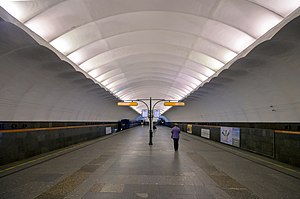
Prospekt Bolshevikov (Russian: Проспект Большевиков) is a station on the Line 4 of Saint Petersburg Metro, opened on December 30, 1985.

Ulitsa Dybenko (Saint Petersburg Metro)
Saint Petersburg Metro Station
Distance: Approx. 9332 meters
Latitude and longitude: 59.907444,30.483356
Ulitsa Dybenko (Russian: У́лица Дыбéнко) is a station on the Line 4 of Saint Petersburg Metro, opened on October 1, 1987.

Kudrovo
Town in Leningrad Oblast, Russia
Distance: Approx. 7867 meters
Latitude and longitude: 59.9,30.51666667
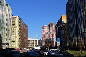
Kudrovo (Russian: Ку́дрово) is a town in Vsevolozhsky District of Leningrad Oblast, Russia, located east of and immediately adjacent to the city of St. Petersburg. Formerly a village, it was granted town status on 29 June 2018.
Yanino-1
Urban-type settlement in Leningrad Oblast, Russia
Distance: Approx. 5255 meters
Latitude and longitude: 59.94666667,30.55666667
Yanino-1 (Russian: Янино-1) is an urban locality (an urban-type settlement) in Vsevolozhsky District of Leningrad Oblast, Russia, located east of Saint Petersburg. Municipally it is, together with other localities, incorporated as Zanevskoye Urban Settlement, one of the eight urban settlements in the district. Population is 21,273.
Weather in this IP's area
overcast clouds
-3 Celsius
-9 Celsius
-3 Celsius
-3 Celsius
1020 hPa
90 %
1020 hPa
1017 hPa
10000 meters
5.3 m/s
13.47 m/s
208 degree
94 %