139.28.52.83 - IP Lookup: Free IP Address Lookup, Postal Code Lookup, IP Location Lookup, IP ASN, Public IP
Country:
Region:
City:
Location:
Time Zone:
Postal Code:
IP information under different IP Channel
ip-api
Country
Region
City
ASN
Time Zone
ISP
Blacklist
Proxy
Latitude
Longitude
Postal
Route
Luminati
Country
ASN
Time Zone
Europe/Moscow
ISP
LLC Oblastnaya Set
Latitude
Longitude
Postal
IPinfo
Country
Region
City
ASN
Time Zone
ISP
Blacklist
Proxy
Latitude
Longitude
Postal
Route
IP2Location
139.28.52.83Country
Region
leningradskaya oblast'
City
kirovsk
Time Zone
Europe/Moscow
ISP
Language
User-Agent
Latitude
Longitude
Postal
db-ip
Country
Region
City
ASN
Time Zone
ISP
Blacklist
Proxy
Latitude
Longitude
Postal
Route
ipdata
Country
Region
City
ASN
Time Zone
ISP
Blacklist
Proxy
Latitude
Longitude
Postal
Route
Popular places and events near this IP address

Shlisselburg
Town in Leningrad Oblast, Russia
Distance: Approx. 8435 meters
Latitude and longitude: 59.95361111,31.03833333
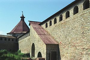
Shlisselburg (Russian: Шлиссельбу́рг, IPA: [ʂlʲɪsʲɪlʲˈburk]; German: Schlüsselburg; Finnish: Pähkinälinna; Swedish: Nöteborg), formerly Oreshek (Орешек) (1323–1611) and Petrokrepost (Петрокрепость) (1944–1992), is a town in Kirovsky District, Leningrad Oblast, Russia, located at the head of the Neva River on Lake Ladoga, 35 kilometers (22 mi) east of St. Petersburg. Population: 13,170 (2010 Census); 12,401 (2002 Census); 12,589 (1989 Soviet census).

Oreshek Fortress
Fortress in Shlisselburg, Russia
Distance: Approx. 8446 meters
Latitude and longitude: 59.9537,31.0384
The Shlisselburg Fortress or Oreshek Fortress (Russian: Крепость Орешек) is one of a series of fortifications built in Oreshek (now known as Shlisselburg) on Orekhovy Island in Lake Ladoga, near the modern city of Saint Petersburg in Russia. The first fortress was built in 1323. It was the scene of many conflicts between Russia and Sweden and changed hands between the two empires.

Operation Iskra
Soviet military operation in World War II
Distance: Approx. 4563 meters
Latitude and longitude: 59.9,31.0675
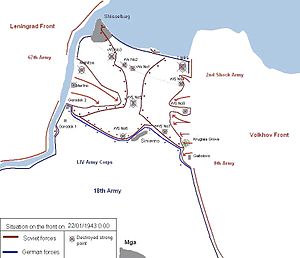
Operation Iskra (Russian: операция Искра, lit. 'Operation Spark'), a Soviet military operation in January 1943 during World War II, aimed to break the Wehrmacht's siege of Leningrad. Planning for the operation began shortly after the failure of the Sinyavino Offensive. The German defeat in the Battle of Stalingrad in late 1942 had weakened the German front.

Sinyavino, Leningrad Oblast
Urban-type settlement in Leningrad Oblast, Russia
Distance: Approx. 4522 meters
Latitude and longitude: 59.9,31.06666667
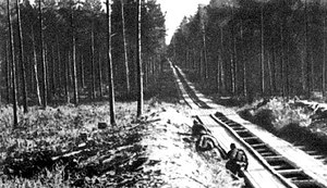
Sinyavino (Russian: Синя́вино) is an urban locality (an urban-type settlement) in Kirovsky District of Leningrad Oblast, Russia, located several kilometers inland from the southern shore of Lake Ladoga, 58 kilometers (36 mi) east of St. Petersburg and 8 kilometers (5.0 mi) east from Kirovsk. Municipally it is incorporated as Sinyavinskoye Urban Settlement, one of the eight urban settlements in the district.

Kirovsk, Leningrad Oblast
Town in Leningrad Oblast, Russia
Distance: Approx. 1726 meters
Latitude and longitude: 59.86666667,30.98333333
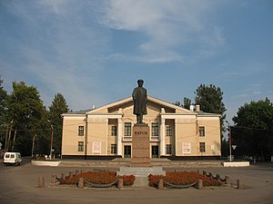
Kirovsk (Russian: Ки́ровск) is a town and the administrative center of Kirovsky District in Leningrad Oblast, Russia, located on the left bank of the Neva River, 33 kilometers (21 mi) east of St. Petersburg. Population: 25,650 (2010 Census); 24,361 (2002 Census); 23,655 (1989 Soviet census).

Ladozhsky Bridge
Bridge in Russia
Distance: Approx. 3039 meters
Latitude and longitude: 59.908,30.987
Ladozhsky Bridge (Russian: Ла́дожский мост) is uppermost bridge across the Neva River. It is located in Leningrad Oblast, near Kirovsk. It is a part of Murmansk Highway (M18 highway).

Nevsky Pyatachok
Bridgehead for Soviet troops in the battle to lift the blockade of Leningrad
Distance: Approx. 4772 meters
Latitude and longitude: 59.84361111,30.95333333
Nevsky Pyatachok (Russian: Не́вский пятачо́к) is the name of the Neva Bridgehead 50 km east south-east of Leningrad and 15 km south of Shlisselburg. It was the site of one of the most critical and costly campaigns during the Siege of Leningrad from September 1941 until May 1943 to reopen land communications with the city during the German siege. The Russian word pyatachok means a five-kopeck coin, or (by way of a metaphor) a very small area.
Operation Nordlicht (1942)
Distance: Approx. 5755 meters
Latitude and longitude: 59.9075,31.0836
Operation Nordlicht (German, 'Northern Light') was devised by the German high command, the Oberkommando des Heeres ("High Command of the Army") after a year-long battle for Leningrad when Adolf Hitler ordered a final assault on the besieged city. The main objective of the operation was to capture Leningrad using forces of Army Group North under Field Marshal Georg von Küchler, and thereby bring an end to the siege and free up hundreds of thousands of troops. Meanwhile, the Germans were also preparing for the Battle of Stalingrad.

Siege of Nöteborg (1702)
1702 siege of the Great Northern War
Distance: Approx. 7971 meters
Latitude and longitude: 59.95,31.0333
The siege of Nöteborg was one of the first sieges of the Great Northern War, when Russian forces captured the Swedish fortress of Nöteborg (later renamed Shlisselburg) in October 1702. Peter the Great had assembled a force of 20,000 men for this task, and marched for ten days to his destination. About 12,000 of these men were positioned on the banks of the Neva river, where they camped until 6 October (N.S.).

Kirovsky District, Leningrad Oblast
District in Leningrad Oblast, Russia
Distance: Approx. 940 meters
Latitude and longitude: 59.87388889,31.00416667
Kirovsky District (Russian: Ки́ровский райо́н) is an administrative and municipal district (raion), one of the seventeen in Leningrad Oblast, Russia. It is located in the center of the oblast and borders with Volkhovsky District in the east, Kirishsky District in the southeast, Nevsky and Kolpinsky Districts of the federal city of St. Petersburg in the west, Tosnensky District in the southwest, and with Vsevolozhsky District in the northwest.
Sinyavino offensive (1942)
Distance: Approx. 5769 meters
Latitude and longitude: 59.9075,31.08388889
The Sinyavino offensive (or third Sinyavino offensive) was an operation planned by the Soviet Union in the summer of 1942 with the aim of breaking the siege of Leningrad, which had begun the previous summer, to establish a reliable supply line to Leningrad. At the same time, German forces were planning Operation Northern Light (German: Nordlicht) to capture the city and link up with Finnish forces. To achieve that heavy reinforcements were arriving from Sevastopol, which the German forces captured in July 1942.

Dubrovka, Vsevolozhsky District, Leningrad Oblast
Urban-type settlement in Leningrad Oblast, Russia
Distance: Approx. 5481 meters
Latitude and longitude: 59.84166667,30.93611111
Dubrovka (Russian: Дубро́вка) is an urban locality (an urban-type settlement) in Vsevolozhsky District of Leningrad Oblast, Russia, located on the right bank of the Neva River northeast of Saint Petersburg. Municipally it is incorporated as Dubrovskoye Urban Settlement, one of the eight urban settlements in the district. Population: 6,693 (2010 Census); 5,432 (2002 Census); 6,093 (1989 Soviet census).
Weather in this IP's area
overcast clouds
-3 Celsius
-9 Celsius
-3 Celsius
-3 Celsius
1017 hPa
90 %
1017 hPa
1013 hPa
10000 meters
5.67 m/s
14.63 m/s
213 degree
99 %
