139.28.20.71 - IP Lookup: Free IP Address Lookup, Postal Code Lookup, IP Location Lookup, IP ASN, Public IP
Country:
Region:
City:
Location:
Time Zone:
Postal Code:
IP information under different IP Channel
ip-api
Country
Region
City
ASN
Time Zone
ISP
Blacklist
Proxy
Latitude
Longitude
Postal
Route
Luminati
Country
Region
an
City
elrepilado
ASN
Time Zone
Europe/Madrid
ISP
Snell Cuenca Minera S.L
Latitude
Longitude
Postal
IPinfo
Country
Region
City
ASN
Time Zone
ISP
Blacklist
Proxy
Latitude
Longitude
Postal
Route
IP2Location
139.28.20.71Country
Region
andalucia
City
hinojales
Time Zone
Europe/Madrid
ISP
Language
User-Agent
Latitude
Longitude
Postal
db-ip
Country
Region
City
ASN
Time Zone
ISP
Blacklist
Proxy
Latitude
Longitude
Postal
Route
ipdata
Country
Region
City
ASN
Time Zone
ISP
Blacklist
Proxy
Latitude
Longitude
Postal
Route
Popular places and events near this IP address

Cumbres Mayores
Place in Andalusia, Spain
Distance: Approx. 8621 meters
Latitude and longitude: 38.06666667,-6.63333333
Cumbres Mayores is a town and municipality located in the province of Huelva, Spain. It holds a population of 2,022 inhabitants.

Cañaveral de León
Distance: Approx. 6132 meters
Latitude and longitude: 38.01666667,-6.51666667
Cañaveral de León is a town and municipality located in the province of Huelva, Spain. According to the 2005 census, it has a population of 419 inhabitants and covers a 35 km2 area (12.0 people/km2). It sits at an altitude of 533 m above sea level, and is 134 km from the capital.

Cortelazor
Town in Huelva, Spain
Distance: Approx. 7978 meters
Latitude and longitude: 37.93333333,-6.61666667
Cortelazor is a town located in the province of Huelva, Spain. According to the 2005 census, it has a population of 289 inhabitants and covers an area of forty square kilometres. It sits at an altitude of 622 metres above sea level, and is 120 kilometres from the capital.

Fuentes de León
Place in Extremadura, Spain
Distance: Approx. 8618 meters
Latitude and longitude: 38.06666667,-6.53333333
Fuentes de León (Extremaduran: Fuentis de Lión) is a municipality located in the province of Badajoz, Extremadura, Spain. According to the 2005 census (INE), the municipality has a population of 2674 inhabitants.

Sierra de Aracena and Picos de Aroche Natural Park
Protected area in Huelva Province, Spain
Distance: Approx. 4487 meters
Latitude and longitude: 37.95972222,-6.58527778
Sierra de Aracena and Picos de Aroche Natural Park (Spanish: Parque natural de Sierra de Aracena y Picos de Aroche) is a protected area in the Sierra de Aracena range, part of the Sierra Morena mountain system, Huelva Province, southwestern Spain. The natural park spreads across 28 municipalities with a population of 41,000 people. Rivers which run through it include the Odiel and Murtigas.

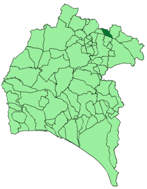
Hinojales
Place in Andalusia, Spain
Distance: Approx. 3 meters
Latitude and longitude: 38,-6.58333333
Hinojales is a town and municipality located in the province of Huelva, Spain. According to the 2008 census, the municipality had a population of 338 inhabitants.

La Nava
Place in Andalusia, Spain
Distance: Approx. 5744 meters
Latitude and longitude: 37.96666667,-6.53333333
La Nava is a town and municipality located in the province of Huelva, Spain. According to the 2015 census, the municipality had a population of 330 inhabitants.
Las Capellanías
Prehistoric funerary complex in Spain
Distance: Approx. 6132 meters
Latitude and longitude: 38.01666667,-6.51666667
Las Capellanías is a prehistoric funerary complex in Cañaveral de León, Huelva, Spain. Excavation in the area began after road construction workers found a stela in June 2018, and was carried out by staff and students from the universities of Seville, Huelva and Durham. The necropolis was found in 2022.
Weather in this IP's area
broken clouds
11 Celsius
10 Celsius
11 Celsius
11 Celsius
1029 hPa
80 %
1029 hPa
960 hPa
10000 meters
1.49 m/s
2.06 m/s
32 degree
84 %