139.28.20.208 - IP Lookup: Free IP Address Lookup, Postal Code Lookup, IP Location Lookup, IP ASN, Public IP
Country:
Region:
City:
Location:
Time Zone:
Postal Code:
ISP:
ASN:
language:
User-Agent:
Proxy IP:
Blacklist:
IP information under different IP Channel
ip-api
Country
Region
City
ASN
Time Zone
ISP
Blacklist
Proxy
Latitude
Longitude
Postal
Route
db-ip
Country
Region
City
ASN
Time Zone
ISP
Blacklist
Proxy
Latitude
Longitude
Postal
Route
IPinfo
Country
Region
City
ASN
Time Zone
ISP
Blacklist
Proxy
Latitude
Longitude
Postal
Route
IP2Location
139.28.20.208Country
Region
andalucia
City
aracena
Time Zone
Europe/Madrid
ISP
Language
User-Agent
Latitude
Longitude
Postal
ipdata
Country
Region
City
ASN
Time Zone
ISP
Blacklist
Proxy
Latitude
Longitude
Postal
Route
Popular places and events near this IP address
Alájar
Place in Andalusia, Spain
Distance: Approx. 8375 meters
Latitude and longitude: 37.86666667,-6.65
Alájar is a town and municipality located in the province of Huelva, Spain. According to the 2005 census, the city has a population of 771 inhabitants. The song "Señorita" of the Bollywood movie Zindagi Na Milegi Dobara was shot in this town.

Corteconcepción
Town and municipality in Huelva, Spain
Distance: Approx. 5417 meters
Latitude and longitude: 37.9,-6.5
Corteconcepción is a town and municipality located in the province of Huelva, Spain. According to the 2005 census, it has a population of 620 inhabitants and covers a 49 km2 (19 sq mi) area( people/km²). It sits at an altitude of 572 m (1,877 ft) above sea level, and is 114 km (71 mi) from the capital.

Cortelazor
Town in Huelva, Spain
Distance: Approx. 6550 meters
Latitude and longitude: 37.93333333,-6.61666667
Cortelazor is a town located in the province of Huelva, Spain. According to the 2005 census, it has a population of 289 inhabitants and covers an area of forty square kilometres. It sits at an altitude of 622 metres above sea level, and is 120 kilometres from the capital.

Sierra de Aracena and Picos de Aroche Natural Park
Protected area in Huelva Province, Spain
Distance: Approx. 7616 meters
Latitude and longitude: 37.95972222,-6.58527778
Sierra de Aracena and Picos de Aroche Natural Park (Spanish: Parque natural de Sierra de Aracena y Picos de Aroche) is a protected area in the Sierra de Aracena range, part of the Sierra Morena mountain system, Huelva Province, southwestern Spain. The natural park spreads across 28 municipalities with a population of 41,000 people. Rivers which run through it include the Odiel and Murtigas.

Fuenteheridos
Place in Andalusia, Spain
Distance: Approx. 7829 meters
Latitude and longitude: 37.9,-6.65
Fuenteheridos is a town and municipality located in the province of Huelva, Spain. According to the Nation Institute of Statistics ( INE 2023), there were 806 inhabitants in 2023. Situated near the N-433 road, it is rarely busy except on warm evenings.

La Nava
Place in Andalusia, Spain
Distance: Approx. 8451 meters
Latitude and longitude: 37.96666667,-6.53333333
La Nava is a town and municipality located in the province of Huelva, Spain. According to the 2015 census, the municipality had a population of 330 inhabitants.
Linares de la Sierra
Place in Andalusia, Spain
Distance: Approx. 5016 meters
Latitude and longitude: 37.88333333,-6.61666667
Linares de la Sierra is a town and municipality located in the province of Huelva, Spain. According to the 2008 census, the municipality had a population of 305 inhabitants.

Los Marines
Place in Andalusia, Spain
Distance: Approx. 4918 meters
Latitude and longitude: 37.9,-6.61666667
Los Marines is a town and municipality located in the province of Huelva, Spain. According to the 2008 census, the municipality had a population of 349 inhabitants.

Puerto Moral
Place in Andalusia, Spain
Distance: Approx. 8390 meters
Latitude and longitude: 37.88333333,-6.46666667
Puerto Moral is a town and municipality located in the province of Huelva, Spain. According to the 2008 census, the municipality had a population of 273 inhabitants.

Gruta de las Maravillas
Distance: Approx. 446 meters
Latitude and longitude: 37.89111111,-6.56472222
The Gruta de las Maravillas (English: "Grotto of the Marvels") is a cave in the town center of Aracena, Andalusia, Spain. It was the first Spanish cave to be opened to the public in 1914. It includes a total of 2130 subterranean meters of subterranean passages.
Sierra de Aracena
Mountain range in Andalusia, Spain
Distance: Approx. 4918 meters
Latitude and longitude: 37.9,-6.61666667
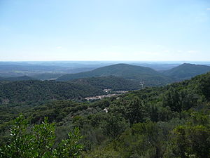
Sierra de Aracena is the westernmost mountain range of the Sierra Morena, Andalusia, Spain. It is located in the northern part of Huelva Province. The range is named after the town of Aracena.
Weather in this IP's area
light rain
9 Celsius
7 Celsius
9 Celsius
9 Celsius
1021 hPa
99 %
1021 hPa
960 hPa
8528 meters
2.48 m/s
8.47 m/s
188 degree
99 %

