Country:
 Réunion
Region:
City:
Latitude and Longitude:
Time Zone:
Postal Code:
IP information under different IP Channel
ip-api
Country
Region
City
ASN
Time Zone
ISP
Blacklist
Proxy
Latitude
Longitude
Postal
Route
IPinfo
Country
Region
City
ASN
Time Zone
ISP
Blacklist
Proxy
Latitude
Longitude
Postal
Route
MaxMind
Country
Region
City
ASN
Time Zone
ISP
Blacklist
Proxy
Latitude
Longitude
Postal
Route
Luminati
Country
RECity
saintdenis
ASN
Time Zone
Indian/Reunion
ISP
TELCO-OI-AS
Latitude
Longitude
Postal
db-ip
Country
Region
City
ASN
Time Zone
ISP
Blacklist
Proxy
Latitude
Longitude
Postal
Route
ipdata
Country
Region
City
ASN
Time Zone
ISP
Blacklist
Proxy
Latitude
Longitude
Postal
Route
Popular places and events near this IP address
Bras-Panon
Commune in Réunion, France
Distance: Approx. 4459 meters
Latitude and longitude: -20.9953,55.6761
Bras-Panon (French pronunciation: [bʁa panɔ̃]) is a commune on the Indian Ocean island of Réunion, which is an overseas department and region of France. Bras-Panon borders the communes of Saint-André, Saint-Benoît and Salazie; as well as the Mât river, the Rivière des Roches and the Indian Ocean. The commune is a large producer of vanilla, and holds the largest Agricultural Show on the island, every May.

Sainte-Suzanne, Réunion
Commune in Réunion, France
Distance: Approx. 7832 meters
Latitude and longitude: -20.9056,55.6072
Sainte-Suzanne (French pronunciation: [sɛ̃t syzan]) is a commune on the north coast of the French island and department of Réunion, an island located approximately 950 km (590 mi) east of the island of Madagascar.
Quartier-Français
Village in Réunion
Distance: Approx. 3647 meters
Latitude and longitude: -20.9325,55.63833333
Quartier-Français is a village on the island of Réunion. The village is located on the island's northeastern coast in the commune of Sainte-Suzanne.

Rivière des Roches (Réunion)
River in Réunion, France
Distance: Approx. 7030 meters
Latitude and longitude: -21.00527778,55.70083333
The Rivière des Roches is a river on the Indian Ocean island of Réunion, which is an overseas department and region of France. The 17.9 km (11.1 mi) long river flows northeast from the centre of the island, reaching the sea close to the town of Bras-Panon. The Rivière des Marsouins follows a largely parallel course, reaching the sea three kilometres to the south.
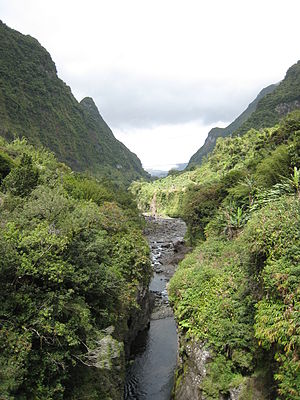
Rivière du Mât
River in Réunion, France
Distance: Approx. 5512 meters
Latitude and longitude: -20.98055556,55.7
The Rivière du Mât is a river on the Indian Ocean island of Réunion. It is 34.8 km (21.6 mi) long. It flows northeast from its sources on the slopes of Le Gros Morne and Piton des Neiges, reaching the sea close to Saint-André.
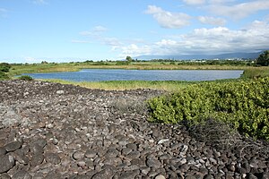
Étang de Bois Rouge
Lagoon in Réunion
Distance: Approx. 5100 meters
Latitude and longitude: -20.9175,55.64916667
Étang de Bois Rouge is a lake in the city of St.André, on the Indian Ocean island of Réunion, which is an overseas department and region of France. The lake lies at an elevation of 1 m, and its surface area is 0.05 km².

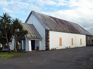
Saint-André, Réunion
Commune in Réunion, France
Distance: Approx. 302 meters
Latitude and longitude: -20.9606,55.6506
Saint-André (French pronunciation: [sɛ̃t‿ɑ̃dʁe]) is the fifth-largest commune in the French overseas department of Réunion. It is located on the northeast part of the island of Réunion. The small lake Étang de Bois Rouge is located in the commune.

Niagara Fall (Réunion)
Waterfall in Sainte-Suzanne, Réunion
Distance: Approx. 6772 meters
Latitude and longitude: -20.9207,55.6038
Niagara Fall is a waterfall in the commune of Sainte-Suzanne on the island of Réunion. Its height is approximately 25 metres (82 ft). It is of easy access by car, and its pool is a popular picnic place on weekends and holidays.
Canton of Saint-André-1
Distance: Approx. 3707 meters
Latitude and longitude: -20.93,55.65
The canton of Saint-André-1 is an administrative division of Réunion, an overseas department and region of France. Its borders were modified at the French canton reorganisation which came into effect in March 2015. Its seat is in Saint-André.
Canton of Saint-André-2
Distance: Approx. 369 meters
Latitude and longitude: -20.96,55.65
The canton of Saint-André-2 is an administrative division of Réunion, an overseas department and region of France. Its borders were modified at the French canton reorganisation which came into effect in March 2015. Its seat is in Saint-André.
Canton of Saint-André-3
Distance: Approx. 746 meters
Latitude and longitude: -20.97,55.65
The canton of Saint-André-3 is an administrative division of Réunion, an overseas department and region of France. Its borders were modified at the French canton reorganisation which came into effect in March 2015. Its seat is in Saint-André.
Cascade Pichon
Series of waterfalls located in Haiti
Distance: Approx. 2130 meters
Latitude and longitude: -20.948,55.638
Cascade Pichon (Haitian Creole: Kaskad Pichon) is a series of waterfalls located in the Belle-Anse Arrondissement, in the Sud-Est department of Haiti. The waterfalls are fed by an underground lake. The former Haitian dictator Jean-Claude Duvalier named Cascade Pichon one of Haiti's greatest tourist destinations.
Weather in this IP's area
clear sky
20 Celsius
20 Celsius
19 Celsius
21 Celsius
1016 hPa
94 %
1016 hPa
1004 hPa
10000 meters
2.57 m/s
190 degree
05:42:56
18:21:24