Country:
 Indonesia
Region:
City:
Latitude and Longitude:
Time Zone:
Postal Code:
IP information under different IP Channel
ip-api
Country
Region
City
ASN
Time Zone
ISP
Blacklist
Proxy
Latitude
Longitude
Postal
Route
IPinfo
Country
Region
City
ASN
Time Zone
ISP
Blacklist
Proxy
Latitude
Longitude
Postal
Route
MaxMind
Country
Region
City
ASN
Time Zone
ISP
Blacklist
Proxy
Latitude
Longitude
Postal
Route
Luminati
Country
IDRegion
jb
City
bekasi
ASN
Time Zone
Asia/Jakarta
ISP
Linknet ASN
Latitude
Longitude
Postal
db-ip
Country
Region
City
ASN
Time Zone
ISP
Blacklist
Proxy
Latitude
Longitude
Postal
Route
ipdata
Country
Region
City
ASN
Time Zone
ISP
Blacklist
Proxy
Latitude
Longitude
Postal
Route
Popular places and events near this IP address
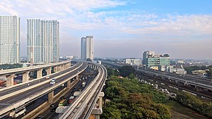
Bekasi
Largest city of West Java, Indonesia
Distance: Approx. 35 meters
Latitude and longitude: -6.2349,106.9923
Bekasi (Indonesian pronunciation: [ˈbəkasi], Sundanese: ᮘᮨᮊᮞᮤ) is a largest city in West Java, Indonesia, located on the eastern border of Jakarta. It second largest and serves as a commuter city within the Greater Jakarta. According to the 2020 Census by Statistics Indonesia (BPS), Bekasi had 2,543,676 inhabitants.

Bekasi railway station
Railway station in Indonesia
Distance: Approx. 713 meters
Latitude and longitude: -6.2359,106.9986
Bekasi Station (BKS) is a railway station located in Marga Mulya, North Bekasi, Bekasi, West Java. The station is at an altitude of +19 meters above sea level. This station serves the KRL Commuterline and inter-city trains.
South Bekasi
District in West Java, Indonesia
Distance: Approx. 3457 meters
Latitude and longitude: -6.25555556,106.96861111
South Bekasi (Indonesian: Bekasi Selatan) is one of the twelve administrative districts (kecamatan) within the municipality of Bekasi, in Jabodetabek (Jakarta's metropolitan area) on the island of Java, Indonesia. The district covers an area of 1,581 hectares (3,907 acres), and had a population of 203,654 at the 2010 Census and 210,805 at the 2020 Census; the official estimate as at mid 2023 was 214,220. The administrative centre is located in Pekayon Jaya, and the district is sub-divided into five urban "villages" or communities (kelurahan), as listed below with their areas, their populations as at the 2020 Census and th official estimates as at mid 2022, together with their postcodes.

Patriot Stadium (Indonesia)
Multi-purpose stadium in Indonesia
Distance: Approx. 353 meters
Latitude and longitude: -6.238358,106.991897
Patriot Candrabhaga Stadium (Indonesian: Stadion Patriot Candrabhaga) is a multi-purpose stadium located in Bekasi, West Java, Indonesia. It is currently used mostly for association football matches. The stadium holds 30,000 people.

Kranji railway station
Railway station in Indonesia
Distance: Approx. 1812 meters
Latitude and longitude: -6.2245125,106.9798459
Kranji Station (KRI) is a class III railway station located in Kranji, West Bekasi, Bekasi, West Java. The station, which is located at an altitude of +18 m, is included in the Operation Area I Jakarta and is the westernmost railway station in Bekasi City and West Java for the Rajawali–Cikampek railway, as well as the northernmost in West Java. This station only serves the Cikarang Loop Line.

Bekasi Timur railway station
Railway station in Indonesia
Distance: Approx. 3149 meters
Latitude and longitude: -6.246888,107.018111
Bekasi Timur Station (BKST, also known as Ampera Station or Bulak Kapal Station) is a class III railway station located in Duren Jaya, East Bekasi, Bekasi, West Java. The station, which is located at an altitude of +19 meters, is included in the Jakarta Operational Area I and only serves the KRL Commuterline route.
Bekasi Barat LRT Station
LRT station in Indonesia
Distance: Approx. 1987 meters
Latitude and longitude: -6.252926,106.990076
Bekasi Barat LRT Station is a light rail station located in Jalan Jend. Ahmad Yani, Pekayon Jaya, Bekasi Selatan, Bekasi. The station, which is located at an altitude of +38.57 meters, serves the Bekasi line of the Jabodebek LRT system.
West Bekasi
District in West Java, Indonesia
Distance: Approx. 3457 meters
Latitude and longitude: -6.25555556,106.96861111
West Bekasi (Indonesian: Bekasi Barat) is one of the twelve administrative districts (kecamatan) within the municipality of Bekasi, in Jabodetabek (Jakarta's metropolitan area) on the island of Java, Indonesia. The district covers an area of 1,490 hectares (3,682 acres), and had a population of 272,557 at the 2010 Census and 281,681 at the 2020 Census; the official estimate as at mid 2023 was 286,110. The administrative centre is located in Bintara, and the district is sub-divided into five urban "villages" or communities (kelurahan), as listed below with their areas and their populations as at mid 2022, together with their postcodes.
Medansatria
District in West Java, Indonesia
Distance: Approx. 3457 meters
Latitude and longitude: -6.25555556,106.96861111
Medansatria or Medan Satria is one of the twelve administrative districts (kecamatan) within the city municipality of Bekasi, in Jabodetabek (Jakarta's metropolitan area) on the island of Java, Indonesia. The district covers an area of 1,321 hectares (3,264 acres), and had a population of 161,121 at the 2010 Census and 162,119 at the 2020 Census; the official estimate as at mid 2023 was 163,380. The administrative centre is located in Medansatria kelurahan, and the district is sub-divided into four urban "villages" or communities (kelurahan), as listed below with their areas and their populations as at mid 2022, together with their postcodes.
Rawalumbu
District in West Java, Indonesia
Distance: Approx. 3457 meters
Latitude and longitude: -6.25555556,106.96861111
Rawalumbu is one of the twelve administrative districts (kecamatan) within the city municipality of Bekasi, in Jabodetabek (Jakarta's metropolitan area) on the island of Java, Indonesia. The district covers an area of 1,685 hectares (4,164 acres), and had a population of 208,334 at the 2010 Census and 220,699 at the 2020 Census; the official estimate as at mid 2023 was 225,790. The administrative centre is located in Bojong Rawalumbu, and the district is sub-divided into four urban "villages" or communities (kelurahan), as listed below with their areas and their populations as at mid 2022, together with their postcodes.
Pondok Gede, Bekasi
District in West Java, Indonesia
Distance: Approx. 3457 meters
Latitude and longitude: -6.25555556,106.96861111
Pondok Gede or Pondokgede is one of the twelve administrative districts (kecamatan) within the city municipality of Bekasi, in Jabodetabek (Jakarta's metropolitan area) on the island of Java, Indonesia. The district covers an area of 1,743 hectares (4,307 acres), and had a population of 246,503 at the 2010 Census and 251,195 at the 2020 Census; the official estimate as at mid 2023 was 254,110. The administrative centre is located in Jati Waringin, and the district is sub-divided into five urban "villages" or communities (kelurahan), as listed below with their areas and their populations as at mid 2022, together with their postcodes.
Pondok Melati, Bekasi
District in West Java, Indonesia
Distance: Approx. 3457 meters
Latitude and longitude: -6.25555556,106.96861111
Pondok Melati is one of the twelve administrative districts (kecamatan) within the city municipality of Bekasi, in Jabodetabek (Jakarta's metropolitan area) on the island of Java, Indonesia. The district covers an area of 1,102 hectares (2,723 acres), and had a population of 128,934 at the 2010 Census and 131,122 at the 2020 Census; the official estimate as at mid 2023 was 132,560. The administrative centre is located in Jati Rahayu, and the district is sub-divided into four urban "villages" or communities (kelurahan), as listed below with their areas and their populations as at mid 2022, together with their postcodes.
Weather in this IP's area
scattered clouds
29 Celsius
31 Celsius
29 Celsius
31 Celsius
1011 hPa
58 %
1011 hPa
1009 hPa
6000 meters
1.54 m/s
240 degree
50 %
05:43:10
17:48:36