139.181.48.118 - IP Lookup: Free IP Address Lookup, Postal Code Lookup, IP Location Lookup, IP ASN, Public IP
Country:
Region:
City:
Location:
Time Zone:
Postal Code:
IP information under different IP Channel
ip-api
Country
Region
City
ASN
Time Zone
ISP
Blacklist
Proxy
Latitude
Longitude
Postal
Route
Luminati
Country
ASN
Time Zone
America/Chicago
ISP
COLT Technology Services Group Limited
Latitude
Longitude
Postal
IPinfo
Country
Region
City
ASN
Time Zone
ISP
Blacklist
Proxy
Latitude
Longitude
Postal
Route
IP2Location
139.181.48.118Country
Region
oregon
City
wilsonville
Time Zone
America/Los_Angeles
ISP
Language
User-Agent
Latitude
Longitude
Postal
db-ip
Country
Region
City
ASN
Time Zone
ISP
Blacklist
Proxy
Latitude
Longitude
Postal
Route
ipdata
Country
Region
City
ASN
Time Zone
ISP
Blacklist
Proxy
Latitude
Longitude
Postal
Route
Popular places and events near this IP address
Wilsonville, Oregon
City in Oregon, United States
Distance: Approx. 579 meters
Latitude and longitude: 45.30666667,-122.76638889
Wilsonville is a city in Clackamas and Washington counties in the U.S. state of Oregon. Founded with the name Boones Landing for the Boones Ferry that crossed the Willamette River, the community became Wilsonville in 1880. The city was incorporated in 1969 with a population of approximately 1,000.
Wilsonville High School
Public school in Wilsonville, , Oregon, United States
Distance: Approx. 1512 meters
Latitude and longitude: 45.30773,-122.746897
Wilsonville High School (WVHS) is a four-year suburban, public high school in Wilsonville, Oregon, United States and is part of the West Linn-Wilsonville School District.
Charbonneau, Oregon
Neighborhood in Clackamas County, Oregon, United States
Distance: Approx. 1682 meters
Latitude and longitude: 45.28722222,-122.75805556
Charbonneau (also known as the Charbonneau District) is a private planned community within the city limits of Wilsonville in Clackamas County, Oregon, United States. It is on the opposite side the Willamette River from the main area of the city. The development was named for Jean Baptiste Charbonneau, the son of Sacagawea.

Boones Ferry
Distance: Approx. 1278 meters
Latitude and longitude: 45.29312,-122.775038
Boones Ferry (also Boone's Ferry) was a cable ferry which crossed the Willamette River at present-day Wilsonville, Oregon, United States, from 1847 to 1954. It was part of a major land-based thoroughfare in pioneer times linking fledgling Portland with the pre-territorial government at Champoeg, and later Salem. It was eventually made obsolete by the Boone Bridge on Interstate 5.
Boone Bridge (Oregon)
Bridge in Wilsonville, Oregon
Distance: Approx. 1176 meters
Latitude and longitude: 45.291766,-122.76932
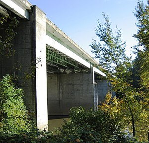
Boone Bridge is a steel girder highway bridge over the Willamette River at Wilsonville, Oregon, in the United States. Built in 1954, it crosses the river to the Charbonneau section of Wilsonville, carrying Interstate 5 into the open Willamette Valley from the Portland metropolitan area. Maintained by the Oregon Department of Transportation, the 1,111-foot-long (339 m) bridge has three travel lanes in each direction.
Wilsonville railroad bridge
Bridge in Wilsonville, Oregon
Distance: Approx. 1371 meters
Latitude and longitude: 45.292928,-122.776487
The Wilsonville railroad bridge is a steel truss bridge that crosses the Willamette River at Wilsonville, Oregon, United States. This 1,220-foot-long (370 m) structure was finished in 1975 to replace a 1907 bridge at the same location and carries rail traffic for the Portland and Western Railroad. The original bridge was built to carry the Oregon Electric Railway across the river near the Boones Ferry.

Wilsonville Transit Center
Distance: Approx. 1379 meters
Latitude and longitude: 45.311341,-122.775258
Wilsonville Transit Center, also called SMART Central at Wilsonville Station, is a bus and commuter rail transport hub in Wilsonville, Oregon, United States. The transit center, which is owned and operated by the City of Wilsonville, is the hub for the South Metro Area Regional Transit (SMART) bus system. The Portland metropolitan area's regional transit agency, TriMet, operates the southern terminus of its WES Commuter Rail at the facility; WES connects with the Blue and Red lines of MAX Light Rail at Beaverton Transit Center.
Oregon Korean War Memorial
War memorial in Wilsonville, Oregon, United States
Distance: Approx. 552 meters
Latitude and longitude: 45.3066,-122.7631
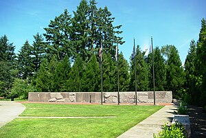
The Oregon Korean War Memorial is a war memorial located in Wilsonville, Oregon, United States. Completed in 2000, it honors the Oregon soldiers and the Korean people from the Korean War. The memorial is located within a 5.5-acre (22,000 m2) city park and features a 109-foot (33 m)-long granite wall that includes the names of those Oregonians who died or were listed as missing from the war.
Wilsonville Memorial Park
Park in Wilsonville, Oregon, U.S.
Distance: Approx. 618 meters
Latitude and longitude: 45.29777778,-122.75861111
Wilsonville Memorial Park is a large municipal park in Wilsonville, Oregon, United States. Opened in 1969, the 126-acre (51 ha) park is the largest and oldest in the city. Located off Wilsonville Road east of Interstate 5, the park includes a plaza with water features, athletic fields and courts, trails, a skatepark, picnic areas, a dog park, and playground equipment.
Arts and Technology High School
Public charter school in Wilsonville, , Oregon, United States
Distance: Approx. 46 meters
Latitude and longitude: 45.302113,-122.764149
Arts and Technology High School, known as ATHS or ArtTech, was a public charter high school in Wilsonville, Oregon, United States. Part of the West Linn-Wilsonville School District, the school opened in 2005. it closed at the end of the 2021-2022 school year.

Town Center Park
Distance: Approx. 499 meters
Latitude and longitude: 45.30611111,-122.76305556
Town Center Park is a small municipal park in Wilsonville, Oregon, United States. Located in the middle of Wilsonville's town center, the 5-acre (2.0 ha) park cost $4.5 million to complete. The park includes the Oregon Korean War Memorial, a visitor center, paths, a play area, picnic tables, and an amphitheater among other features.

Wilsonville Public Library
Public library in Wilsonville, Oregon
Distance: Approx. 245 meters
Latitude and longitude: 45.3025,-122.76128
The Wilsonville Public Library (WPL) is the single-location public library of the city of Wilsonville in the U.S. state of Oregon. Established in 1982, the library moved to its present location near Wilsonville Memorial Park in 1988. WPL is a part of the Library Information Network of Clackamas County and serves a population of about 21,900.
Weather in this IP's area
broken clouds
8 Celsius
7 Celsius
7 Celsius
9 Celsius
1034 hPa
86 %
1034 hPa
1024 hPa
10000 meters
2.57 m/s
220 degree
75 %


