139.178.76.101 - IP Lookup: Free IP Address Lookup, Postal Code Lookup, IP Location Lookup, IP ASN, Public IP
Country:
Region:
City:
Location:
Time Zone:
Postal Code:
IP information under different IP Channel
ip-api
Country
Region
City
ASN
Time Zone
ISP
Blacklist
Proxy
Latitude
Longitude
Postal
Route
Luminati
Country
Region
va
City
ashburn
ASN
Time Zone
America/New_York
ISP
PACKET
Latitude
Longitude
Postal
IPinfo
Country
Region
City
ASN
Time Zone
ISP
Blacklist
Proxy
Latitude
Longitude
Postal
Route
IP2Location
139.178.76.101Country
Region
virginia
City
ashburn
Time Zone
America/New_York
ISP
Language
User-Agent
Latitude
Longitude
Postal
db-ip
Country
Region
City
ASN
Time Zone
ISP
Blacklist
Proxy
Latitude
Longitude
Postal
Route
ipdata
Country
Region
City
ASN
Time Zone
ISP
Blacklist
Proxy
Latitude
Longitude
Postal
Route
Popular places and events near this IP address

Ashburn, Virginia
Census-designated place in Virginia, United States
Distance: Approx. 2078 meters
Latitude and longitude: 39.03,-77.47111111
Ashburn is a rapidly growing census-designated place (CDP) in Loudoun County, Virginia, United States. At the 2010 United States census, its population was 43,511, up from 3,393 in 1990. It is 30 miles (48 km) northwest of Washington, D.C., and part of the Washington metropolitan area.
Broad Run High School
Public school in Ashburn, Loudoun County, Virginia
Distance: Approx. 1892 meters
Latitude and longitude: 39.0225,-77.49166667
Broad Run High School is a public secondary school in Ashburn, an unincorporated area in Loudoun County, Virginia, United States. Broad Run is part of the Loudoun County Public Schools system (LCPS). It was ranked as the #1 Best Public High School in Loudoun County and the #9 Best Public High School in Virginia by U.S. News in 2020.

Loudoun County Public Schools
Public school division serving Loudoun County, Virginia, United States
Distance: Approx. 2302 meters
Latitude and longitude: 39.033609,-77.517316
Loudoun County Public Schools (LCPS) is a branch of the Loudoun County, Virginia, United States government, and administers public schools in the county. LCPS's headquarters is located at 21000 Education Court in Ashburn, an unincorporated section of the county. Due to rapid growth in the region, LCPS is one of the fastest-growing school divisions in Virginia and the third largest school division in the state.
Belmont, Virginia
Census-designated place in Virginia
Distance: Approx. 3219 meters
Latitude and longitude: 39.06472222,-77.51
Belmont is a census-designated place (CDP) in Loudoun County, Virginia, United States. The population as of the 2010 United States Census was 5,966. It is 5 miles (8 km) southeast of Leesburg, the Loudoun county seat, and 31 miles (50 km) northwest of Washington, D.C. The Belmont Manor House, built between 1799 and 1802 by a son of Richard Henry Lee, is in the northeast part of the CDP and is now the clubhouse for a gated golf community.

Broadlands, Virginia
Census-designated place in Virginia
Distance: Approx. 3430 meters
Latitude and longitude: 39.01805556,-77.52027778
Broadlands is a census-designated place (CDP) in Loudoun County, Virginia, United States. It is a 1,500-acre (610 ha) master-planned community started and developed by Van Metre Homes in the 1990s. It is built on wetlands and is certified as a Community Wildlife Habitat by the National Wildlife Federation.

Ryan, Virginia
Unincorporated community in Virginia, United States
Distance: Approx. 2729 meters
Latitude and longitude: 39.015,-77.49305556
Ryan is an unincorporated community in Loudoun County, Virginia, United States. The community was once at the corner of Shellhorn, Ryan, and Waxpool roads. It is now a part of the Ashburn communities.

Belmont Manor House
Historic house in Virginia, United States
Distance: Approx. 3328 meters
Latitude and longitude: 39.06939167,-77.49134167
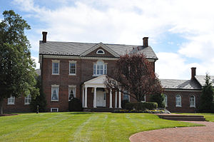
Belmont Manor House, formally known as Belmont Plantation, is a two-story, five-part Federal mansion in Loudoun County, Virginia, United States, built between the years of 1799–1802 by Ludwell Lee (1760–1836), son of Richard Henry Lee. The land surrounding the mansion, the Belmont property, was handed down to his first wife (also his first cousin), Flora Lee, from their grandfather, Thomas Lee. Located in the Belmont census-designated place, the Belmont Manor House and property have been owned since 1995 by Toll Brothers, Inc.
Edelman Financial Field
Distance: Approx. 3780 meters
Latitude and longitude: 39.055103,-77.452971
Edelman Financial Field was a planned 4,000-seat multisport stadium in Ashburn, Virginia, within the Washington D.C. metropolitan area, that would have hosted the Loudoun Hounds of the Atlantic League of Professional Baseball and Virginia Cavalry FC of the North American Soccer League.

Ashburn Presbyterian Church
Presbyterian church in Virginia, USA
Distance: Approx. 582 meters
Latitude and longitude: 39.03867,-77.48515
Ashburn Presbyterian Church is a historic Presbyterian church located in Ashburn, Loudoun County, Virginia. It was built in 1878, and is a one-story, rectangular wood-frame building in the Carpenter Gothic style. The church measures 33 feet wide by 50 feet long, and is topped by a steep gable roof.
One Loudoun, Virginia
Census-designated place in Virginia
Distance: Approx. 3443 meters
Latitude and longitude: 39.05277778,-77.45583333
One Loudoun is a census-designated place (CDP) in Loudoun County, Virginia, United States. It is a mixed-use development just south of Virginia State Route 7, 29 miles (47 km) northwest of Washington, D.C., and 7 miles (11 km) southeast of Leesburg. One Loudoun was developed since the 2010 census, so it was not recognized as a census-designated place until the 2020 census.

Ashburn Colored School
School in Ashburn, Virginia
Distance: Approx. 1031 meters
Latitude and longitude: 39.047737,-77.486348
The Ashburn Colored School is a former one-room schoolhouse for black students located at 20593 Ashburn Road in Ashburn, Virginia. Constructed in the late 19th century, it was in use until 1958. In the 21st century it has been restored after being dilapidated and vandalized.
Goose Creek Village, Virginia
Census-designated place in Virginia, United States
Distance: Approx. 2711 meters
Latitude and longitude: 39.04444444,-77.5225
Goose Creek Village is a census-designated place (CDP) in Loudoun County, Virginia, United States. It was first drawn as a CDP prior to the 2020 census.
Weather in this IP's area
scattered clouds
15 Celsius
13 Celsius
13 Celsius
16 Celsius
1008 hPa
43 %
1008 hPa
999 hPa
10000 meters
6.17 m/s
9.26 m/s
270 degree
40 %
