Country:
 Australia
Region:
City:
Latitude and Longitude:
Time Zone:
Postal Code:
IP information under different IP Channel
ip-api
Country
Region
City
ASN
Time Zone
ISP
Blacklist
Proxy
Latitude
Longitude
Postal
Route
IPinfo
Country
Region
City
ASN
Time Zone
ISP
Blacklist
Proxy
Latitude
Longitude
Postal
Route
MaxMind
Country
Region
City
ASN
Time Zone
ISP
Blacklist
Proxy
Latitude
Longitude
Postal
Route
Luminati
Country
AURegion
nsw
City
sydney
ASN
Time Zone
Australia/Sydney
ISP
QANTAS Airways Limited
Latitude
Longitude
Postal
db-ip
Country
Region
City
ASN
Time Zone
ISP
Blacklist
Proxy
Latitude
Longitude
Postal
Route
ipdata
Country
Region
City
ASN
Time Zone
ISP
Blacklist
Proxy
Latitude
Longitude
Postal
Route
Popular places and events near this IP address
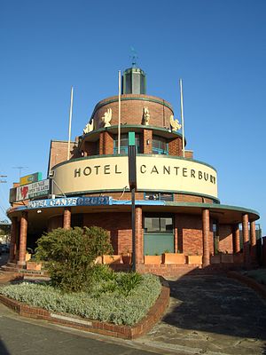
Canterbury, New South Wales
Suburb of Sydney, New South Wales, Australia
Distance: Approx. 1463 meters
Latitude and longitude: -33.9126,151.118
Canterbury is a suburb of western Sydney, in the state of New South Wales, Australia. Canterbury is located 10.5 kilometres (6.5 mi) south-west of the Sydney central business district in the City of Canterbury-Bankstown. The former City of Canterbury took its name from the suburb, however its administrative centre was located in the adjacent suburb of Campsie, which is also a large commercial centre.

Canterbury Park Racecourse
Horse racing facility in Sydney, Australia
Distance: Approx. 1335 meters
Latitude and longitude: -33.906824,151.115398
Canterbury Park Racecourse is a racecourse for horse racing in Sydney, New South Wales, Australia. It is located 11 km (7 mi) from the Sydney Central Business District, in King Street in the suburb of Canterbury, adjacent to Canterbury railway station. The racecourse is operated by the Australian Turf Club.
Sydney Olympic FC
Football club
Distance: Approx. 885 meters
Latitude and longitude: -33.91666667,151.09472222
Sydney Olympic Football Club is an Australian semi-professional soccer club, based in Belmore, Sydney, New South Wales, that plays in the National Premier Leagues NSW. The club was founded as Pan-Hellenic Soccer Club in 1957 by Greek immigrants. In 1977, the club changed its name to Sydney Olympic and became a founding member of the Phillips Soccer League, later named the National Soccer League (NSL), the inaugural national football league of Australia, remaining a member of the competition until its demise in 2004. Sydney Olympic have won many trophies in Australian football, including two NSL Championships, two NSL Cups, the NSL Minor Premiership and three NSW Premier League Championships.

Campsie railway station
Railway station in Sydney, New South Wales, Australia
Distance: Approx. 151 meters
Latitude and longitude: -33.910376,151.102579
Campsie railway station is a heritage-listed railway station located on the Bankstown line, serving the Sydney suburb of Campsie. It was previously served by Sydney Trains T3 Bankstown line services.

Belmore railway station
Railway station in Sydney, New South Wales, Australia
Distance: Approx. 1391 meters
Latitude and longitude: -33.91725833,151.0887111
Belmore railway station is a heritage-listed railway station located on the Bankstown line at Burwood Road, Belmore in the City of Canterbury-Bankstown local government area of New South Wales, Australia. It was designed and built by NSW Government Railways from 1895 to 1937. It is also known as Belmore Railway Station Group and Burwood Road.
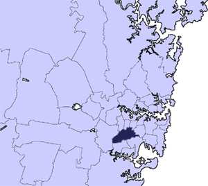
City of Canterbury (New South Wales)
Former local government area in New South Wales, Australia
Distance: Approx. 589 meters
Latitude and longitude: -33.91666667,151.1
The City of Canterbury was a local government area in the Inner South-West region of Sydney, New South Wales, Australia. The council area was within the northern part of the Parish of St George above Wolli Creek and The M5 but below The Cooks River. The city was primarily residential and light industrial in character, and was home to over 130 nationalities.

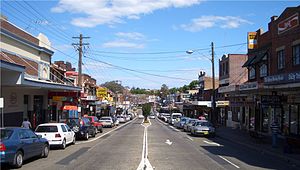
Campsie, New South Wales
Suburb of Sydney, New South Wales, Australia
Distance: Approx. 326 meters
Latitude and longitude: -33.91461,151.10183
Campsie is a suburb in the state of New South Wales, Australia. Campsie is 11 kilometres south west of the Sydney central business district, on the southern bank of the Cooks River. Campsie is one of the administrative centres of the City of Canterbury-Bankstown.
Belmore, New South Wales
Suburb of Sydney, New South Wales, Australia
Distance: Approx. 1481 meters
Latitude and longitude: -33.9175,151.08777778
Belmore is a suburb of Sydney, in the state of New South Wales, Australia. Belmore is located 11 kilometres south-west of the Sydney central business district, in the local government area of the City of Canterbury-Bankstown.

Belmore Sports Ground
Football field in Belmore, Sydney, New South Wales, Australia
Distance: Approx. 885 meters
Latitude and longitude: -33.91666667,151.09472222
Belmore Sports Ground, formerly known as Belmore Oval, is a multi-purpose stadium in Belmore, New South Wales, Australia. The park covers 22 acres (89,000 m2) and from 1951 has contained the Belmore Bowling Recreation Club green. It is close to Belmore railway station.
Canterbury Hospital
Hospital in New South Wales, Australia
Distance: Approx. 947 meters
Latitude and longitude: -33.9196,151.0984
The Canterbury Hospital is a teaching hospital in Campsie, a south-western suburb of Sydney, New South Wales, Australia. Canterbury Hospital was opened in 1929 and was rebuilt in 1998. Canterbury Hospital is one of many hospitals in a network under the management of Sydney Local Health District.
Canterbury Olympic Ice Rink
Public ice rink in New South Wales, Australia
Distance: Approx. 1052 meters
Latitude and longitude: -33.90972222,151.11333333
Canterbury Olympic Ice Rink was an ice sports and public ice skating centre, located in the Sydney suburb of Canterbury, New South Wales. It hosted a number of major ice hockey games, including East Coast Super League games. The venue offered a wide variety of activities including ice skating lessons, birthday parties, figure skating, speed skating, synchronised skating, public skating sessions.

Bethungra, Canterbury
Historic site in New South Wales, Australia
Distance: Approx. 1285 meters
Latitude and longitude: -33.9148,151.1156
Bethungra is a large stone house in Sydney, Australia. It is heritage-listed, and was at one time used as a convent, but now a private residence. The house is located at 9 Fore Street, Canterbury, New South Wales.
Weather in this IP's area
overcast clouds
12 Celsius
11 Celsius
11 Celsius
12 Celsius
1022 hPa
88 %
1022 hPa
1019 hPa
10000 meters
1.66 m/s
2.71 m/s
319 degree
100 %
06:20:27
19:04:28