Country:
Region:
City:
Latitude and Longitude:
Time Zone:
Postal Code:
IP information under different IP Channel
ip-api
Country
Region
City
ASN
Time Zone
ISP
Blacklist
Proxy
Latitude
Longitude
Postal
Route
Luminati
Country
Region
nsw
City
sydney
ASN
Time Zone
Australia/Sydney
ISP
QANTAS Airways Limited
Latitude
Longitude
Postal
IPinfo
Country
Region
City
ASN
Time Zone
ISP
Blacklist
Proxy
Latitude
Longitude
Postal
Route
db-ip
Country
Region
City
ASN
Time Zone
ISP
Blacklist
Proxy
Latitude
Longitude
Postal
Route
ipdata
Country
Region
City
ASN
Time Zone
ISP
Blacklist
Proxy
Latitude
Longitude
Postal
Route
Popular places and events near this IP address

Hurlstone Park
Suburb of Sydney, New South Wales, Australia
Distance: Approx. 1040 meters
Latitude and longitude: -33.91058,151.12919
Hurlstone Park is a suburb in the Inner West of Sydney, New South Wales, Australia. Hurlstone Park is located nine kilometres south-west of the Sydney central business district and is mostly in the local government area of the City of Canterbury-Bankstown, and partly in the Inner West Council. The suburb is bounded by: the Cooks River to the south, Garnet Street to the east, New Canterbury Road to the north, Canterbury Road to the north-west, and Church Street to the west.

Trinity Grammar School (New South Wales)
School in Australia
Distance: Approx. 697 meters
Latitude and longitude: -33.89944444,151.13055556
Trinity Grammar School is a multi-campus independent Anglican single-sex early learning, primary and secondary day school for boys, in inner-western Sydney, New South Wales, Australia. The main campus in Summer Hill provides a comprehensive education to students from Year 7 to Year 12; the campus in Strathfield provides a comprehensive education to early learning and primary school students, from Kindergarten to Year 6; and outdoor education facilities are located at Woollamia on the NSW South Coast. The school previously enrolled boarders until the end of 2019.

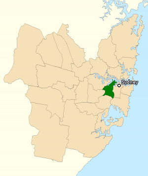
Division of Grayndler
Australian federal electoral division
Distance: Approx. 1287 meters
Latitude and longitude: -33.897,151.148
The Division of Grayndler is an Australian electoral division in the state of New South Wales. It is currently represented by Prime Minister of Australia and Leader of the Australian Labor Party, Anthony Albanese. Grayndler covers most of Sydney's newly formed Inner West Council.

Lewisham, New South Wales
Suburb of Sydney, New South Wales, Australia
Distance: Approx. 1202 meters
Latitude and longitude: -33.8949,151.144415
Lewisham is a suburb in the Inner West of Sydney, in the state of New South Wales, Australia. Lewisham is located 7 kilometres south-west of the Sydney central business district, in the local government area of Inner West Council.

Dulwich Hill
Suburb of Sydney, New South Wales, Australia
Distance: Approx. 734 meters
Latitude and longitude: -33.90833333,151.14166667
Dulwich Hill is a suburb in the Inner West of Sydney, in the state of New South Wales, Australia. It is 7.5 kilometres south-west of the Sydney central business district, in the local government area of Inner West Council. Dulwich Hill stretches south to the shore of the Cooks River.

Hurlstone Park railway station
Railway station in Sydney, New South Wales, Australia
Distance: Approx. 893 meters
Latitude and longitude: -33.9105,151.1319
Hurlstone Park railway station is a heritage-listed railway station located on the Bankstown line, serving the Sydney suburb of Hurlstone Park.

Dulwich Hill railway station
Railway station in Sydney, Australia
Distance: Approx. 953 meters
Latitude and longitude: -33.9111,151.1409
Dulwich Hill railway station is a heritage-listed railway station located on the Bankstown line, serving the Sydney suburb of Dulwich Hill.
Canterbury Boys' High School
Public, single-sex school in New South Wales, Australia
Distance: Approx. 1185 meters
Latitude and longitude: -33.90416667,151.12361111
Canterbury Boys' High School (CBHS) is a public secondary day school for boys located in Canterbury, a south-western suburb of Sydney, New South Wales, Australia. It is near the Canterbury Park Racecourse and about 200 metres north of Canterbury Girls' High School. Established in January 1918 as the Canterbury Intermediate High School, Canterbury Boys' High School is part of the St.
Christian Brothers' High School, Lewisham
School in Lewisham, Inner West, Sydney, Australia
Distance: Approx. 1070 meters
Latitude and longitude: -33.89722222,151.14527778
Christian Brothers' High School, Lewisham (also known as CBHS Lewisham), is a private Roman Catholic comprehensive single-sex secondary day school for boys, located in Lewisham, an inner-western suburb of Sydney, New South Wales, Australia. Established in 1891 by the Christian Brothers, the school has a non-selective enrolment policy and currently caters for approximately 1,350 boys from Year 5 to Year 12. The school is the oldest of the Christian Brothers schools operating in Sydney.

Dulwich High School of Visual Arts and Design
Arts school in Sydney, Australia
Distance: Approx. 748 meters
Latitude and longitude: -33.90416667,151.14444444
Dulwich High School of Visual Arts & Design (abbreviated as DHSVAD) is a government coeducational specialist secondary school, with speciality in visual arts and design, located in Dulwich Hill, an inner western suburb of Sydney, New South Wales, Australia. Re-established in 2003, the school is run by the New South Wales Department of Education and Training. The School offers a comprehensive education program with a strong focus on visual arts and design throughout all years and subjects.

2MM
Radio station
Distance: Approx. 407 meters
Latitude and longitude: -33.90486111,151.13236111
2MM is a narrowcast radio station based in the Sydney suburb of Dulwich Hill. 2MM broadcasts a Greek language service to Sydney and Wollongong.

Pressure Tunnel and Shafts
Historic site in New South Wales, Australia
Distance: Approx. 1079 meters
Latitude and longitude: -33.8954,151.1298
Pressure Tunnel and Shafts is a heritage-listed water supply system at Potts Hill, City of Canterbury-Bankstown, New South Wales, Australia. It was designed by the Water Board, which built the tunnel from 1921 to 1935. It is the third largest pressure tunnel in the world.
Weather in this IP's area
light rain
19 Celsius
20 Celsius
18 Celsius
20 Celsius
1020 hPa
88 %
1020 hPa
1016 hPa
10000 meters
3.09 m/s
90 degree
100 %
05:43:53
19:36:25