Country:
Region:
City:
Latitude and Longitude:
Time Zone:
Postal Code:
IP information under different IP Channel
ip-api
Country
Region
City
ASN
Time Zone
ISP
Blacklist
Proxy
Latitude
Longitude
Postal
Route
Luminati
Country
Region
in
City
terrehaute
ASN
Time Zone
America/Indiana/Indianapolis
ISP
INDSTATE
Latitude
Longitude
Postal
IPinfo
Country
Region
City
ASN
Time Zone
ISP
Blacklist
Proxy
Latitude
Longitude
Postal
Route
db-ip
Country
Region
City
ASN
Time Zone
ISP
Blacklist
Proxy
Latitude
Longitude
Postal
Route
ipdata
Country
Region
City
ASN
Time Zone
ISP
Blacklist
Proxy
Latitude
Longitude
Postal
Route
Popular places and events near this IP address
Indiana State University
Public university in Terre Haute, Indiana, US
Distance: Approx. 677 meters
Latitude and longitude: 39.47,-87.41
Indiana State University (ISU) is a public university in Terre Haute, Indiana. It was founded in 1865 and offers over 100 undergraduate majors and more than 75 graduate and professional programs. Indiana State is classified among "D/PU: Doctoral/Professional Universities".
Hulman Center
Arena at Indiana State University
Distance: Approx. 561 meters
Latitude and longitude: 39.46833333,-87.405
The Hulman Center is a 9,000-seat multi-purpose arena on the campus of Indiana State University in Terre Haute, Indiana, United States.

Eugene V. Debs Home
Historic house in Indiana, United States
Distance: Approx. 239 meters
Latitude and longitude: 39.47186111,-87.40547222
The Eugene V. Debs House, on the campus of Indiana State University in Terre Haute, Indiana, was a home of union leader Eugene V. Debs. It was declared a National Historic Landmark in 1966. The museum is maintained by the Eugene V. Debs Foundation, a non-profit educational foundation.

Emeline Fairbanks Memorial Library
Library in Indiana , United States
Distance: Approx. 452 meters
Latitude and longitude: 39.47032,-87.40701
Emeline Fairbanks Memorial Library is located in Terre Haute, Indiana. It was built in 1906 by the Modern Construction Company of Terre Haute. The building is in the Beaux Arts architectural style.
Indiana State University Recreational Center
Building in Terre Haute, Indiana
Distance: Approx. 510 meters
Latitude and longitude: 39.474002,-87.409146
The Student Rec Center at Indiana State University is a building nearing completion on Indiana State's campus in Terre Haute, Indiana. The rec center will include a three-court gymnasium and a multi-activity court with a durable surface suitable for such activities as soccer and roller hockey. Plans also call for a leisure aquatics facility, jogging track, climbing wall, fitness center, spinning room, two multi-purpose rooms, student lounge, juice bar, and outdoor recreation yard.
Stalker Hall
Classroom in Chestnut Street; on the Quadrangle of Indiana State University
Distance: Approx. 585 meters
Latitude and longitude: 39.470167,-87.408858
Stalker Hall is the current home of the College of Arts and Sciences at Indiana State University. Originally named the Education & Social Studies Building upon completion in 1954, it was renamed Stalker Hall in 1966 in honor of Francis Marion Stalker, a long-member of the Faculty from 1892–1929. From 2004–2005, it underwent a $5.5 million renovation which addressed structural, technological and cosmetic deficiencies.
Terre Haute Masonic Temple
United States historic place
Distance: Approx. 510 meters
Latitude and longitude: 39.46916667,-87.40611111
The Terre Haute Masonic Temple in Terre Haute, Indiana is a Classical Revival-style Masonic building that ground was broken for in 1915, cornerstone was laid in 1916, and opened in 1917. It was listed on the National Register of Historic Places by the United States Department of the Interior in 1995. The structure was commissioned by the Terre Haute Masonic Temple Association which was included one director from each of the following bodies that funded the building of the temple: Social Lodge No.
Tirey Hall
Student Union in Chestnut Street; on the Quadrangle of Indiana State University
Distance: Approx. 601 meters
Latitude and longitude: 39.469079,-87.407827
Tirey Hall is the current home of the Terre Haute Symphony and is located at Indiana State University. Originally named the Student Union upon completion in 1940, it was renamed Tirey Hall in 1963 in honor of Ralph Noble Tirey, the fifth President of the University; his tenure ran from 1934–1953. The building was a PWA funded project, to the tune of $191,782.00.
Michael Simmons Student Activity Center
Distance: Approx. 82 meters
Latitude and longitude: 39.47313,-87.404245
Michael Simmons Student Activity Center is the current home of Indiana State University Trike and Tandem Races in Terre Haute, Indiana, USA. Constructed in 2005 by MSI Construction, INC. of Clinton Indiana to seat approximately 2,500 people, the facility's primary use is the home of Homecoming tradition of trike and the spring week tradition of Tandem. The stadium was officially dedicated on October 21, 2005. The stadium and its grounds also are used for intramural softball and football.

State Normal Library
United States historic place
Distance: Approx. 580 meters
Latitude and longitude: 39.46972222,-87.40833333
State Normal Library, also known as the Normal Hall, is a historic library building located on the campus of Indiana State University at Terre Haute, Vigo County, Indiana. It was built between 1907 and 1909, and is a three-story, Classical Revival style brick and limestone building. An addition was constructed in 1957, creating an "L"-plan.

Terre Haute station (Amtrak)
Distance: Approx. 429 meters
Latitude and longitude: 39.47527778,-87.4075
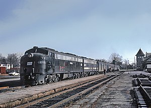
Terre Haute station, also known as the Big Four Depot, was a train station in Terre Haute, Indiana. Construction on the Big Four Railroad station started in 1898 and it opened to passengers on July 27, 1899. The station served Big Four (Cleveland, Cincinnati, Chicago and St.

Terre Haute Union Station
Former train station in Terre Haute, Indiana
Distance: Approx. 11 meters
Latitude and longitude: 39.47321,-87.40317
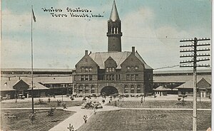
Terre Haute Union Station was a passenger train station located at Ninth Street and Spruce Street, Terre Haute, Indiana, serving riders for nearly 67 years. It was completed on August 15, 1893, at the cost of $273,000. Union Station was designed by Cincinnati architect Samuel Hannaford.
Weather in this IP's area
overcast clouds
9 Celsius
9 Celsius
8 Celsius
9 Celsius
1021 hPa
84 %
1021 hPa
1003 hPa
10000 meters
100 %
07:34:16
17:34:35

