Country:
 Brazil
Region:
City:
Latitude and Longitude:
Time Zone:
Postal Code:
IP information under different IP Channel
ip-api
Country
Region
City
ASN
Time Zone
ISP
Blacklist
Proxy
Latitude
Longitude
Postal
Route
IPinfo
Country
Region
City
ASN
Time Zone
ISP
Blacklist
Proxy
Latitude
Longitude
Postal
Route
MaxMind
Country
Region
City
ASN
Time Zone
ISP
Blacklist
Proxy
Latitude
Longitude
Postal
Route
Luminati
Country
BRRegion
rs
City
cachoeirinha
ASN
Time Zone
America/Sao_Paulo
ISP
Fenix Wireless Internet Ltda
Latitude
Longitude
Postal
db-ip
Country
Region
City
ASN
Time Zone
ISP
Blacklist
Proxy
Latitude
Longitude
Postal
Route
ipdata
Country
Region
City
ASN
Time Zone
ISP
Blacklist
Proxy
Latitude
Longitude
Postal
Route
Popular places and events near this IP address
Canoas
Municipality in South, Brazil
Distance: Approx. 8757 meters
Latitude and longitude: -29.92,-51.18
Canoas (Portuguese pronunciation: [kaˈnoɐs]) is a municipality in the state of Rio Grande do Sul, Brazil, forming part of the Greater Porto Alegre area. It is the largest municipality of the metropolitan region of Porto Alegre and the third largest municipality of Rio Grande do Sul. Officially declared a city on June 27, 1939, after its separation from São Sebastião do Caí and Gravataí, Canoas derives its name from the historical crafting of canoes in the area.

Alvorada
Place in South, Brazil
Distance: Approx. 8105 meters
Latitude and longitude: -29.98972222,-51.08333333
Alvorada (Portuguese: [aw.voˈɾa.dɐ] , lit. 'dawn') is a municipality in the state of Rio Grande do Sul, in the south of Brazil, adjacent to the capital of the state, Porto Alegre. The city is also known as "The Capital of Solidarity." Alvorada is primarily a bedroom community with most workers commuting to adjacent cities such as Porto Alegre to work. Its name means "the awakening" or "the sunrise".

Lutheran University of Brazil
Distance: Approx. 7844 meters
Latitude and longitude: -29.8872,-51.1629
The Lutheran University of Brazil (Portuguese: Universidade Luterana do Brasil or ULBRA) is a university which covers several states throughout Brazil.

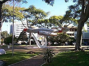
Canoas Air Force Base
Air base of the Brazilian Air Force
Distance: Approx. 6123 meters
Latitude and longitude: -29.94555556,-51.14361111
Canoas Air Force Base – ALA3 (IATA: QNS, ICAO: SBCO) is a base of the Brazilian Air Force, located in Canoas, near Porto Alegre, Brazil.

Nossa Senhora de Fátima Aerodrome
Brazilian airport
Distance: Approx. 6123 meters
Latitude and longitude: -29.94555556,-51.14361111
Campo Nossa Senhora de Fátima (IATA: QNS, ICAO: SBCO) is a temporary aerodrome located in Canoas, serving Porto Alegre and the region of Greater Porto Alegre, Brazil. It started operations on May 27, 2024, as a contingency measure after the indefinite closure of Salgado Filho Airport as a result of 2024 Rio Grande do Sul floods that caused critical damage to the latter. It operates using the facilities (runways, taxiways and apron) of Canoas Air Force Base.
Weather in this IP's area
thunderstorm with light rain
21 Celsius
21 Celsius
21 Celsius
21 Celsius
1007 hPa
94 %
1007 hPa
1001 hPa
4000 meters
3.09 m/s
140 degree
100 %
06:02:06
18:25:29