Country:
Region:
City:
Latitude and Longitude:
Time Zone:
Postal Code:
IP information under different IP Channel
ip-api
Country
Region
City
ASN
Time Zone
ISP
Blacklist
Proxy
Latitude
Longitude
Postal
Route
Luminati
Country
ASN
Time Zone
America/Sao_Paulo
ISP
TELEFONICA GLOBAL SOLUTIONS PERU S.A.C.
Latitude
Longitude
Postal
IPinfo
Country
Region
City
ASN
Time Zone
ISP
Blacklist
Proxy
Latitude
Longitude
Postal
Route
db-ip
Country
Region
City
ASN
Time Zone
ISP
Blacklist
Proxy
Latitude
Longitude
Postal
Route
ipdata
Country
Region
City
ASN
Time Zone
ISP
Blacklist
Proxy
Latitude
Longitude
Postal
Route
Popular places and events near this IP address
Estádio Parque São Jorge
Football stadium in Brazil
Distance: Approx. 2020 meters
Latitude and longitude: -23.52683333,-46.56846944
The Estádio Alfredo Schürig, most commonly known as Estádio Parque São Jorge, or Fazendinha, is a football stadium inaugurated on July 22, 1928 in São Paulo, Brazil. It can hold up to 18,500 people. The stadium is owned by Sport Club Corinthians Paulista.

Mooca (district of São Paulo)
District of São Paulo, Brazil
Distance: Approx. 3071 meters
Latitude and longitude: -23.55916668,-46.59805557
Mooca (Portuguese pronunciation: [ˈmɔka]) from tupi mo-oka, meaning to build houses (formerly written as "Moóca" prior to the Reforms of Portuguese orthography) is a district in the subprefecture of the same name in the city of São Paulo, Brazil. Mooca today is home to over 75,000 inhabitants, spread in its 7.7 square kilometres (3.0 sq mi). It is also considered one of the fastest-growing districts in the city, experiencing over the last years a vigorous momentum in the construction industry.

Tatuapé
District of São Paulo, Brazil
Distance: Approx. 919 meters
Latitude and longitude: -23.53813889,-46.56689444
Tatuapé (Portuguese pronunciation: [tatwaˈpɛ], from Tupi Guarani "path of the armadillo", or "short way") is a district in the subprefecture of Mooca, in São Paulo, Brazil. It is divided by a railway and the eight lane Radial Leste highway cutting the district into two, northern and southern, parts. It is home to Platina 220, the tallest building of São Paulo, scheduled to be fully operational in 2022.
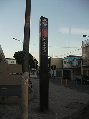
Belém (São Paulo Metro)
São Paulo Metro station
Distance: Approx. 1744 meters
Latitude and longitude: -23.543216,-46.58952
Belém is a station on Line 3 (Red) of the São Paulo Metro.

Tatuapé (São Paulo Metro)
São Paulo Metro station
Distance: Approx. 607 meters
Latitude and longitude: -23.540314,-46.576184
Tatuapé is a station which is part of a metropolitan system composed by CPTM and São Paulo Metro. It is connected to Shopping Metrô Tatuapé (south of the station) and Shopping Metrô Boulevard Tatuapé (north of the station). It's located in the homonymous district of Tatuapé, divided physically between areas 3 and 4 of the capital.

Carrão-Assaí Atacadista (São Paulo Metro)
São Paulo Metro station
Distance: Approx. 1204 meters
Latitude and longitude: -23.537599,-46.563513
Carrão-Assaí Atacadista is a station on Line 3 (Red) of the São Paulo Metro. The station was renamed after the purchase of the naming right by the market network Assaí Atacadista.

Southeast Zone of São Paulo
Place in São Paulo, Brazil
Distance: Approx. 2163 meters
Latitude and longitude: -23.55833333,-46.5875
The Southeast Zone is an Administrative Zone of São Paulo, Brazil.

Paróquia Nossa Senhora do Bom Conselho
Church in São Paulo, Brazil
Distance: Approx. 2248 meters
Latitude and longitude: -23.559297,-46.587613
Paróquia Nossa Senhora do Bom Conselho is a parish located in the Mooca district of São Paulo, Brazil, in the Roman Catholic Diocese of Campo Limpo. The parish is in the Belém sector of the Archdiocese of São Paulo. It was established on 24 March 1940.

Paróquia São José do Belém
Church in São Paulo, Brazil
Distance: Approx. 2251 meters
Latitude and longitude: -23.54083333,-46.59416667
Paróquia São José do Belém is a church located in São Paulo, Brazil. It was established on 14 July 1897.

Paróquia São Paulo Apóstolo
Church in São Paulo, Brazil
Distance: Approx. 1398 meters
Latitude and longitude: -23.5475,-46.58583333
Paróquia São Paulo Apóstolo is a church located in São Paulo, Brazil. It was established on 8 December 1939.

Anália Franco (São Paulo Metro)
Future Green Line 2 Station of the São Paulo Metro
Distance: Approx. 2491 meters
Latitude and longitude: -23.5636,-46.5596
Anália Franco is a future São Paulo Metro station under construction, belonging to Line 2-Green, as part of the line expansion plan. It is estimated to be opened in 2026.

Figueira Altos do Tatuapé
Skyscraper in Nova Lima, Brazil
Distance: Approx. 826 meters
Latitude and longitude: -23.55159,-46.56978
Figueira Altos do Tatuapé is a residential skyscraper in the Tatuapé district of the Eastern Zone of São Paulo, Brazil. Built between 2017 and 2021, the tower stands at 168.2 m (552 ft) tall with 52 floors and is the current 13th tallest building in Brazil.
Weather in this IP's area
broken clouds
25 Celsius
25 Celsius
24 Celsius
26 Celsius
1013 hPa
66 %
1013 hPa
928 hPa
10000 meters
5.14 m/s
190 degree
75 %
05:13:26
18:28:44
