Country:
Region:
City:
Latitude and Longitude:
Time Zone:
Postal Code:
IP information under different IP Channel
ip-api
Country
Region
City
ASN
Time Zone
ISP
Blacklist
Proxy
Latitude
Longitude
Postal
Route
Luminati
Country
Region
pr
City
pinhais
ASN
Time Zone
America/Sao_Paulo
ISP
SIX INTERNET LTDA
Latitude
Longitude
Postal
IPinfo
Country
Region
City
ASN
Time Zone
ISP
Blacklist
Proxy
Latitude
Longitude
Postal
Route
db-ip
Country
Region
City
ASN
Time Zone
ISP
Blacklist
Proxy
Latitude
Longitude
Postal
Route
ipdata
Country
Region
City
ASN
Time Zone
ISP
Blacklist
Proxy
Latitude
Longitude
Postal
Route
Popular places and events near this IP address

Pinheirão
Football stadium in Brazil
Distance: Approx. 6447 meters
Latitude and longitude: -25.43152778,-49.21930556
The Centro Poliesportivo Pinheiro, also known as the Pinheirão is a football stadium inaugurated on June 15, 1985 in Curitiba, Paraná, Brazil, with a maximum capacity of 35,000 people. The stadium is owned by the Paranaense Football Federation (meaning Federação Paranaense de Futebol in Portuguese), and was the home ground of Paraná Clube. Its formal name means Pinheiro Multi-Modality Center and honors the Pine tree, which is a common tree in the state.

Autódromo Internacional de Curitiba
Former racing circuit in Brazil
Distance: Approx. 4763 meters
Latitude and longitude: -25.44472222,-49.19694444
Autódromo Internacional de Curitiba (also known as Autódromo de Pinhais and Circuito Raul Boesel) was a motorsports circuit located in Pinhais, Brazil. It has been host to the World Touring Car Championship, TC2000, Fórmula Truck and Stock Car Brasil racing. Until 2013 the circuit has also been host of the South American Formula 3 Series, namely the Formula 3 Sudamericana.

Pinhais
Place in South, Brazil
Distance: Approx. 3904 meters
Latitude and longitude: -25.4325,-49.19333333
Pinhais is a municipality in Paraná state in Brazil. As of 2020, the population was 133,490. It was emancipated from the municipality of Piraquara in 1992 and is part of the Metropolitan region of Curitiba.
Bosque de Portugal
Distance: Approx. 7675 meters
Latitude and longitude: -25.41583333,-49.23166667
Bosque de Portugal is a public park located in the city of Curitiba, capital of the state of Paraná, Brazil.

Botanical Garden of Curitiba
Distance: Approx. 8678 meters
Latitude and longitude: -25.44277778,-49.23944444
The Jardim Botânico de Curitiba, also known in English as the Botanical Garden of Curitiba and formally referred to as Jardim Botânico Fanchette Rischbieter, is a prominent park situated in Curitiba, the capital of the state of Paraná in southern Brazil. It is a key tourist attraction and landmark within the city and houses a portion of the Federal University of Paraná campus. The international identification code for the garden is CURIT. Established in 1991, the Jardim Botânico de Curitiba was designed in the style of French formal gardens.
Piraquara River
River in Brazil
Distance: Approx. 4917 meters
Latitude and longitude: -25.45,-49.11666667
The Piraquara River is a river of Paraná state in southern Brazil.
Capão da Imbuia Wood
Distance: Approx. 6544 meters
Latitude and longitude: -25.43583333,-49.21944444
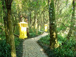
The Capão da Imbuia Woods (Brazilian Portuguese: Bosque do Capão da Imbuia) is a public area of the city of Curitiba, the capital of the state of Paraná, in Brazil. With a large expanse of native forest (39,000 m²), the woods have several features, such as a path in the woods known as "Path of the Araucaria", a metal catwalk that loops around the woods, and the "Museum of Natural History", with stuffed animals, skeletons, pictures and many more exhibits that show the typical fauna and flora of Brazil. The woods also house a closed biological research site.
Bacacheri Airport
Airport in Paraná, Brazil
Distance: Approx. 8139 meters
Latitude and longitude: -25.40333333,-49.23361111
Bacacheri Airport (IATA: BFH, ICAO: SBBI) is an airport in Curitiba, Brazil. It is named after the neighbourhood where it is located.
Atuba Park
Park in Curitiba, Brazil
Distance: Approx. 7063 meters
Latitude and longitude: -25.38027778,-49.20722222
Atuba Park is a park located in Curitiba, state of Paraná, Brazil.
Cajuru Park
Park in Curitiba, Brazil
Distance: Approx. 5536 meters
Latitude and longitude: -25.45972222,-49.19352778
The Cajuru Linear Park (Brazilian Portuguese: Parque Linear do Cajuru), known simply as the Cajuru Park, is a park located in Curitiba, state of Paraná, Brazil.
Bacacheri Park
Park located in Curitiba, state of Parana, Brazil
Distance: Approx. 8341 meters
Latitude and longitude: -25.39,-49.23
Bacacheri Park is a park located in Curitiba, state of Paraná, Brazil

Colégio Suíço-Brasileiro de Curitiba
Swiss School in Brazil
Distance: Approx. 3671 meters
Latitude and longitude: -25.43519444,-49.18994444
The Colégio Suíço-Brasileiro de Curitiba, the Swiss School Curitiba, German: Schweizerschule Curitiba, is a bilingual private school recognized by the Brazilian state of Paraná. It is the only school in Curitiba with German and Portuguese as languages of instruction. The school comprises nursery, kindergarten, primary, secondary and high school.
Weather in this IP's area
few clouds
23 Celsius
23 Celsius
22 Celsius
24 Celsius
1015 hPa
69 %
1015 hPa
914 hPa
10000 meters
4.12 m/s
90 degree
20 %
05:19:22
18:45:12


