138.219.173.33 - IP Lookup: Free IP Address Lookup, Postal Code Lookup, IP Location Lookup, IP ASN, Public IP
Country:
Region:
City:
Location:
Time Zone:
Postal Code:
IP information under different IP Channel
ip-api
Country
Region
City
ASN
Time Zone
ISP
Blacklist
Proxy
Latitude
Longitude
Postal
Route
Luminati
Country
Region
ca
City
patterson
ASN
Time Zone
America/Los_Angeles
ISP
SOCIEDAD BUENA HOSTING, S.A.
Latitude
Longitude
Postal
IPinfo
Country
Region
City
ASN
Time Zone
ISP
Blacklist
Proxy
Latitude
Longitude
Postal
Route
IP2Location
138.219.173.33Country
Region
california
City
patterson
Time Zone
America/Los_Angeles
ISP
Language
User-Agent
Latitude
Longitude
Postal
db-ip
Country
Region
City
ASN
Time Zone
ISP
Blacklist
Proxy
Latitude
Longitude
Postal
Route
ipdata
Country
Region
City
ASN
Time Zone
ISP
Blacklist
Proxy
Latitude
Longitude
Postal
Route
Popular places and events near this IP address

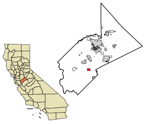
Patterson, California
City in California, United States
Distance: Approx. 317 meters
Latitude and longitude: 37.47305556,-121.13277778
Patterson is a city in Stanislaus County, California, United States, located off Interstate 5. It is 27 miles (43 km) southeast of Tracy and is part of the Modesto Metropolitan Statistical Area. Patterson is known as the "Apricot Capital of the World"; and holds an annual Apricot Fiesta to celebrate with many drinks, food, desserts and games.
Patterson High School (California)
School in Patterson, California, United States
Distance: Approx. 738 meters
Latitude and longitude: 37.47093,-121.13801
Patterson High School is located in the town of Patterson in Stanislaus County, California. It is in the Patterson Joint Unified School District. The school is known for the Aztec Calendar mural on the library wall painted by Circulo de Hombres.

Crows Landing, California
Census-designated place in California, United States
Distance: Approx. 9447 meters
Latitude and longitude: 37.39472222,-121.08444444
Crows Landing is a census-designated place (CDP) in Stanislaus County, California. Crows Landing is about 20 miles (32 km) southwest of Modesto. Crows Landing sits at an elevation of 128 feet (39 m).

NASA Crows Landing Airport
Airport in Crows Landing / Patterson, California
Distance: Approx. 7297 meters
Latitude and longitude: 37.40805556,-121.10944444
NASA Crows Landing Airport (IATA: NRC, ICAO: KNRC, FAA LID: NRC) is a private use airport owned by the NASA Ames Research Center, 1 nautical mile (1.9 km; 1.2 mi) northwest of the central business district of Crows Landing, in Stanislaus County, California, United States. The airfield was formerly named Naval Auxiliary Landing Field Crows Landing or NALF Crows Landing when operated by the U.S. Navy. In January 2011, Airport-data.com reported the airport status as closed permanently.
Rancho Del Puerto
1844 Mexican land grant in California
Distance: Approx. 5356 meters
Latitude and longitude: 37.48,-121.07
Rancho Del Puerto was a 13,340-acre (54.0 km2) Mexican land grant in present-day Stanislaus County, California given in 1844 by Governor Manuel Micheltorena to Mariano and Pedro Hernández. The grant extended east of the present-day Highway 33 to the San Joaquin River. The northern boundary was Del Puerto Creek and the southern boundary was just south of Marshall Road, and encompassed present-day Patterson.
Del Puerto Creek
River in California, United States
Distance: Approx. 7869 meters
Latitude and longitude: 37.54138889,-121.11555556
Del Puerto Creek, originally Arroyo de La Puerta (Creek of the Door) is a tributary of the San Joaquin River draining eastern slopes of part of the Diablo Range within the Central Valley of California, United States. The Creek enters the San Joaquin River, about 2 1/2 miles southeast of Grayson, California in Stanislaus County.
Salado Creek (California)
River in California, United States
Distance: Approx. 2181 meters
Latitude and longitude: 37.49083333,-121.125
Salado Creek, originally Arroyo Salado Grande (Big Salt Creek) is a tributary of the San Joaquin River draining eastern slopes of part of the Diablo Range within the Central Valley of California, United States. The Creek ends before it reaches the San Joaquin River, north of Patterson in Stanislaus County.
Little Salado Creek
River in California, United States
Distance: Approx. 4903 meters
Latitude and longitude: 37.43333333,-121.10222222
Little Salado Creek, originally Arroyita Salado (Little Salt Creek) is a tributary of the San Joaquin River draining eastern slopes of part of the Diablo Range within the Central Valley of California, United States. The Creek ends before it reaches the San Joaquin River, south of Patterson in Stanislaus County. Arroyita Salado was a watering place on El Camino Viejo in the San Joaquin Valley and provided water for Rancho Del Puerto.
Del Puerto Canyon
Distance: Approx. 7073 meters
Latitude and longitude: 37.48833333,-121.20694444
Del Puerto Canyon is the valley or canyon of Del Puerto Creek in Stanislaus County, California. The canyon mouth is at an elevation of 223 feet (68 meters). Its head is located at 37°23′51″N 121°27′26″W and is at an elevation of 2,800 feet (850 meters) on the south slope of Red Mountain.
Weather in this IP's area
overcast clouds
11 Celsius
10 Celsius
11 Celsius
11 Celsius
1022 hPa
93 %
1022 hPa
1008 hPa
10000 meters
1.61 m/s
2.03 m/s
8 degree
100 %