138.219.157.7 - IP Lookup: Free IP Address Lookup, Postal Code Lookup, IP Location Lookup, IP ASN, Public IP
Country:
Region:
City:
Location:
Time Zone:
Postal Code:
ISP:
ASN:
language:
User-Agent:
Proxy IP:
Blacklist:
IP information under different IP Channel
ip-api
Country
Region
City
ASN
Time Zone
ISP
Blacklist
Proxy
Latitude
Longitude
Postal
Route
db-ip
Country
Region
City
ASN
Time Zone
ISP
Blacklist
Proxy
Latitude
Longitude
Postal
Route
IPinfo
Country
Region
City
ASN
Time Zone
ISP
Blacklist
Proxy
Latitude
Longitude
Postal
Route
IP2Location
138.219.157.7Country
Region
la paz
City
san luis talpa
Time Zone
America/El_Salvador
ISP
Language
User-Agent
Latitude
Longitude
Postal
ipdata
Country
Region
City
ASN
Time Zone
ISP
Blacklist
Proxy
Latitude
Longitude
Postal
Route
Popular places and events near this IP address

Cuyultitán
Municipality in La Paz, El Salvador
Distance: Approx. 8552 meters
Latitude and longitude: 13.55,-89.1
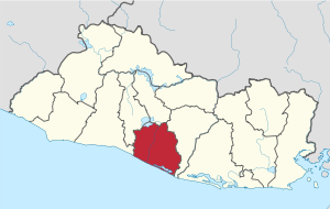
Cuyultitán is a municipality in the La Paz department of El Salvador.

El Rosario, La Paz
Municipality in La Paz, El Salvador
Distance: Approx. 6709 meters
Latitude and longitude: 13.5,-89.03333333
El Rosario is a municipality in the La Paz department of El Salvador.

San Juan Talpa
Municipality in La Paz, El Salvador
Distance: Approx. 2974 meters
Latitude and longitude: 13.5,-89.08333333
San Juan Talpa is a municipality in the La Paz department of El Salvador.

San Luis Talpa
Municipality in La Paz, El Salvador
Distance: Approx. 1026 meters
Latitude and longitude: 13.46666667,-89.08333333
San Luis Talpa is a municipality in the La Paz department of El Salvador. It is close to Saint Óscar Arnulfo Romero y Galdámez International Airport, which itself is about eight kilometers from the capital, San Salvador.

El Salvador International Airport
Salvadoran largest airport serving San Salvador located in San Luis Talpa, La Paz
Distance: Approx. 5179 meters
Latitude and longitude: 13.44083333,-89.05555556
El Salvador International Airport Saint Óscar Arnulfo Romero y Galdámez (Spanish: Aeropuerto Internacional de El Salvador San Óscar Arnulfo Romero y Galdámez), (IATA: SAL, ICAO: MSLP), previously known as Comalapa International Airport (Aeropuerto Internacional de Comalapa) and as Comalapa Air Base (Base Aérea de Comalapa) to the military, is a joint-use civilian and military airport that serves San Salvador, El Salvador. It is located in the south central area of the country, in the city of San Luis Talpa, Department of La Paz, and occupies a triangle of 2,519.8 acres (1,019.7 ha), bordered by the Pacific Ocean on the south and the Jiboa River on the east, with the coastal highway to the northwest. It is close to sea level allowing aircraft to operate efficiently at maximum capacity.
Weather in this IP's area
clear sky
26 Celsius
26 Celsius
26 Celsius
26 Celsius
1015 hPa
53 %
1015 hPa
989 hPa
10000 meters
5.66 m/s
30 degree