138.219.13.164 - IP Lookup: Free IP Address Lookup, Postal Code Lookup, IP Location Lookup, IP ASN, Public IP
Country:
Region:
City:
Location:
Time Zone:
Postal Code:
ISP:
ASN:
language:
User-Agent:
Proxy IP:
Blacklist:
IP information under different IP Channel
ip-api
Country
Region
City
ASN
Time Zone
ISP
Blacklist
Proxy
Latitude
Longitude
Postal
Route
db-ip
Country
Region
City
ASN
Time Zone
ISP
Blacklist
Proxy
Latitude
Longitude
Postal
Route
IPinfo
Country
Region
City
ASN
Time Zone
ISP
Blacklist
Proxy
Latitude
Longitude
Postal
Route
IP2Location
138.219.13.164Country
Region
san miguel
City
moncagua
Time Zone
America/El_Salvador
ISP
Language
User-Agent
Latitude
Longitude
Postal
ipdata
Country
Region
City
ASN
Time Zone
ISP
Blacklist
Proxy
Latitude
Longitude
Postal
Route
Popular places and events near this IP address

San Miguel Department (El Salvador)
Department of El Salvador
Distance: Approx. 2140 meters
Latitude and longitude: 13.522,-88.234
San Miguel (Spanish pronunciation: [ˈsam miˈɣel]) is a department in the eastern part of El Salvador. The capital is San Miguel. The department is 2,077 km2 in area and has a population of over 678,000.

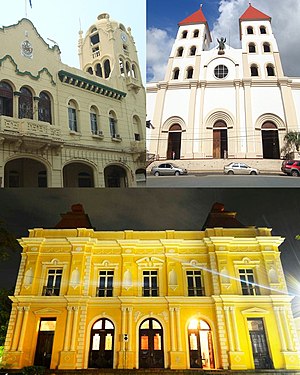
San Miguel, El Salvador
City in San Miguel Department, El Salvador
Distance: Approx. 9746 meters
Latitude and longitude: 13.48138889,-88.1775
San Miguel (Spanish pronunciation: [ˈsam miˈɣel]) is a city in eastern El Salvador. It is the country's third most populous city. It is located 138 km (86 mi) east of the capital, San Salvador.

Moncagua
Municipality in San Miguel Department, El Salvador
Distance: Approx. 4 meters
Latitude and longitude: 13.53333333,-88.25
Moncagua is a municipality in the San Miguel department of El Salvador. Moncagua is also a well known area of hot springs. Moncagua is known as "tierra caliente" or "hot land" in literal English translation.

Quelepa
Distance: Approx. 3096 meters
Latitude and longitude: 13.52944444,-88.22166667
Quelepa is an important archaeological site located in eastern El Salvador. Generally considered to have been settled by the Lenca people, the site was founded around 400 BC in the Late Preclassic period (500 BC - AD 250). The inhabitants constructed a platform from plaster and pumice and rebuilt it a number of times.
El Platanar Airport
Airport
Distance: Approx. 7860 meters
Latitude and longitude: 13.58694444,-88.29722222
El Platanar Airport (ICAO: MSPT) is an airport serving the town of El Platanar in San Miguel Department, El Salvador. The runway is 1 kilometre (0.6 mi) northwest of the city. El Platanar town is 16 kilometres (10 mi) northwest of San Miguel, the department capital.
Cathedral Basilica of Queen of Peace, San Miguel
Church in San Miguel, El Salvador
Distance: Approx. 9886 meters
Latitude and longitude: 13.4829,-88.1748
The Cathedral Basilica of Queen of Peace (Spanish: Catedral-Basílica Reina de la Paz), also called San Miguel Cathedral, is a Catholic church located in the city of San Miguel, El Salvador. In 1740 the mayor of San Salvador, Manuel Gálvez del Corral, reported that in San Miguel there was a parish church, two convents (San Francisco and La Merced) and two hermitages (San Sebastian and Calvary). In 1862 the parish church, which bore the name "St Michael Archangel", was demolished to build a larger temple that would also serve as an oratory of veneration for the Virgin Our Lady of Peace.
Weather in this IP's area
scattered clouds
25 Celsius
25 Celsius
25 Celsius
25 Celsius
1013 hPa
50 %
1013 hPa
973 hPa
10000 meters
1.07 m/s
0.75 m/s
360 degree
35 %
