138.199.126.55 - IP Lookup: Free IP Address Lookup, Postal Code Lookup, IP Location Lookup, IP ASN, Public IP
Country:
Region:
City:
Location:
Time Zone:
Postal Code:
ISP:
ASN:
language:
User-Agent:
Proxy IP:
Blacklist:
IP information under different IP Channel
ip-api
Country
Region
City
ASN
Time Zone
ISP
Blacklist
Proxy
Latitude
Longitude
Postal
Route
db-ip
Country
Region
City
ASN
Time Zone
ISP
Blacklist
Proxy
Latitude
Longitude
Postal
Route
IPinfo
Country
Region
City
ASN
Time Zone
ISP
Blacklist
Proxy
Latitude
Longitude
Postal
Route
IP2Location
138.199.126.55Country
Region
missouri
City
kansas city
Time Zone
America/Chicago
ISP
Language
User-Agent
Latitude
Longitude
Postal
ipdata
Country
Region
City
ASN
Time Zone
ISP
Blacklist
Proxy
Latitude
Longitude
Postal
Route
Popular places and events near this IP address

KMBC-TV
TV station in Kansas City, Missouri
Distance: Approx. 2302 meters
Latitude and longitude: 39.08361111,-94.51611111
KMBC-TV (channel 9) is a television station in Kansas City, Missouri, United States, affiliated with ABC. It is owned by Hearst Television alongside CW affiliate KCWE (channel 29). The two stations share studios on Winchester Avenue in the Ridge-Winchester section of Kansas City, Missouri; KMBC-TV's transmitter is located in the city's Blue Valley section. KMBC-TV also serves as an alternate ABC affiliate for the St.

KCWE
TV station in Kansas City, Missouri
Distance: Approx. 2302 meters
Latitude and longitude: 39.08361111,-94.51611111
KCWE (channel 29) is a television station in Kansas City, Missouri, United States, affiliated with The CW. It is owned by Hearst Television alongside ABC affiliate KMBC-TV (channel 9). The two stations share studios on Winchester Avenue in the Ridge-Winchester section of Kansas City, Missouri; KCWE's transmitter is located in the city's Blue Valley section. Originally proposed for channel 32, channel 29 went on the air in September 1996 as KCWB, Kansas City's first local affiliate of The WB. It was owned by a group of Kansas City and television investors, who subcontracted its operation to KMBC-TV under a local marketing agreement.

Pendleton Heights, Kansas City
Neighborhood of Kansas City, Missouri
Distance: Approx. 3163 meters
Latitude and longitude: 39.11,-94.55444444
Pendleton Heights is a historic neighborhood in Kansas City, Missouri, United States. It is near the downtown highway loop, between Paseo and Chestnut Trafficway to the west and east, and Independence Avenue and Cliff Drive to the south and north. As a historic district of Kansas City, Pendleton Heights is the second oldest specifically residentially-designed neighborhood, after Quality Hill.

Exposition Park (Kansas City)
Distance: Approx. 2968 meters
Latitude and longitude: 39.0947303,-94.5507133
Exposition Park is a former baseball ground located in Kansas City, Missouri, United States. The ground was home to the Kansas City Cowboys of the American Association for the 1888 and 1889 seasons. It was located at 15th and Montgall from 1888 to 1902 in the 18th and Vine-Downtown East, Kansas City neighborhood.

Elmwood Cemetery (Kansas City, Missouri)
United States historic place
Distance: Approx. 1096 meters
Latitude and longitude: 39.09611111,-94.52583333
Elmwood Cemetery is a 43-acre (17 ha) historic rural cemetery, located in what became the urban area of 4900 Truman Road at the corner of Van Brunt Avenue in Kansas City, Missouri. With an estimated 35,000—38,000 plots, the cemetery is owned, operated, and maintained by the non-profit organization Elmwood Cemetery Society.
Northeast High School (Missouri)
Public school in Kansas City, Missouri, United States
Distance: Approx. 734 meters
Latitude and longitude: 39.10833,-94.52523
Northeast High School is a public high school located at 415 Van Brunt Boulevard in Kansas City, Missouri, next to Northeast Middle School. It is part of the Kansas City Public Schools.

Kansas City Museum
United States historic place
Distance: Approx. 2428 meters
Latitude and longitude: 39.1158,-94.54241
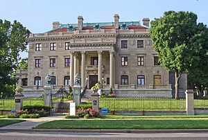
The Kansas City Museum is located in Kansas City, Missouri, United States. In 1910, the site was built by lumber baron and civic leader Robert A. Long as his private family estate, with the four-story historic Beaux-Arts style mansion named Corinthian Hall. In 1940, the site was donated by Long's heirs to become a public museum.
East High School (Missouri)
Public school in Kansas City, Missouri, United States
Distance: Approx. 1823 meters
Latitude and longitude: 39.08795,-94.52119
East High School is a comprehensive high school located at 1924 Van Brunt Boulevard in Kansas City, Missouri. It is part of the Kansas City Public Schools.
Washington-Wheatley, Kansas City
Historic neighborhood in United States
Distance: Approx. 3137 meters
Latitude and longitude: 39.0843,-94.54431
Washington-Wheatley is a historic neighborhood in Kansas City, Missouri, United States. The neighborhood is located between 18th Street and 27th Street and Prospect Avenue to I-70. It is mostly an African-American neighborhood on the East Side.
Kansas City Bolt and Nut Company plant
Industrial plant
Distance: Approx. 1701 meters
Latitude and longitude: 39.10406944,-94.49890833
Kansas City Bolt and Nut Company was a diverse steel parts manufacturing plant in Kansas City, Missouri that through its successors at its peak in the 1950s employed more than 4,500 people. The plant started in 1888. In 1925 it was acquired by Sheffield Steel Corporation with its variety of products and was billed as a department store of the steel industry with a more diversified line of products than any mill in the country." It was located near the confluence of the Missouri River and Blue River (Missouri) in Kansas City's Northeast Industrial District.
Holy Name Catholic Church (Kansas City, Missouri)
Historic church in Missouri, United States
Distance: Approx. 3417 meters
Latitude and longitude: 39.08472222,-94.54916667
The Holy Name Catholic Church in Kansas City, Missouri was a building from 1928. It was listed on the National Register of Historic Places in 2003. The building was demolished in 2011.
Sheffield, Kansas City
Neighborhood of Kansas City, Missouri
Distance: Approx. 708 meters
Latitude and longitude: 39.106115,-94.510787
Sheffield is a neighborhood of Kansas City, Missouri, United States. A post office called Sheffield was established in 1888, and remained in operation until 1902. The community's name is a transfer from Sheffield, England.
Weather in this IP's area
clear sky
3 Celsius
-1 Celsius
3 Celsius
3 Celsius
1007 hPa
75 %
1007 hPa
974 hPa
10000 meters
5.82 m/s
18.56 m/s
195 degree