Country:
Region:
City:
Latitude and Longitude:
Time Zone:
Postal Code:
IP information under different IP Channel
ip-api
Country
Region
City
ASN
Time Zone
ISP
Blacklist
Proxy
Latitude
Longitude
Postal
Route
Luminati
Country
ASN
Time Zone
America/Chicago
ISP
AMGEN
Latitude
Longitude
Postal
IPinfo
Country
Region
City
ASN
Time Zone
ISP
Blacklist
Proxy
Latitude
Longitude
Postal
Route
db-ip
Country
Region
City
ASN
Time Zone
ISP
Blacklist
Proxy
Latitude
Longitude
Postal
Route
ipdata
Country
Region
City
ASN
Time Zone
ISP
Blacklist
Proxy
Latitude
Longitude
Postal
Route
Popular places and events near this IP address
Zandberg, North Brabant
Neighborhood in Breda, Netherlands
Distance: Approx. 1164 meters
Latitude and longitude: 51.57694444,4.78305556
Zandberg is a neighbourhood and residential district to the southeast of the city centre of Breda, an extension raised in the 1920s and 1930s. It is only one of four parts of one of the seven greater quarters of that city, officially called 'Breda East' (Breda Oost).

Siege of Breda (1624)
Siege within the Eighty Years' War
Distance: Approx. 1642 meters
Latitude and longitude: 51.58333056,4.78333056
The siege of Breda of 1624–1625 occurred during the Eighty Years' War. The siege resulted in Breda, a Dutch fortified city, falling into the control of the Army of Flanders.

NAC Stadion
Multi-use stadium in Breda, Netherlands
Distance: Approx. 1182 meters
Latitude and longitude: 51.5825,4.76722222
NAC Stadion was a multi-use stadium in Breda, Netherlands. It was used mostly for football matches and hosted the home matches of NAC Breda. The stadium was able to hold 20,000 people and opened in 1940.

Roman Catholic Diocese of Breda
Roman Catholic diocese in the Netherlands
Distance: Approx. 1847 meters
Latitude and longitude: 51.5875,4.7774
The Diocese of Breda (Latin: Dioecesis Bredana) is a Latin Church diocese of the Catholic Church in Breda, the Netherlands.
NAC stadion Heuvelstraat
Distance: Approx. 1634 meters
Latitude and longitude: 51.57638889,4.74583333
NAC Stadion Heuvelstraat is a football stadium in Breda, Netherlands. It is used for football matches, hosted the home matches of NAC Breda and is now homeground of RKSV Groen Wit. The stadium was able to hold 5,500 people and opened in 1931.
NAC Stadion t Ploegske
Dutch football stadium
Distance: Approx. 1687 meters
Latitude and longitude: 51.57916667,4.78972222
`t Ploegske was a football stadium in Breda, Netherlands. It was used for football matches and hosted the home matches of NAC Breda. The stadium was able to hold 3,000 people, including 150 seats.
Mirabelle (Breda restaurant)
Restaurant in Breda, Netherlands
Distance: Approx. 1762 meters
Latitude and longitude: 51.56628611,4.74451111
Mirabelle is a defunct restaurant located in the Mirabella Estate in Breda, in the Netherlands. It was a fine dining restaurant that was awarded one Michelin star in 1959 and retained that rating until 1967. In recent years the restaurant came into hot water.

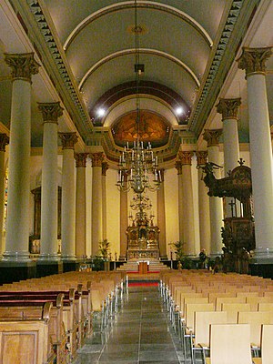
St. Anthony of Padua Cathedral, Breda
Church in Breda, Netherlands
Distance: Approx. 1849 meters
Latitude and longitude: 51.5875,4.7775
The St. Anthony of Padua Cathedral (Dutch: Sint-Antoniuskathedraal) or Cathedral of St. Anthony, is the Roman Catholic cathedral of the Diocese of Breda, located in the city of Breda, in the Netherlands.
Siege of Breda (1813)
Distance: Approx. 1643 meters
Latitude and longitude: 51.58333306,4.78333306
The siege of Breda took place from 19 to 22 December 1813 and was a small yet important engagement between French and allied troops in the Liberation Wars. Breda was abandoned by its garrison early in December and occupied by a Russian force. With Breda being the strategic link between the French garrisons of Gorinchem and Antwerp, and to hold control over the main road between Breda and Antwerp, the French began a counterattack.

Siege of Breda (1793)
Siege of the War of the First Coalition
Distance: Approx. 1642 meters
Latitude and longitude: 51.58333056,4.78333056
The siege of Breda took place from 21 to 27 February 1793 in the course of the Flanders Campaign during the War of the First Coalition .

Bouvigne Castle
Distance: Approx. 1471 meters
Latitude and longitude: 51.56263,4.78346
Bouvigne Castle is a castle outside the Ginneken district in the Dutch province of North Brabant, near the Mastbos south of Breda. Behind it lies the Markdal. It has been owned by the Brabantse Delta Water Board since 1972.

Maczek Memorial Breda
Museum in The Netherlands
Distance: Approx. 1820 meters
Latitude and longitude: 51.58186,4.74745
The Maczek Memorial Breda is a museum in Breda, Noord-Brabant, The Netherlands. It tells the story of the liberation of Breda in 1944 by the First Polish Armoured Division led by General Stanisław Maczek. The museum was opened in 2020.
Weather in this IP's area
mist
5 Celsius
2 Celsius
4 Celsius
6 Celsius
1028 hPa
87 %
1028 hPa
1028 hPa
8000 meters
3.6 m/s
100 degree
100 %
07:47:32
17:01:55
